

Coming soon to NJ: The return of sunny skies and comfortable air
The Bottom Line
Humidity. Love it or hate it, it is a staple of summertime here in New Jersey. This week, conditions have ranged from sticky to steamy. And we have another day and a half of thick, tropical air before big changes arrive.
Thursday will be soupy, with clouds and a few spotty downpours around. One more push of rain Friday morning will mark the arrival of our cold front. Humidity levels will drop dramatically through the day. The weekend looks dropdead gorgeous, with comfortable air, abundant sunshine, and warm temperatures. And then the heat is on again for part of next week.

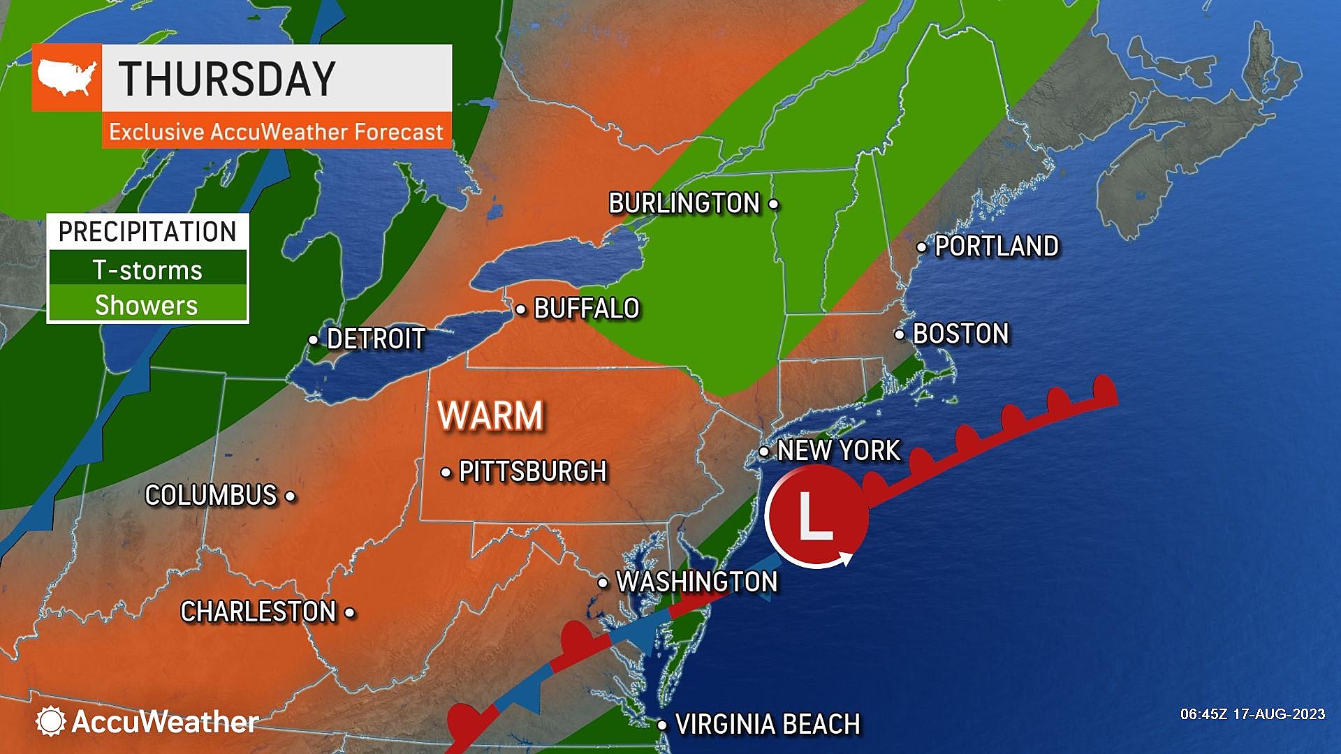
Thursday
There is still a "river of rain" just southeast of New Jersey, associated with a stalled frontal boundary. It is far enough away that we are not getting soaked. But still close enough to drive clouds, humidity, and occasional raindrops.
As dew points rise into the 70s, it is going to be another steamy day. Temperatures mainly in the 70s Thursday morning will climb to around 80 to 85 for most Thursday afternoon. The humid wind will be blowing from the southeast — an ocean breeze — potentially keeping the Jersey Shore cooler.
There will be a lot of clouds overhead too. Having said that, some extra sunshine may break out to the north and west by late afternoon.
Isolated downpours are in the forecast once again too. There are two problems with popcorn showers that form in this kind of tropical air mass. First, they can happen anytime and anywhere. (I just hate saying the weather is unpredictable ... but it is.) Second, lacking any significant steering current, little downpours popup and just sit in one spot until they fizzle out. One town gets soaked, while the next one over just sees ominous clouds.
We face one more muggy night Thursday night, as temperatures stay above the 70-degree mark. One final batch of showers and thunderstorms will come into play after Midnight.
Friday
Cold front day is transition day. You should notice a big difference from morning to night.
Showers and thunderstorms may carry through daybreak Friday morning, as our cold front approaches. There should not be much rain with this grand finale round — the best chance of brief raindrops will be across the northern half of New Jersey.
Later Friday morning, rain exits and skies will start to clear. The wind will become breezy, if not gusty at times — over 20 mph. That is the classic "whoosh" of slightly cooler, much drier air arriving.
Dew points will drop from the steamy 70s into the comfy 50s by Friday evening. While the air will be more comfortable and less thick, Friday will still be a warm day. I expect highs to reach the 80s once again.
Friday night should be gorgeous, as we tap into that drier air. Low temperatures will drop to around 60 degrees by Saturday morning.
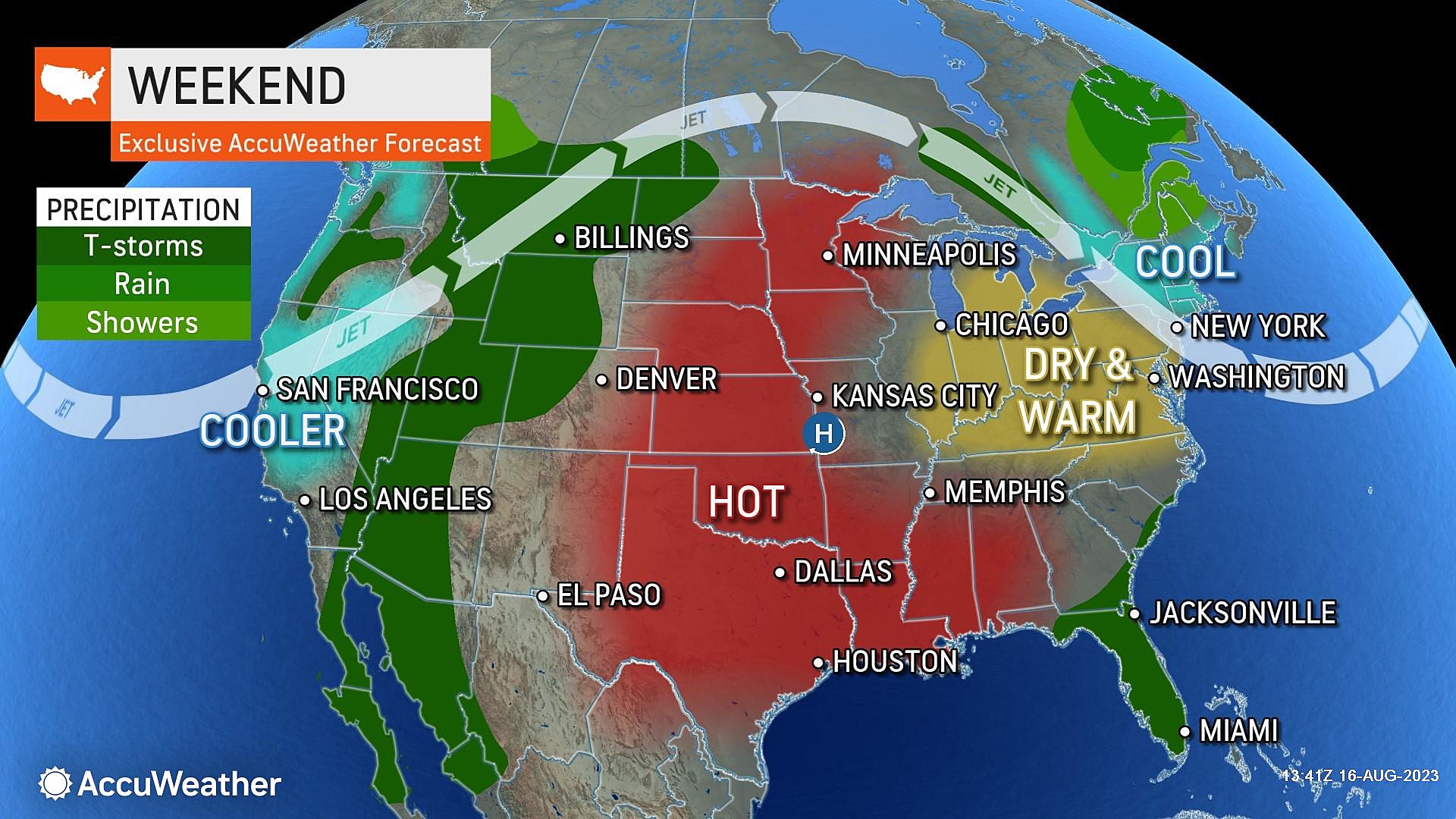
Saturday
Mostly sunny, dry, and not humid in the slightest. High temperatures will hit about 80 degrees. Some areas — including NW NJ and the Shore — will end up in the 70s. I don't think that will be "too cool" for summer activities though, since skies will be sunny and winds relatively light.
Sunday
If you like it warmer, Sunday will be your day. Especially since humidity levels will stay in the basement.
With a few clouds building in, highs on Sunday will push into the mid to upper 80s.
A couple of forecast models put some nuisance showers over NJ on Sunday. I don't buy it — I am keeping a dry forecast.
The Extended Forecast
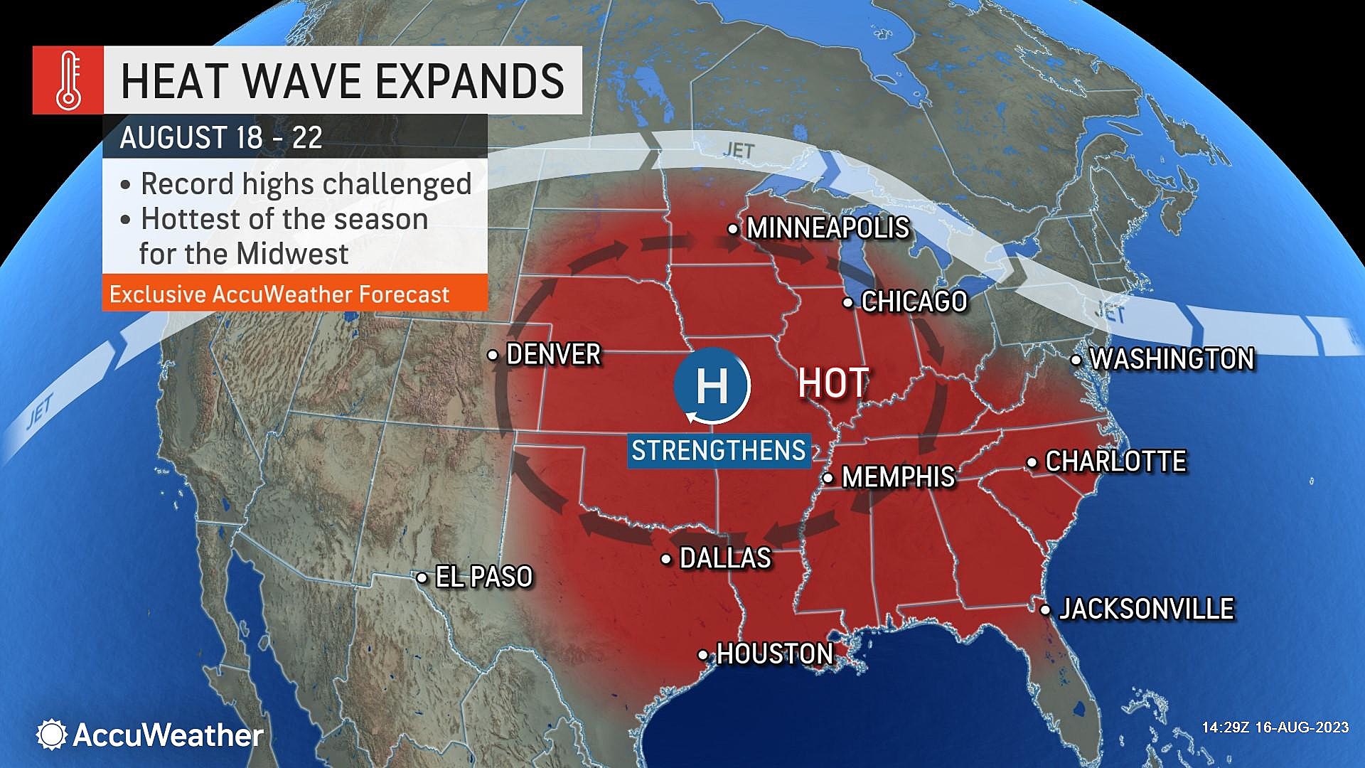
The warming trend continues into early next week, as high temperatures surge into the 90s on Monday. Humidity will return to the "moderate" category, as dew points rise into the 60s — sticky, but not quite tropical.
In fact, much of the country will swelter next week as a massive heat ridge builds in.
But yet again, New Jersey will be protected, as cooler air prevails. The timing of that cooldown is still in question — sometime in the Tuesday to Wednesday window. And we still need to figure out the extent of any rain and/or thunderstorms too.
LOOKING UP: 40 Breathtaking Images Of The Perseid Meteor Shower Around The World
Gallery Credit: Rob Carroll
Dan Zarrow is Chief Meteorologist for Townsquare Media New Jersey. Follow him on Facebook or Twitter for the latest forecast and realtime weather updates.
28 Pics That Prove Dogs Rule When Riding Surfboards
Gallery Credit: Rob Carroll
More From New Jersey 101.5 FM


