

Cooler, unsettled weather prevails across NJ through the weekend
The Bottom Line
So much for warmth. Once again, temperatures soared into summerlike territory on Wednesday, with widespread 80s and even a few 90s. The warm stretch is all over now, as cooler air and clouds return to New Jersey. Plus, a frontal boundary stalled to our south will serve as a "highway" for atmospheric impulses and waves of rain in the coming days.
Most of Thursday morning looks nice, but clouds increase and showers arrive by midday. A batch of steadier rain is possible late Thursday night. And then Friday looks quite unpleasant, as persistent showers and drizzle prevent temperatures from budging much above 50 degrees.
The Mother's Day Weekend is also a mixed bag. Saturday will be the nicer, warmer, drier day.

Thursday
Good start, soggy finish.
As dawn breaks on Thursday morning, we are seeing peeks of bright sky and temperatures around 60 degrees. Quite pleasant — and you can probably skip the jacket early on.
Clouds will thicken up by late morning. And then showers will arrive from the southwest, starting as early as 10 or 11 a.m. Those raindrops will spread throughout the Garden State through the midday and afternoon hours.

Most of New Jersey should see a shower or thunderstorm at some point Thursday, but it certainly will not be a total washout. There is technically a threat for severe weather along the southern edge of the state — but I am thinking the ingredients are not coming together, and the biggest risk stays south of us. Still, could we see a downpour or gust of wind somewhere in NJ? Sure.

I have bumped up Thursday's high temperature forecast to around 70 degrees. That is close to normal for early May.
Model guidance suggests a steadier batch of rain will push into New Jersey late Thursday night. Low temperatures will dip to around the 50-degree mark.
Friday
Just yuck.
Friday is not going to be a nice weather day. From morning through early evening, we will see showers and drizzle passing through. All light stuff, but the wet weather will be persistent.
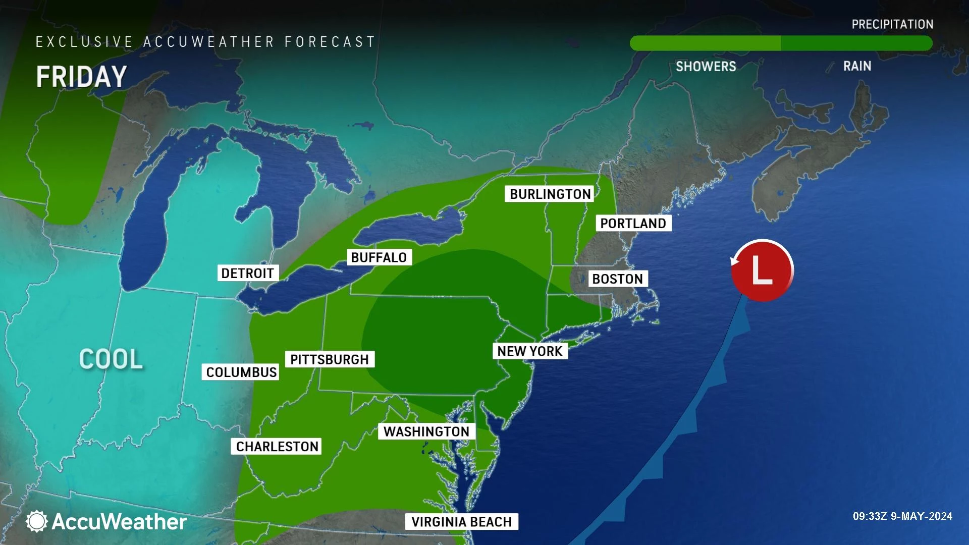
Under thick clouds, temperatures will go nowhere. My forecast calls for highs only in the lower 50s. But legitimately, some spots could get stuck in the 40s all day.
It is going to be damp and raw, feeling more like mid-March than early May.,
Saturday
Saturday has potential. But temperatures will still end up about 10 degrees below seasonal normals.
I will optimistically call Saturday partly sunny, featuring a mix of blue sky and clouds. High temperatures will hopefully improve to the lower 60s Saturday afternoon.
Previously, I kept Saturday's forecast dry. But I do have to mention a chance of a shower in the late-day (late afternoon to evening) hours. Only one model — the GFS — shows this batch of wet weather affecting NJ. That is why I would not bet on it, and why I am calling it a "slight" chance in my on-air and online forecasts.

Sunday
Sunday is Mother's Day. And sorry moms, you're getting wet again.

A compact piece of energy is forecast to drive in one final piece of rain over the first half of Sunday. I am not convinced it will rain across every corner of New Jersey. But once again, it is hard to call Sunday a pleasant day.
Especially with high temperatures sliding backward into the 50s again. We might see some late afternoon clearing.
Monday & Beyond
As soon as the weekend ends, of course the sun will come out and temperatures will warm up again. I think this is the third weekend in a row in this ironically unfortunate pattern.
I'm still thinking we will see mainly 70s next week. Although a potential coastal storm midweek will drive in rain, clouds, cooler temperatures, and possibly some coastal flooding concerns.
The best supermarkets in New Jersey
Dan Zarrow is Chief Meteorologist for Townsquare Media New Jersey. Follow him on Facebook for the latest forecast and realtime weather updates.
Latest additions to NJ DOT's 2024 collection of humorous safety messages
Gallery Credit: Dan Alexander
More From New Jersey 101.5 FM


