

April showers return: 48 hours of damp, dreary weather for NJ
The Bottom Line
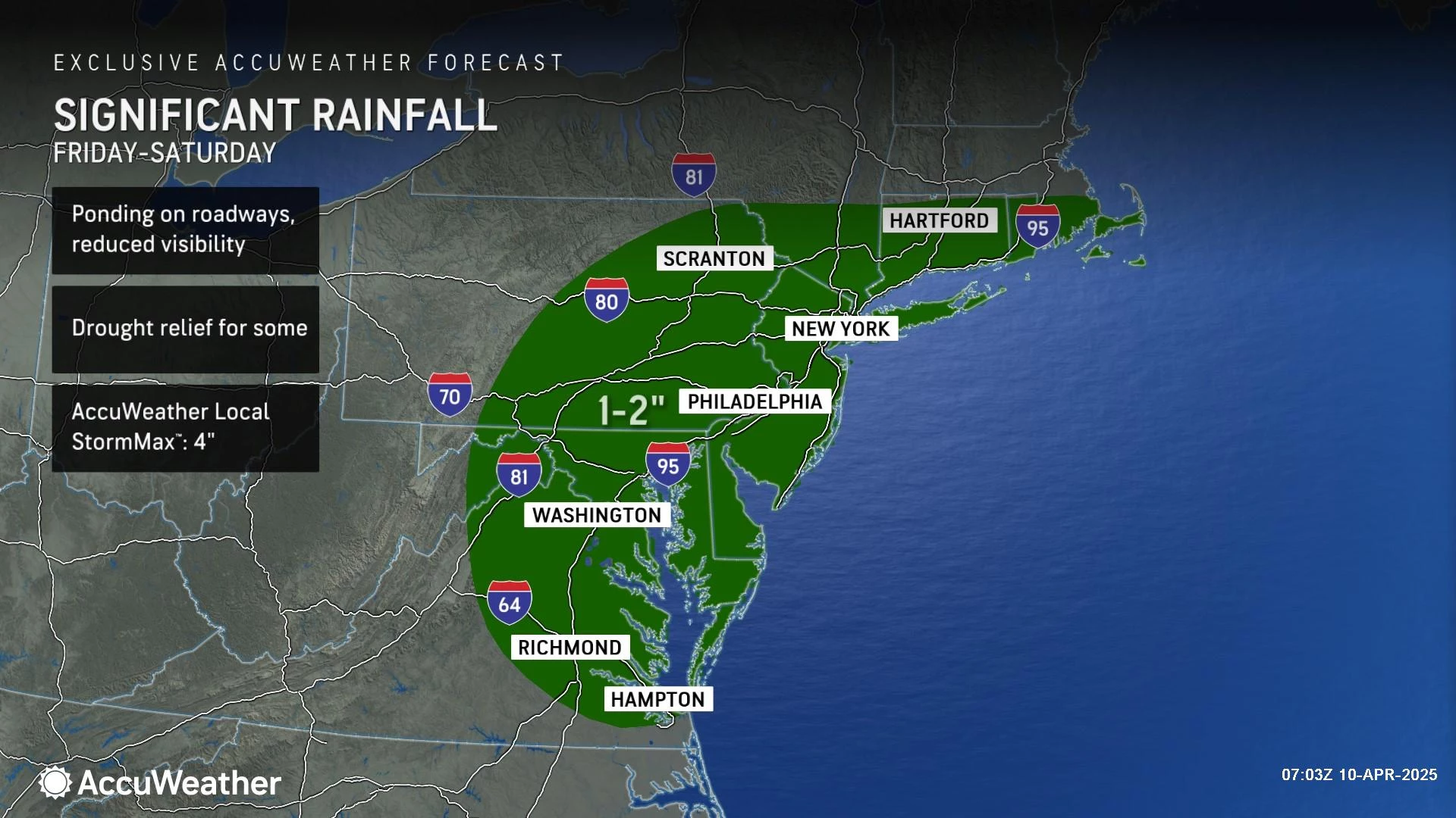
Oh good, more rain. Yes, we still really need it, with about three-quarters of New Jersey still officially in drought status. The dreary weather and the unseasonable temperatures are getting old at this point. We are craving another round of springtime warmth — but it's not coming until early next week.
Our next storm system will be slow to arrive Thursday and slow to depart Saturday. The biggest push of rain will be Friday night.
It's all gloom and no doom — other than an inch of rain and maybe a few snowflakes, I do not see any hazardous weather threats for the state.

Thursday
Thursday starts dry and ends wet.
We are starting off on the chilly side. You'll be reaching for the heavier jacket and the car heater with temperatures mainly in the 30s. Skies will be partly sunny, as we probably stay dry throughout Thursday morning.
As clouds thicken up and a stiff breeze kicks up Thursday afternoon, showers will creep in from west to east. By late afternoon, I suspect most of New Jersey will be overcast and damp.
High temperatures on Thursday will reach the lower 50s. Similar to Wednesday, and still almost 10 degrees below seasonal normals.
Occasional showers are expected Thursday night. Mainly rain, although I could see some snowflakes along and north of Interstate 80. Overnight lows will dip to around 40 degrees.
Friday
Not a nice weather day.
Expect periods of rain through Friday morning and afternoon. But that also means we will see periods of dry-ish weather along the way too — Friday is not a total washout.
It will be cloudy and breezy and miserably cool. High temps only reach about 45 to 50 degrees.
Starting around sunset Friday, we enter the "brunt" of this storm system — the period with the steadiest, heaviest, most widespread rain. There could be some localized downpours and rumbles of thunder overnight, but I do not think severe weather or flooding will be prominent issues.
Saturday
Saturday will also be a less-than stellar day. And there are some big question marks about precipitation type and when rain will end across New Jersey.
There is one model — the Euro — that shows a flip to snow and wintry mix in North Jersey (north of I-78), potentially leading to multiple inches of accumulation. I do not buy it though — I do not think temperatures will be cold enough to sustain all-snow, and the ground will be too wet and too warm for substantial snow to stick. Still, the chance for slippery spots is there are worth watching.
I believe we'll have residual showers, mist, and drizzle through Saturday morning. And then the afternoon will trend drier. However, skies will stay overcast and temperatures will be uncomfortably cool. Thermometers will be stuck in the 40s all day.
Sunday
Sunday will be the better weather day of the upcoming weekend.
Skies will remain mostly cloudy, but I am keeping a dry forecast for Sunday. Temperatures will respond nicely to the departure of our pesky storm system, pushing into the mid 50s through Sunday afternoon. Still below normal — but warmer than we have been all week.
The Extended Forecast
60s return on Monday, with a mix of clouds and sun. That should be a pleasant April day.
Tuesday will inch closer to 70 degrees, although it will be a cold front day. That means we could see some spotty showers around New Jersey. And then it will turn breezy and colder late-day.
Cooler air returns on Wednesday. Typical of spring in New Jersey, we will probably see more temperature flip-flops between cold and warm through the Easter Weekend.
POP QUIZ: Can you name all 10 interstate highways in New Jersey?
Gallery Credit: Dan Zarrow
Dan Zarrow is Chief Meteorologist for Townsquare Media New Jersey. Follow him on Facebook for the latest forecast and realtime weather updates.
An enlightening tour of Washington, NJ ... all six of them!
Gallery Credit: Dan Zarrow
More From New Jersey 101.5 FM


