
Watch out for another flash flooding and thunderstorm threat, NJ
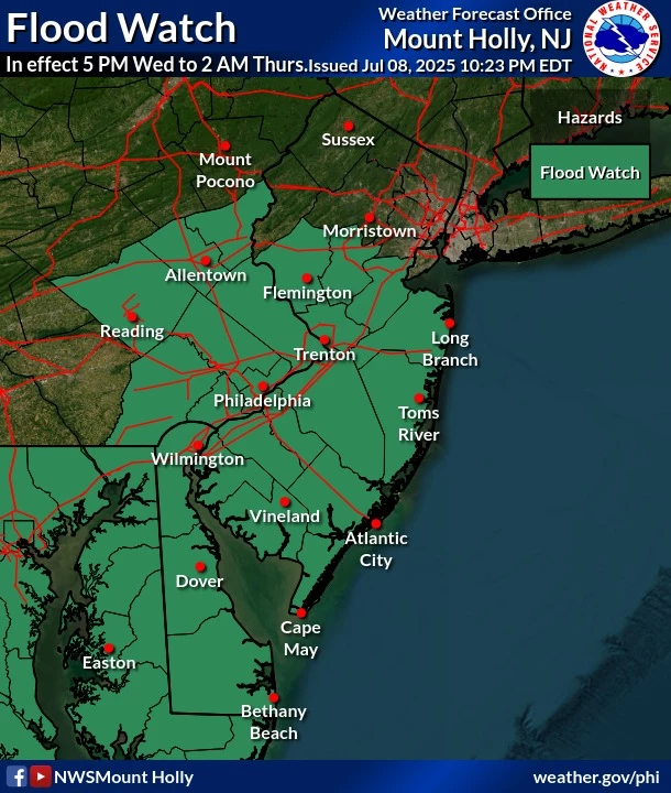
Tuesday's heat and storms turned out to be just as ferocious as feared — top temperature in the state was 100 degrees, top rainfall totals were close to 2 inches, and top wind gusts were near 60 mph. Wednesday will be steamy again, with breaks of sun and highs in the upper 80s. Thankfully, we fall out of "dangerous heat" territory. But the big weather story will be Wednesday night, when a batch of heavy rain and strong thunderstorms rolls into town. Southern and central New Jersey fall under yet another Flood Watch — someone could see 2 or 3 inches of fresh rainfall overnight. Thursday stays unsettled and blah, before improvements arrive for Friday.
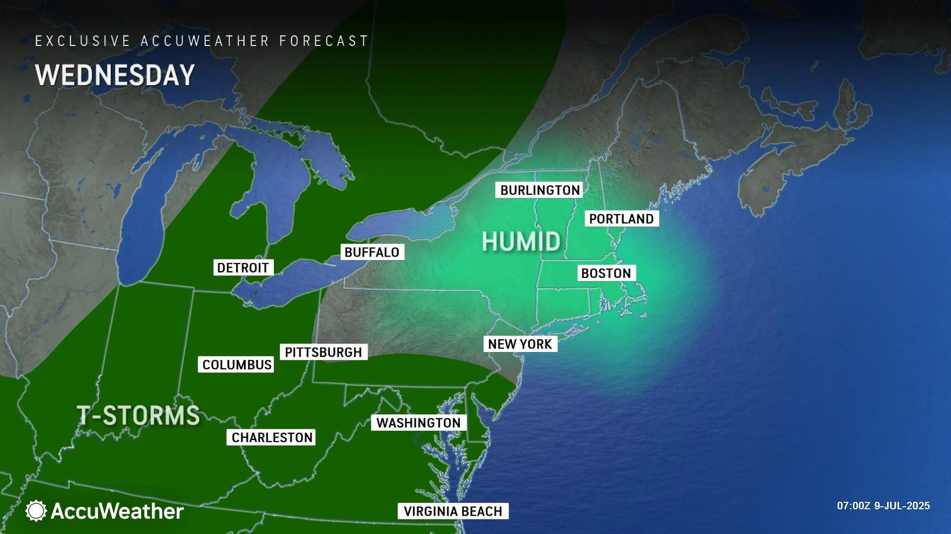
Wednesday NJ weather: Yet another steamy, stormy day
All is quiet Wednesday morning, so we can catch our breath for now. Actually, I have fewer alarm bells in general to ring here. We are done with extreme heat and high rip current risks for now. And even severe weather — meaning wind and tornadoes — is not my top concern with our next round of thunderstorms. Heavy rain and thunderstorms is.
Wednesday will be another steamy summer day, with 70s in the morning and then 85 to 90 degrees in the afternoon. Those high temperatures are pretty typical for early to mid July. Humidity is still high, so the heat index will be in the 90s. Not in the danger zone in the hundreds though.
Look for clouds with breaks of sun throughout the day. There is a chance of a spot shower or thunderstorm at any time through the afternoon, but most of the daytime hours will remain dry.
The big trouble will come Wednesday evening. Here's a rundown of what to expect:
—Timing: Starting around 6 or 7 p.m., a broad area of heavy rain and thunderstorms will roll in from the southwest. Wet, stormy weather will be over New Jersey through most of the overnight hours.
—Severe Weather: The initial thunderstorm hit, just before sunset, could pack a punch with some gusty winds, hail, and high-density lightning. That should quickly transition to just a rain (and flooding) risk through late evening.
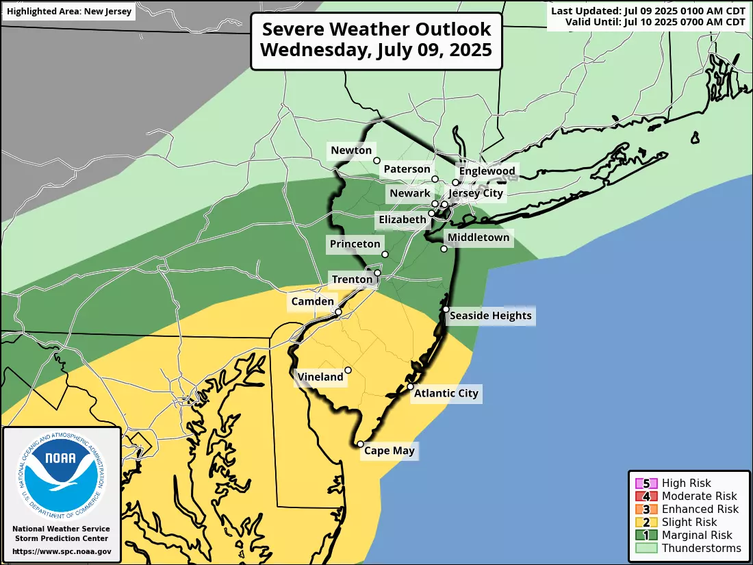
—High Flooding Potential: It looks like the axis of heaviest rain will line up somewhere along and south of the Interstate 195 corridor. That is where upwards of 2 or 3 inches of rain may fall through Thursday morning. Since the ground is already saturated from previous storms, this will be more than enough to cause widespread ponding and flooding issues of low-lying areas, including roadways.
—Medium Flooding Potential: The area of Central Jersey south of the Interstate 78 corridor will also see a healthy soaking from rain overnight, again falling on saturated ground. It will be a good idea to remain vigilant to "big puddles" and potential water inundation issues.
—Low Flooding Potential: North Jersey, this ain't your storm. While it will probably rain north of I-78, with some rumbles of thunder, I do not anticipate any significant severe weather nor any flooding issues.
—Flood Watch: The National Weather Service has laid out yet another Flood Watch for 13 counties in central and southern New Jersey — from Hunterdon, Somerset, and Middlesex on down. The watch specifically cautions that rainfall rates could exceed two inches per hour during the heaviest storms. This geography follows along nicely with the forecast I have laid out here.
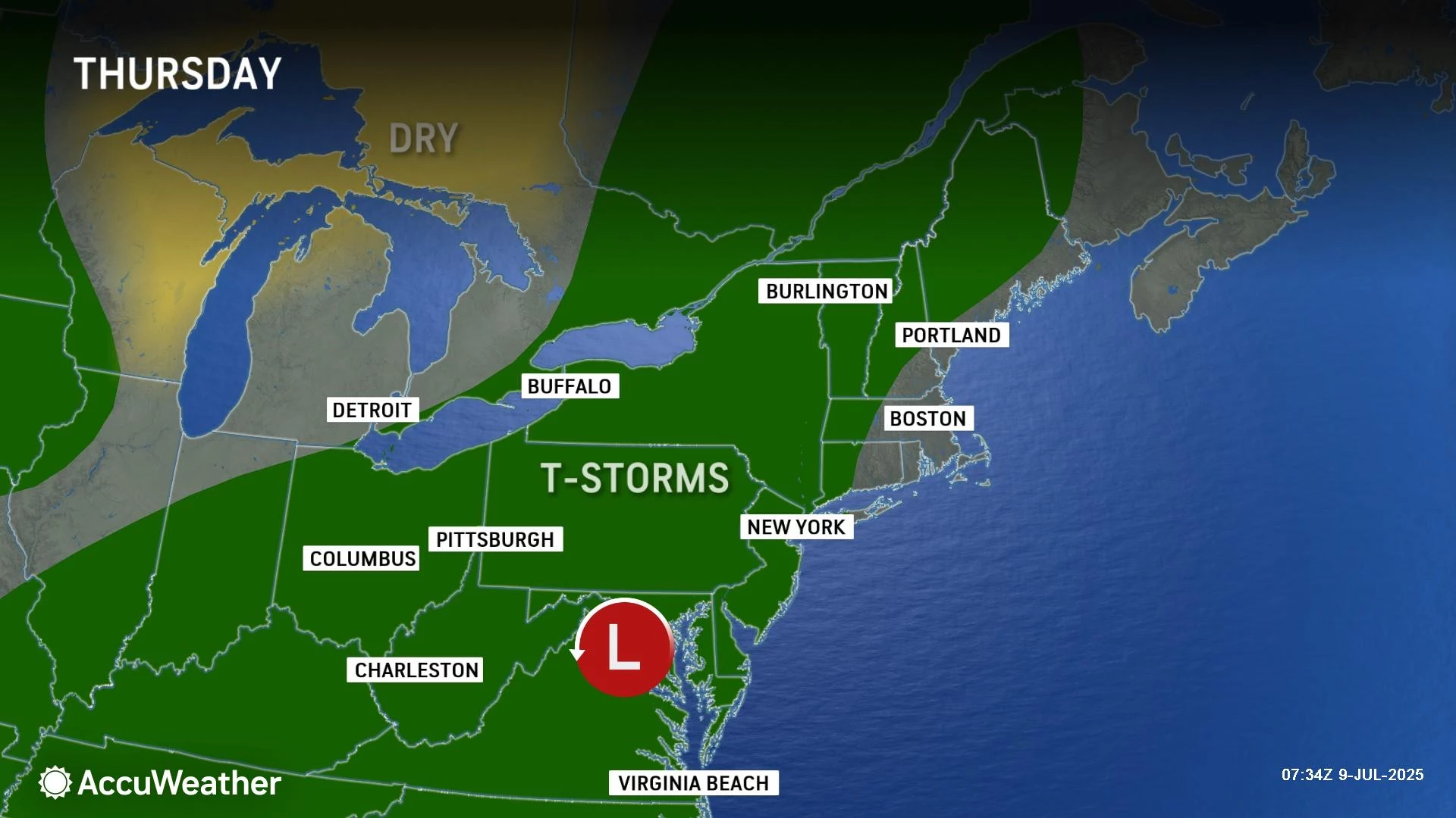
Thursday NJ weather: Just unsettled
The threat of heavy, steady rain should exit New Jersey sometime early Thursday morning. But that does not mean we will completely dry out for the rest of Thursday.
"Unsettled" is a good word for the day, as we will hold on to lots of clouds and occasional showers throughout the day. Maybe some spotty thunderstorms. I do not see anything inherently dangerous or dramatic developing on Thursday — it just will not be a very pleasant, picture-perfect summer day.
At least high temperatures will be held at bay, thanks to the clouds and raindrops. Thermometers will only top out around 80 degrees, give or take.
Friday NJ weather: Improvements
I believe Friday has potential. You may still encounter some clouds and an isolated shower in the morning. But then partial sunshine takes over. And we will enjoy seasonable warmth.
Forecast highs on Friday will reach the mid 80s — you can't complain about that here in the middle of summer. Humidity will still be sticky and steamy, of course.
There will be a chance of a late-day shower or thunderstorm on Friday. But that also looks isolated.
Saturday NJ weather: OK summer weekend
The weekend is coming into better focus. And as I have mentioned previously, there is nothing big standing in our way of enjoying some beach and pool time. But, with continued humid conditions, I just can't guarantee 100% dry weather.
Look for sun and clouds and highs in the upper 80s on Saturday. Again, pretty typical for the hottest part of the year. A popup shower or thunderstorm is possible in the afternoon or early evening, but it does not look widespread or prolonged.
Sunday NJ weather: Seasonably hot
Sunday's forecast looks very similar to Saturday's, with some good sunshine, near 90-degree temperatures, and maybe a popup storm.
Early next week probably heats up a bit more, into the 90s. A midweek cold front could be our next shot at nasty storms, followed by (fingers crossed) a brief respite from the relentless thick humidity.
BEEP BEEP BEEP: These are the 13 types of Wireless Emergency Alerts auto-pushed to your phone
Gallery Credit: Dan Zarrow
Dan Zarrow is Chief Meteorologist for Townsquare Media New Jersey. Follow him on Facebook for the latest forecast and realtime weather updates.
Flooding in Middlesex County, NJ on Aug. 23, 2021
Gallery Credit: Edwin J. Torres, Office of the Governor
More From New Jersey 101.5 FM


