Tropical depression could bring heavy rain to North Carolina
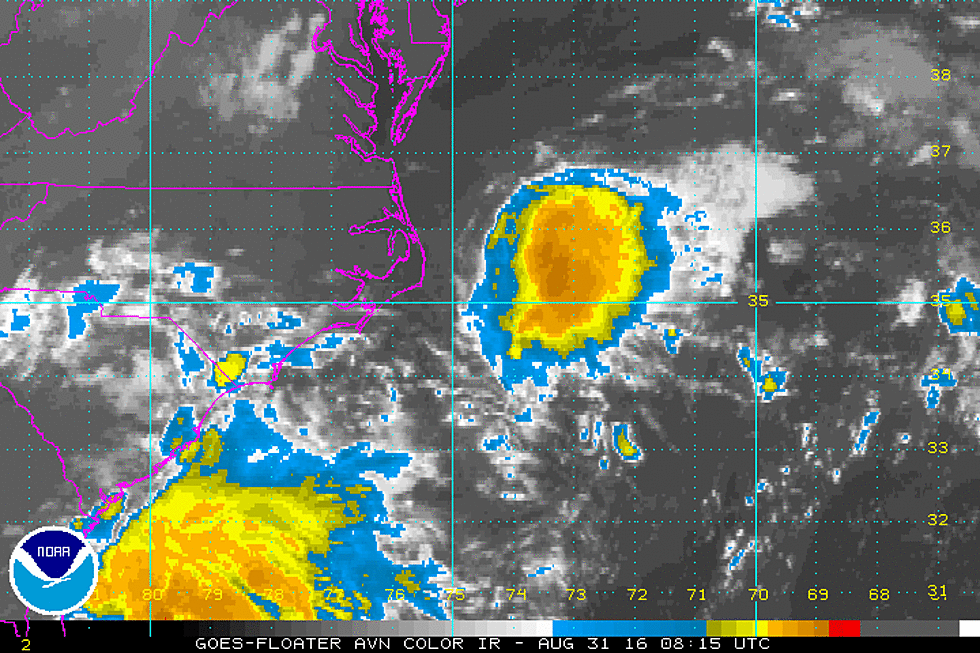
MIAMI — Forecasters say a tropical depression has formed in the Atlantic west of Bermuda, bringing the possibility of heavy rain to the coast of North Carolina early this week.
The U.S. National Hurricane Center in Miami says the depression is located about 405 mph (655 kph) southeast of Cape Hatteras and is moving west at 9 mph. Maximum sustained winds were clocking at 35 mph (55 kph), with higher gusts.
The storm's center is expected to pass offshore of the Outer Banks of North Carolina on Tuesday.
Separately, Hurricane Gaston is gathering strength as it moves northwestward in the Atlantic, but forecasters say it poses no threat to land. The center says Gaston reformed as a hurricane Saturday night.
On Sunday, Gaston was clocking maximum sustained winds of 105 mph (165 kph) winds. The storm was located about 600 miles (970 kilometers) east of Bermuda. Gaston was moving northwest at about 5 mph (7 kph).
Hurricane-force winds extended outward up to 25 miles (35 kilometers) from the center, and tropical-storm-force winds extend outward up to 140 miles (220 kilometers).
Forecasters say Gaston could strengthen in the next day but poses no threat to land.
(Copyright 2016 The Associated Press. All rights reserved. This material may not be published, broadcast, rewritten or redistributed)
More From New Jersey 101.5 FM