
Thursday NJ weather: Very dry air, cool mornings, mild afternoons
The Bottom Line
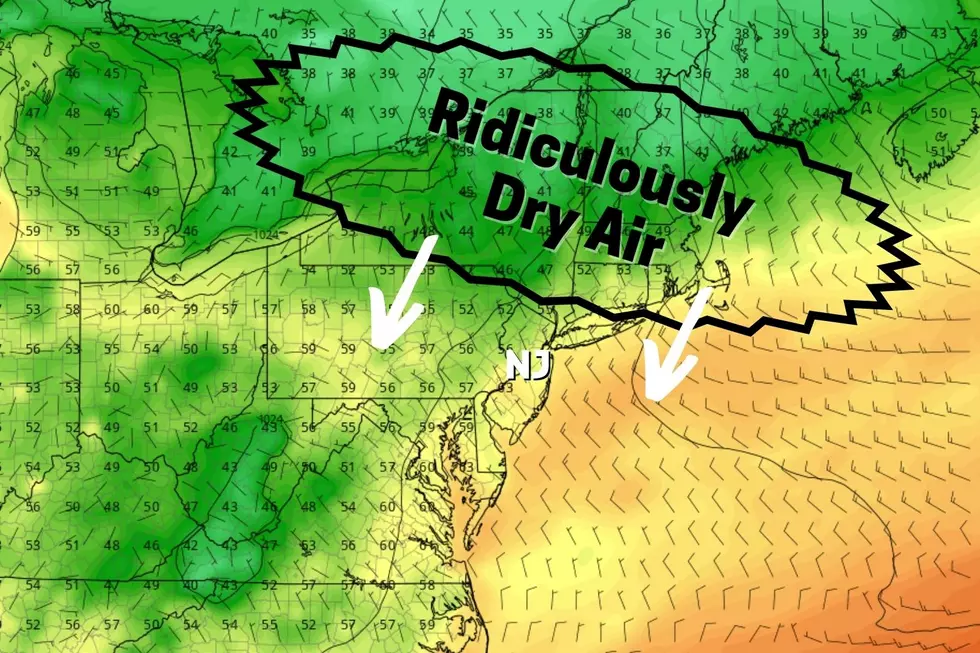
Thursday is a cold front day. But you'll hardly notice. No rain, no clouds. Just an influx of really dry air. And with high pressure and dry air in control of our atmosphere, we'll continue this stretch of pleasant September weather. This forecast is full of mild afternoons, cool (even chilly) mornings, and dry weather.
Of course, while the continuing is unfortunate, given our continuing drought concerns. One item to watch is Tropical Storm Fiona, which earned a name late Wednesday evening. It is still 2,000 miles away from the Jersey Shore, but worth keeping an eye on.
Thursday
We're starting Thursday morning calm and comfortable. Temperatures are on either side of 60 degrees, with a mainly clear sky and a light wind.
Skies will stay bright and sunny all day. High temperatures on Thursday will end up about five degrees cooler than Wednesday, thanks to the arrival of that cooler, drier air mass.
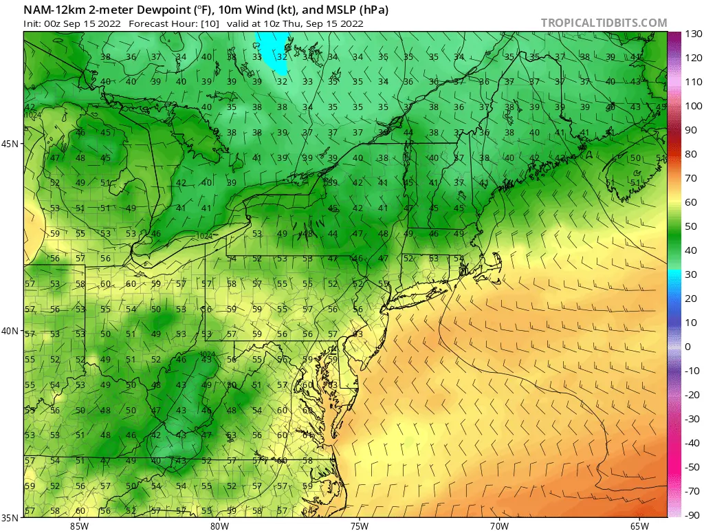
I'll put high temperatures in the lower to mid 70s Thursday afternoon. That's just a smidge below normal for the midpoint of September. It will get breezy for a few hours too, with northwesterly gusts up to about 20 mph.
You will really feel the effects of that dry air Thursday night, which looks to be New Jersey's coolest night since mid-June. We have had a few overnights in September with a smattering of 40s in northwestern New Jersey. But if skies stay clear enough and winds lighten up enough, Friday morning could bring quite a few 40s to the temperature map (away from cities and the coast). We should average 50 degrees for a low — don't be shy about grabbing a light jacket or sweater!
Friday
Despite the cool start, it will be another beautiful September day. Highs will push a degree or two higher, into the mid-upper 70s. It will be mostly sunny and dry, with only a light breeze.
Saturday
This weekend's weather will only feature two minor changes: A few fair-weather clouds building in, and (more prominently) warming temperatures.
Saturday will still be a bright and beautiful day. Look for high temperatures close to 80 degrees. Still not a drop of rain in the vicinity. And winds stay light too.
Sunday
By the end of the weekend, it might feel summer-ish again. High temperatures on Sunday will reach into the lower to mid 80s. With a hint of humidity in the air.
I'll call Sunday partly sunny. But again, it should stay completely dry.
Monday & Beyond
The warmup is set to peak on Monday, with highs in the mid 80s. That's typical for mid-summer, not mid-September.
Our next rain chance is set to arrive Monday night to Tuesday morning. But it only looks like scattered showers, centered over northern New Jersey. In other words, don't expect much here — maybe a tenth of an inch of rain.

So drought concerns continue.
And we are still at the crest of the Atlantic hurricane season. Tropical Storm Fiona is the 6th named storm of the season, currently centered 2,000 miles southeast of New Jersey. Way out there.

If you have a Caribbean vacation coming up in the next week, I'd be worried. Otherwise, we'll watch the track carefully — it could steer anywhere from Mexico to the Gulf Coast to the Carolinas to out to sea. We'll keep you posted if any surf or weather impacts come along from Fiona.
Dan Zarrow is Chief Meteorologist for Townsquare Media New Jersey. Follow him on Facebook or Twitter for the latest forecast and realtime weather updates.
KEEP READING: Scroll to see what the big headlines were the year you were born
Gallery Credit: Andrew Lisa
What would happen to NJ if we were attacked by nuclear weapons?
Gallery Credit: Eric Scott
More From New Jersey 101.5 FM


