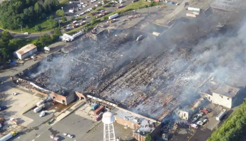
Smoke plume from North Brunswick fire visible from space
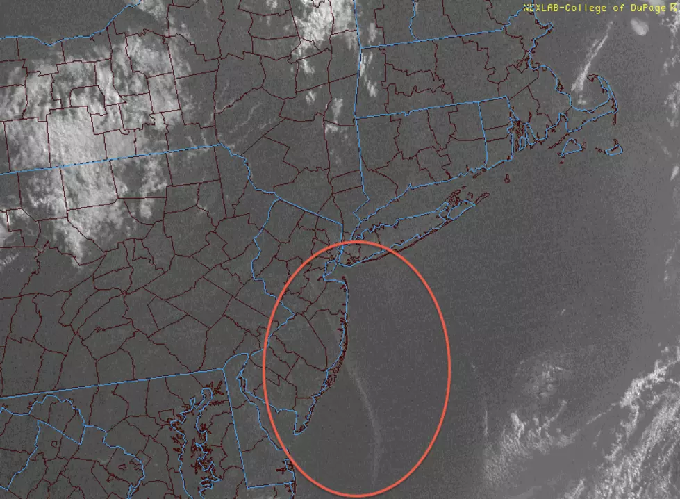
Weather satellites tracked the thick smoke for over 180 miles, from Middlesex County over the Atlantic Ocean.
Thanks to clear skies, yesterday's visible satellite image clearly showed the smoke plume from the North Brunswick warehouse inferno. That is particularly impressive as our weather satellites orbit the earth at an altitude of 22,500 miles - so yes, the smoke plume was visible from outer space!
And the smoke showed up on our ground-based weather radar too. Particles in the smoke reflected the radar beam just as raindrops, hailstones, or snowflakes would.
The plume took over the skies from North Brunswick to the southeast, over parts of Middlesex, Monmouth, and Ocean counties. Residents along the Jersey Shore shared photos all day of the ominous thick smoke. Even more extraordinary is that the plume continued far out over the Atlantic Ocean. By my estimation, the line of smoke was clearly visible about 180 miles away from the site of the fire.
I have never seen a smoke plume that resisted "fanning" or spreading out for such a long distance. I suspect this is due to a stable atmosphere and a light, yet persistent, wind from the northwest that has kept the band of smoke intact.
More From New Jersey 101.5 FM