

NJ weather: Some of the nicest days of the entire year coming up
The Bottom Line
Goodbye rain, hello sunshine. We have passed the one weather "snag" this week, with thunderstorms and pockets of pouring rain overnight. New Jersey is already seeing weather improvements, as low pressure exits and high pressure builds in. Sunshine and dry weather will make for spectacular weather conditions across New Jersey as May turns to June.

Thursday
It is a damp start to the day, as final showers exit northeastern New Jersey and some fog/mist around the rest of the state. At the very least, you will have to deal with wet roads through the Thursday morning commute. Temperatures are in the 50s.
As drier conditions prevail by late morning, drier air will be flowing into New Jersey too. So it is going to be a comfortable, refreshing day. Skies will become partly sunny. And high temperatures will reach the lower 70s. That is 5 to 10 degrees cooler than Wednesday, and slightly below normal for late May. But still quite pleasant.
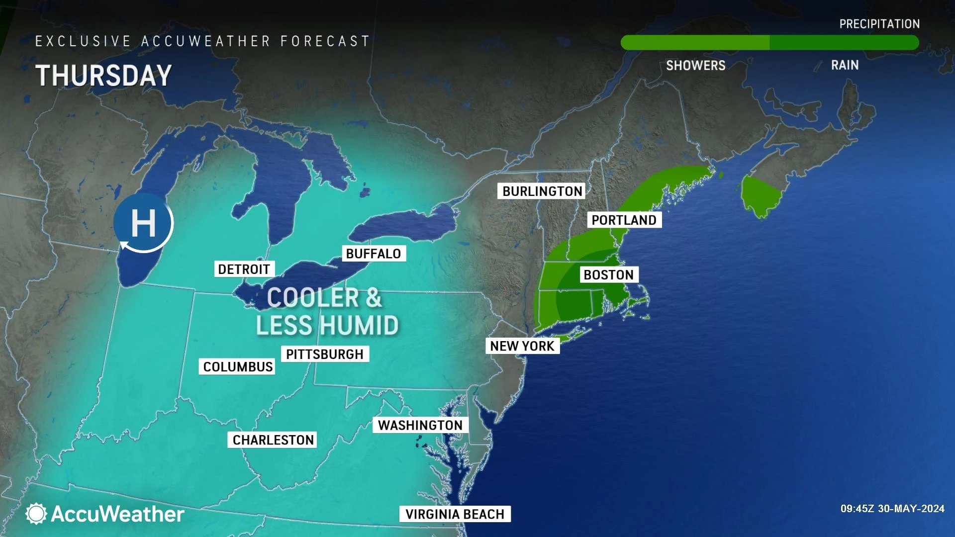
Technically, there is a chance of a popup shower redeveloping at some point in the afternoon. But I think the dry air will prevent anything more than some big puffy cumulus clouds overhead.
With our new drier, cooler air mass in place, you will notice a chill in the air Thursday night. We're not talking about a frosty, freezy, arctic blast. But with low temperatures in the upper 40s to lower 50s, you might be reaching for a jacket Thursday night through Friday morning.
Friday
If I had to describe my vision of a perfect weather day, Friday would be pretty close.
50 in the morning. 75 in the afternoon. Sunny and dry, with low humidity and a light breeze.
Wow.
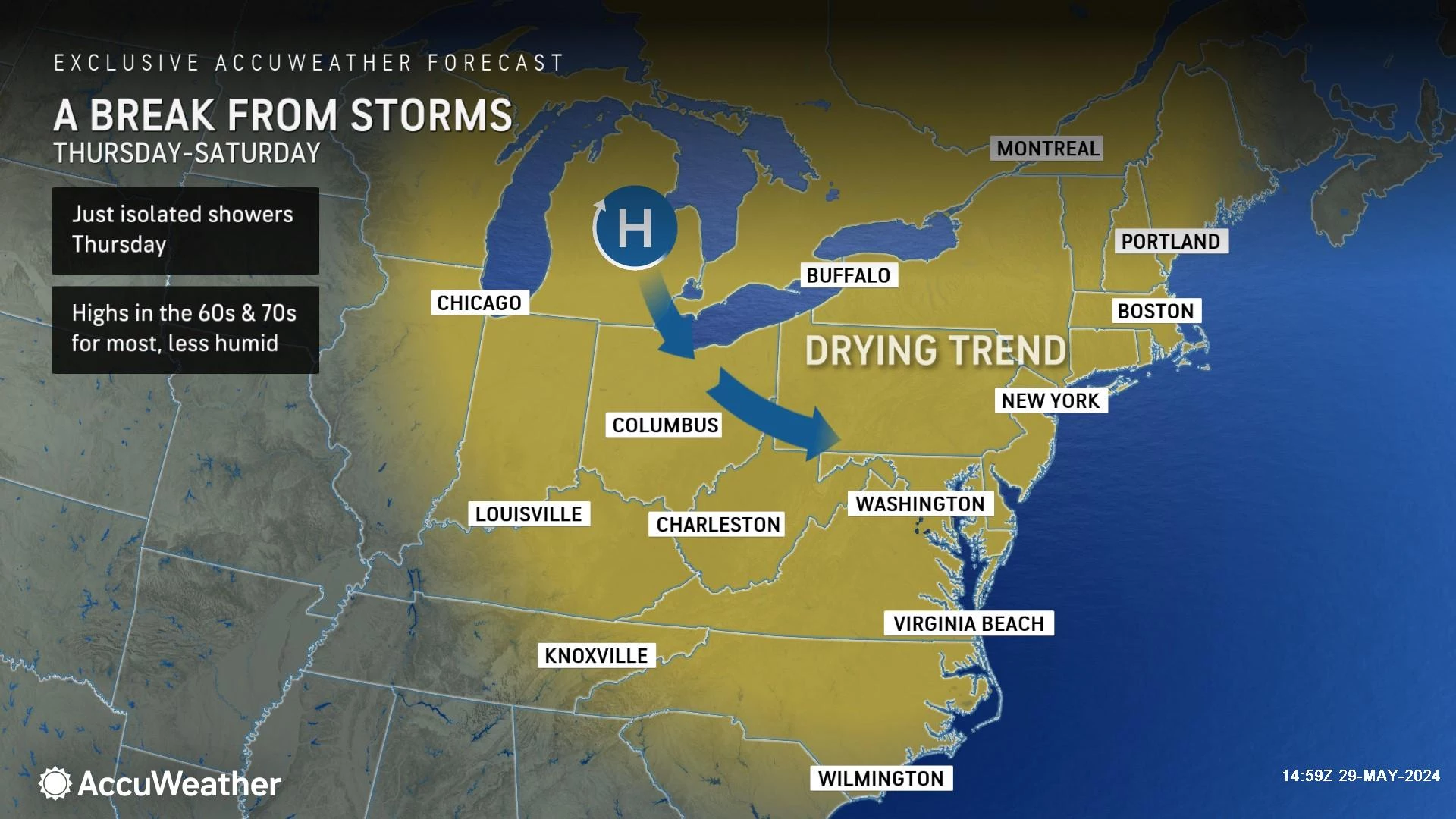
Saturday
June kicks off with equally spectacular weather. Saturday will also be sunny and completely dry. High temperatures tick upward only slightly, to the upper 70s to around 80 degrees.
Wow again.
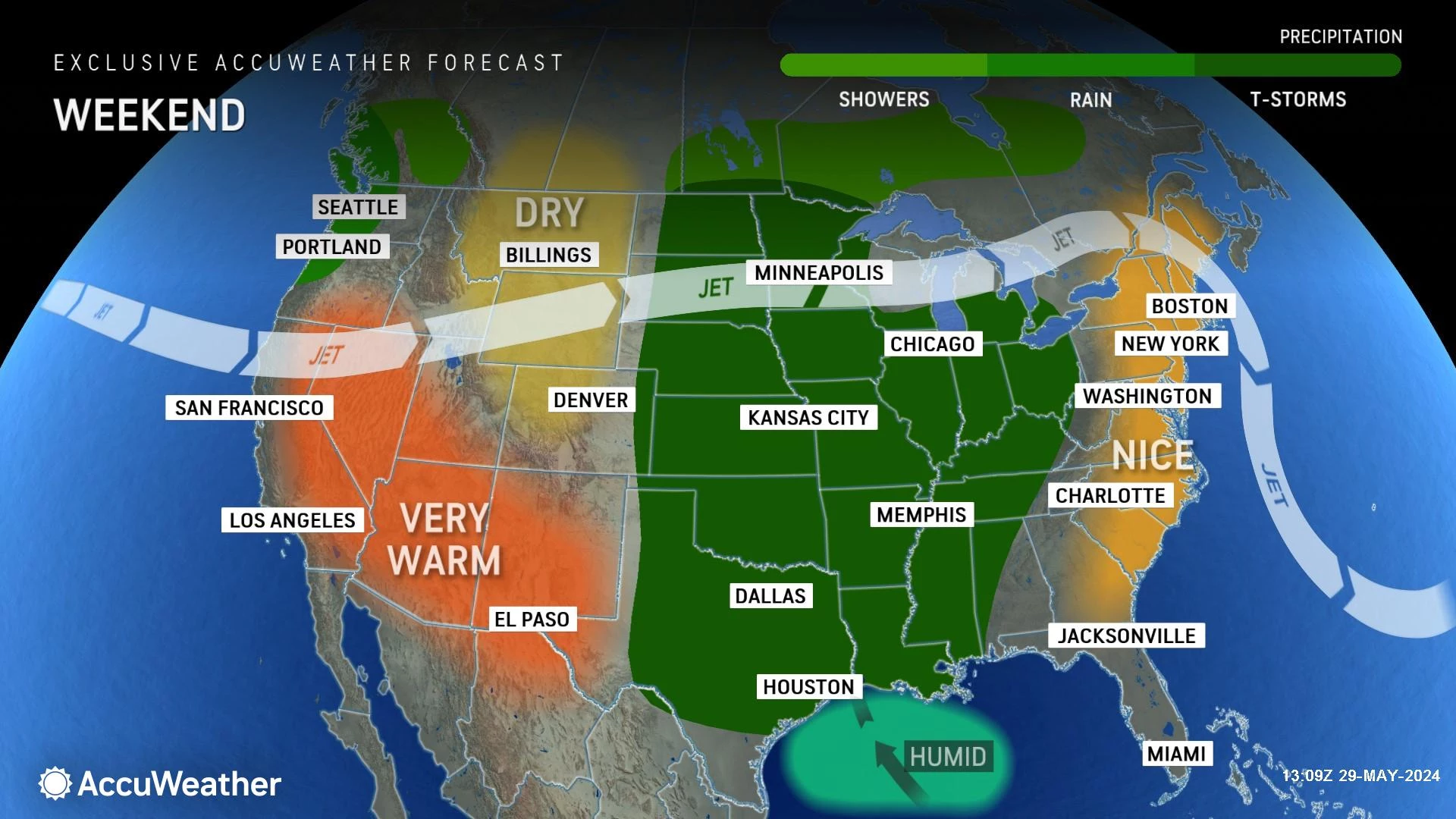
Sunday
Some changes arrive for Sunday, although I am confident the majority of the day will stay pleasant and dry.
First, clouds will roll in, starting Sunday morning. Humidity will also be on the rise, making the air feel a bit stickier again. High temperatures are forecast to reach the warm lower 80s.
The issue for Sunday: Rain. Model guidance now shows a compact storm system coming into New Jersey's vicinity starting Sunday afternoon. It does not look like a severe weather situation, nor a total washout. But rain showers and maybe a thunderstorm could interfere with your plans at the tail-end of the weekend.
The Extended Forecast
Monday and Tuesday will be warm and semi-humid, with inland highs in the 80s and sticky dew points probably in the 60s. I opted for a "partly sunny" call for both days, although a shower or thunderstorm is not impossible.
Our next big storm system will arrive in the second half of the week. Depending which model you choose to believe, part of the state could pick up between 1 and 3 inches of rain anytime between Wednesday and Friday. That would be a real soaking, and might set off some flooding alarm bells. We will have a better sense of how that may play out by the end of the weekend.
Until then, soak in the sun, take a breath of fresh air, and enjoy some of the nicest weather days of 2024!
Latest additions to NJ DOT's 2024 collection of humorous safety messages
Gallery Credit: Dan Alexander
Dan Zarrow is Chief Meteorologist for Townsquare Media New Jersey. Follow him on Facebook for the latest forecast and realtime weather updates.
The complete list of names for the 2024 Atlantic Hurricane Season
Gallery Credit: Dan Zarrow
More From New Jersey 101.5 FM


