

NJ weather: More heavy rain, lower humidity, Hurricane Lee
The Bottom Line
The forecast through the rest of the week is all about active, transitioning weather. Although that is not necessarily a bad thing. We will progress from nice to rainy to not humid. Yes, by Thursday morning, humidity should be zapped from our atmosphere as we finally enjoy a taste of crisp air and an early fall feel.
There is one considerable nuisance looming closer too — Hurricane Lee. As of Tuesday morning, the storm is centered about 1,200 miles southeast of New Jersey, about to make its turn to the north to parallel the Atlantic seaboard.
Weather impacts for NJ still look minimal: some clouds, and a stiff breeze. But coastal impacts will be more significant, including threats of big ocean waves and some coastal flooding.

Tuesday
I think we are all getting tired of occasional downpours at this point. In fact, each of the last four days had at least one NJ weather station that picked up over an inch of rain. Some downpours dumped 3 or 4 inches of rain. Soggy, steamy, and not very September-ish.
With so much lousy weather lately, I actually have to hesitate before declaring... Tuesday looks like a nice day across New Jersey!
The vast majority of the state should stay completely dry, although I can't rule out a stray shower. (Especially late afternoon, to the south.)
Under partly sunny skies, high temperatures will push to about 80 to 85 degrees. Definitely warm. And still sticky, although humidity levels are fading slightly.
It's a good beach day, but only on the sand. The surf is already getting rough due to Hurricane Lee stirring up the Atlantic. A high risk of rip currents is posted for the Jersey Shore, which will continue through at least the upcoming weekend.
Tuesday evening will be uneventful too. Clouds will increase overnight, with lows in the upper 60s.
Wednesday
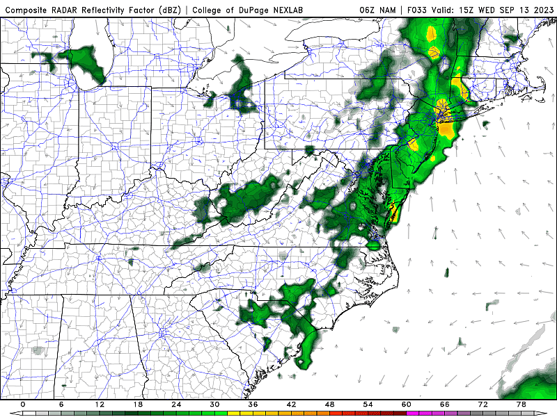
One more soaker. One more push of steady to heavy rain is likely Wednesday morning, as a welcome cold front arrives from the west.
Raindrops will probably begin along the Delaware River just before daybreak Tuesday morning (around 5 a.m.) Heavy rain and localized ponding/flooding could impact the AM commute.
Rain will slowly scale back between mid-morning (9 a.m.) and midday (1 p.m.) A shower or thunderstorm may linger into the afternoon (through about 5 p.m.)
Overall, I do not think Wednesday will be a nice day, although the morning will clearly be the wettest period. It will be cloudy and humid, with high temperatures limited to the upper 70s or so.
Thursday
Early Thursday morning — between Midnight and sunrise — the drydown is on. As dry air filters into New Jersey, humidity levels will drop dramatically. So by the time you wake up Thursday, it should feel much more comfortable outside. (Dew points around 50, rather than near 70.)
So that alone will make Thursday a pleasant day. Sunshine will emerge by mid-morning Thursday, and our weather stays completely dry. It will become breezy, with a refreshing northerly wind gusting to about 20 mph.
Friday & Saturday
Friday is the day we will start to feel impacts from Hurricane Lee, as the powerful storm passes a few hundred miles east of New Jersey. (Closest pass will actually be pre-dawn Saturday morning.)
Again, coastal areas will see some issues. But statewide weather effects will be limited.
Let's run through those impacts, in descending order of severity:
—Big Waves... Tropical systems cause substantial turbulence and swell in the ocean, and Lee will be no exception. The latest models push 8 to 12 foot waves against the Jersey Shore on Friday. Significant beach erosion is possible.
—Coastal Flooding... In addition to the swell, Lee will probably push a foot or two of storm surge toward the Jersey Shore, causing several rounds of flooding of tidal waterways. However, the wind direction will never be easterly (an "on-shore" wind), which will limit the amount of ocean water pushed against our Shore. We will have a better sense of the flooding magnitude in the next 24 hours, as tidal guidance starts to capture the surge potential.
—Wind... It will be breezy. Possibly reaching the "windy" category, with occasional gusts to 30+ mph. Keep in mind, "tropical storm strength" requires sustained winds at 39+ mph, so it's not even close.
—Clouds... At the very least, high cirrus clouds will filter over the eastern half of New Jersey on Friday and Saturday. It may even look mostly cloudy to overcast and kind of gray at times. Meanwhile, farther west, there is a good chance of sunshine for the duration as we end up right on the western edge of the storm.
—Rain... The latest forecast shows nothing more than a sprinkle falling over New Jersey due to Hurricane Lee. If the storm wiggles west, I could see a bit more drizzle coming into play. But nothing "tropical" or dangerous.
—Temperatures... Lee will not have a huge impact on thermometers, although our new air mass certainly will. High temperatures will be limited to the lower 70s on Friday, pushing into the upper 70s on Saturday.
The Extended Forecast
A weak impulse may drive in a shower late Sunday into Monday. Otherwise, the extended forecast looks comfortable, pleasant, and dry. No big increases in temperature or humidity. No major storm systems.
Of course, that statement comes with a huge asterisk, as we are now at the peak of the Atlantic hurricane season. Behind Hurricane Lee, Hurricane Margot is a fish storm. And then there are two more tropical waves coming off the African coast, which could become Nigel and Ophelia (the next two names on the 2023 Atlantic hurricane list). We always have to stay vigilant this time of year.
25 costliest hurricanes of all time
Dan Zarrow is Chief Meteorologist for Townsquare Media New Jersey. Follow him on Facebook for the latest forecast and realtime weather updates.
Your hurricane emergency kit: what to pack
More From New Jersey 101.5 FM


