
NJ weather: Humidity is gone, but here comes Hurricane Lee
The Bottom Line
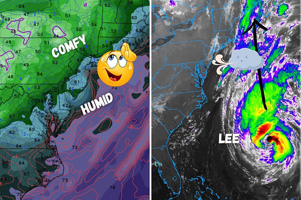
Ahhhh. This is the morning we have been waiting for. As expected, a drier air mass began pushing into New Jersey overnight. As humidity goes down, the air becomes more comfortable and more breathable. Low humidity will be a common thread of the forecast for the foreseeable future, with generally pleasant weather too.
There is one big wrinkle though: Hurricane Lee.
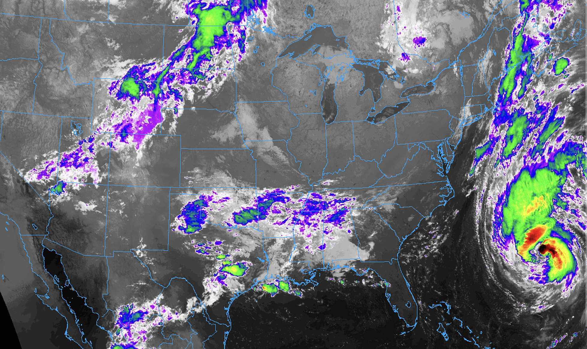
As of this writing, Lee is centered about 800 miles southeast of New Jersey. Significant storm effects are expected from Cape Cod, Massachusetts to Nova Scotia, Canada.

Here in Jersey, we are still focused on coastal impacts with rough surf, big waves, beach erosion, and minor coastal flooding expected. Weather concerns from Lee will be noticeable, but minor overall.

Thursday
As of early Thursday morning, dew points and humidity levels are falling. They have not bottomed out yet, but it is still a very comfortable morning. What a difference a day makes.

While you may spot a few clouds early on Thursday, brilliant beautiful blue skies and sunshine will win out. Our weather stays completely dry, as we put those nasty thunderstorms and downpours behind us.
High temperatures will climb into the mid to upper 70s. Reasonably close to normal for mid-September.
As dry air completely takes hold Thursday night and skies stay crystal clear, we could see the coolest night of the season so far. My forecast puts low temperatures in the lower 50s, on average, by Friday morning. More like mid 50s along the coast. And there will almost certainly be some 40s on the temperature map in NW NJ and the Pine Barrens. Not quite "frost territory," but definitely cool.
Friday
On Friday, our attention turns to the close fly-by of Hurricane Lee. The center of the storm is expected to pass about 350 miles east of New Jersey. Tropical storm force winds are forecast to extend about 250 miles westward from the center. So staying well off-shore.
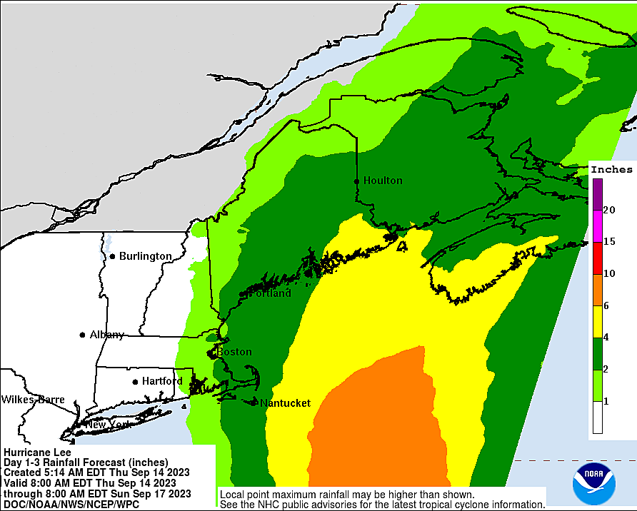
As we have discussed, New Jersey's biggest impact will be big waves, causing dangerous rip currents and beach erosion. Wave heights will probably peak Friday afternoon, with top crests in the 10 to 12 foot range.
The threat for coastal flooding also kicks in with Friday evening's high tide cycle. Storm surge of 1 to 2 feet will push water levels into the "Minor" flooding category. I often call this "the usual spots" — those vulnerable roadways and low-lying areas that see water inundation from practically every strong coastal storm system. The surge and flooding threat will be minimized, as Lee's strongest winds will be parallel to the coast (rather than straight-on perpendicular).

Weather-wise, the latest models push clouds right up against the coast on Friday. But the western half of the state should remain mostly sunny. It will turn breezy on Friday too, with top gusts in the 20-25 mph range.

So Friday will not be an unpleasant weather day. Far from it. There will just be subtle signs that a powerful hurricane is churning over the ocean.
High temperatures will only reach the lower 70s Friday afternoon, as that stiff northerly breeze keeps the cool, dry air mass locked in place. It will be the coolest day of the week.
Saturday
Lee-related weather impacts will likely peak on Saturday. And the surf impacts from Friday will continue too.
Wind gusts to 30+ mph are expected Saturday, especially along the Jersey Shore. Not enough to cause damage, but that is definitely noticeable.
I am going to call Saturday mostly cloudy too, although once again the sky will be brighter to the south and west. High temperatures will push into the mid 70s or so.
And I can't completely rule out an isolated patch of drizzle at some point Saturday, on the backside of Lee's broad circulation. This largely depends on a last-minute westward wobble. I have opted to leave this shower mention out of my on-air and online forecasts, but it will be something to watch.
Sunday
By Sunday, Lee will be racing to the northeast, away from New Jersey. Seas will calm and skies will clear.
We should see some good sunshine around the middle part of Sunday. That will help high temperature pop to around 80 degrees. But don't worry, humidity will still be in the basement. Nice and comfortable.
Late-day Sunday, an impulse riding in from the west could spark some spotty showers. Hit-or-miss raindrops will be limited Sunday afternoon and evening, given our moisture-starved atmosphere. But still, it is worth mentioning that brief periods of rain could affect your outdoor plans.
The Extended Forecast
Monday will be partly sunny, with an isolated shower chance. Highs will again be close to 80.
A weak reinforcing shot of cool, dry air arrives Tuesday. That will keep high temperatures in the 70s, along with golden sunshine and delicious low humidity.
Long-range models show no significant storm systems on the horizon for New Jersey. It looks to be a pretty quiet and generally pleasant second half of September, I am happy to say.
LOOK: The most expensive weather and climate disasters in recent decades
Gallery Credit: KATELYN LEBOFF
Dan Zarrow is Chief Meteorologist for Townsquare Media New Jersey. Follow him on Facebook for the latest forecast and realtime weather updates.
KEEP READING: Get answers to 51 of the most frequently asked weather questions...
More From New Jersey 101.5 FM


