

NJ weather: Another increasingly steamy and stormy forecast this week
Who's ready for the return of (cue dramatic music) humidity?! Our weather is about to turn summerlike again. And I'm not just talking about surging heat and humidity. But over the next 5 days we face some unsettled weather, with a daily chance of a shower or thunderstorm. While there are no washout days, the atmosphere will be fully charged for some severe weather.
We are waking up to cool, crisp conditions on this Tuesday morning. Not as cold as Monday morning, temperatures are generally in the 50s (with some 40s sprinkles in). Forecast models have been very bullish on a round of rain showers drifting in from the northwest during the morning hours (between about 7 a.m. and 11 a.m.) But given our dry atmosphere, I have trouble imagining anything more than patchy drizzle and/or sprinkles here in New Jersey. Yes, I've included the mention of "a few rain shower" in my on-air forecasts. But I don't think everyone in the state gets wet here.
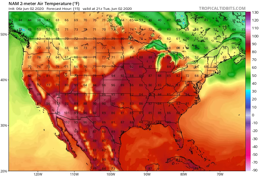
I have to leave an isolated shower chance in the forecast through Tuesday afternoon too. It will be a mostly cloudy day — that equates to about 75 percent sky cover. There is a bit of a disparity amongst our latest guidance regarding temperatures — the GFS shows a cloudier, cooler day while the NAM is more consistent and more seasonable. I'm siding with the warmer solution, putting highs in the mid 70s Tuesday — that is close to normal for early June.
Starting Tuesday evening, you'll start to notice rising humidity in the air. That will accompany another chance for showers and thunderstorms during the evening and overnight hours. Low temperatures will only dip into the lower 60s for most — about 5 degrees above-normal for this time of year.
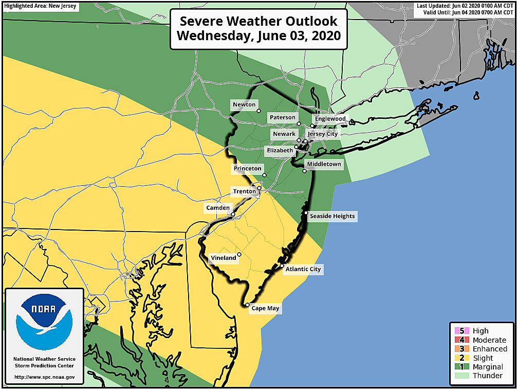
High temps on Wednesday will soar into the lower to mid 80s. It will be warm and humid and breezy, with a mix of sun and clouds. As you bask in the mid-summerlike warmth and sweat in the humidity, keep an eye on the sky. A round of scattered showers and thunderstorms is looking likely for Wednesday afternoon and evening. Given the heat (energy) and humidity (moisture) in the atmosphere, it should be no surprise to see those storms reach strong (40+ mph wind, small hail) or severe (60+ mph wind, hail, tornado) limits.
Thursday looks about the same. Scattered clouds, temperatures in the 80s, dew points in the 60s. And a chance of a late-day shower or storm (potentially less widespread than on Wednesday).
Friday also looks steamy and potentially stormy. The "play by play" of this forecast is pretty muddled this far out, but 80s are almost a guarantee with a shower or storm (again, probably not as widespread as late Wednesday).
By the way, along the way, I fully expect southwestern New Jersey to experience the first 90-degree temperature of 2020 at some point this week. Maybe Wednesday, maybe Friday, maybe both.
Our big transition is set to happen on Saturday, and the timing of our impending cold front will dictate whether Saturday will be humid and/or wet. Here's what we know (and what we don't) about the big Saturday forecast so far:
1.) No matter what, it's going to be warm, in the 80s for one more day.
2.) The latest models have shifted that frontal passage later, to Saturday afternoon.
3.) That means a line of rain and thunderstorms could interrupt your warm late Spring day.
4.) It also means humidity levels would remain uncomfortably high until Saturday evening.
5.) Keep in mind a shift to that timeline could impact the overall "feel" of Saturday.
In any case, we settle into our new air mass for Sunday, which looks like a really nice day. Skies becoming mostly sunny, with a slight cooldown. Highs will be near-normal in the mid to upper 70s. And with a dew point near 50, it will be dry and comfortable too.
Monday looks great too, in the upper 70s. Then another surge of warmth is likely for next week.
One final note. Tropical Depression 3 has formed in the Bay of Campeche, from the remnants of (Pacific Ocean) Tropical Storm Amanda. It is expected to meander in the southwestern Gulf of Mexico for the next few days, dumping tropical rain over Central America and Mexico. Significant tropical development is not expected at this time. Having said that, if TD 3 strengthens into a tropical storm and gets a name, Cristobal is the next on the list.
Dan Zarrow is Chief Meteorologist for Townsquare Media New Jersey. Follow him on Facebook or Twitter for the latest forecast and realtime weather updates.
More From New Jersey 101.5 FM


