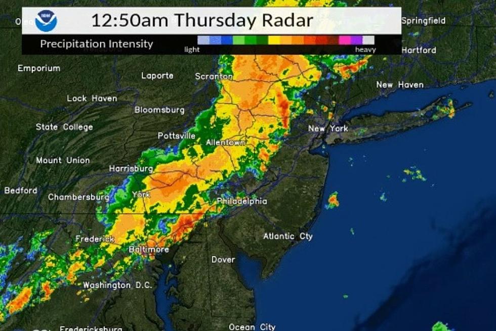
New Jersey dodges a bullet from thunderstorms
Most of New Jersey missed the worst from a line of thunderstorms Wednesday night and early Thursday morning as heavy rain stayed away from most of the state still saturated by Ida.
Initial storms Wednesday night moved very slowly. Because of that, Northampton County in Pennsylvania (just over the Delaware River) picked up four to five inches of rain, according to New Jersey 101.5 Chief Meteorologist Dan Zarrow.
"We definitely dodged a bullet. If that heavy storm cell ended up just 20 miles southeast, over the waterlogged Raritan River basin in central New Jersey, that would absolutely have led to flash flooding issues," Zarrow said.
The line of strong thunderstorms did move into Sussex and Warren counties that dropped around 2 inches of rain but did not linger. Route 46 was closed in Knowlton between Lackawanna Road and Ramseyburg Road because of flooding.
Any local flooding could linger as water will be slow to recede, according to Zarrow.
Power outages were scattered on the JCP&L, PSE&G and Atlantic City Electric outage maps. NJ Transit reported no storm related issues.
There was another area of storms along the Jersey Shore with some strong storms. The ground is not nearly as saturated from Ida and the storms did not have any major impact.
Reeling from criticism over his administration's handling of Ida Gov. Phil Murphy warned people to stay away from standing water and to make sure you could hear warnings from your phone while you slept. The DOT activated its Regional Emergency Operation Centers.
Zarrow said Thursday will be a pretty wet and gloomy day, as scattered rain continues and the threat of flooding and severe weather will be low going forward.
"New Jersey's final raindrops will come through sometime Thursday evening. And then we'll enjoy a string of beautiful weather days through the upcoming weekend," Zarrow said.
Contact reporter Dan Alexander at Dan.Alexander@townsquaremedia.com or via Twitter @DanAlexanderNJ
Incredible, heartbreaking images of Ida's damage in New Jersey
Gallery Credit: Dan Alexander
See 20 Ways America Has Changed Since 9/11
Gallery Credit: Madison Troyer
These shows NJ loves are returning to Broadway
Gallery Credit: Jeff Deminski
More From New Jersey 101.5 FM


