Monday NJ weather: Last full day of summer, still feeling like fall
The Bottom Line
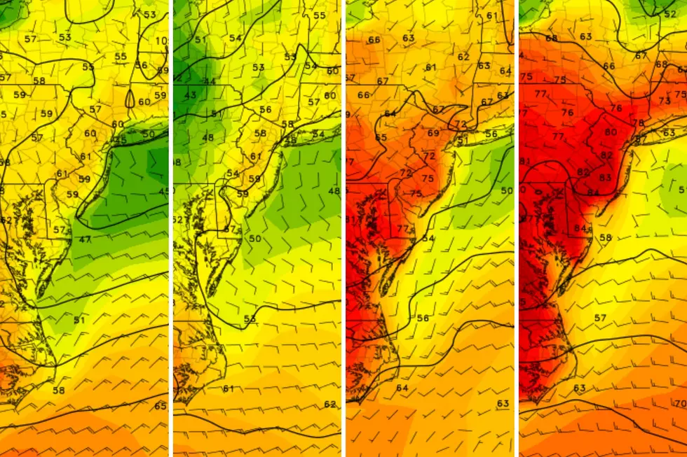
This is a pretty boring weather forecast, with a sprawling high pressure firmly in control of our atmosphere. There are two weather headlines here: Rough surf, and a warming trend.
Monday
If you enjoyed the bright, fall-like weather this weekend, you'll love Monday too. Definitely chilly to start. (Let the record show, I wore a jacket and long pants to work for the first time in a long time Monday morning.) It will be sunny, dry, and cool again. Temperatures are hovering about 10 degrees below seasonal normals, making it feel more like mid-October than mid-September. Look for highs in the lower to mid 60s Monday afternoon.
Hurricane Teddy is spinning about 900 miles southeast of New Jersey, approaching Bermuda. The storm itself will steer clear of us. But it is churning up the Atlantic. So a high risk of rip currents continues Monday. 6 to 8 foot ocean waves are keeping the surf rough, and may be causing some beach erosion. Additionally, the risk for minor to localized moderate coastal flooding will continue at each high tide cycle through Wednesday. (In fact, Monday morning's high tide is expected to be particularly high around Cape May County.)
Monday night will be clear, calm, and chilly once again. Expect most low temps to dip into the lower to mid 40s, with some 30s in the usual cold spots.
Tuesday
Fall officially falls at the Autumnal Equinox, at 9:30 a.m. Tuesday. More sunshine, dry air, and dry weather. It will get a bit breezier late-day. And also a bit warmer, as highs bump into the lower 70s. Still below normal.
Wednesday
Mostly sunny and breezy. And we'll firmly end up on the warm side of normal, with highs between 75 and 80 degrees.
Thursday
Gasp! Clouds will return to the skies of New Jersey on Thursday! The air will become less dry too. (I don't want to call it "more humid," because dew points only increase to the 50s or so — it shouldn't feel sticky at all.) While I wouldn't rule out adding a shower chance eventually, I am favoring the continuation of dry weather. Despite the cloudiness, high temperatures will push to 80 degrees.
Friday & Beyond
Friday will be mostly cloudy and warm, again near 80 degrees.
The weekend forecast is still a little shaky. The GFS model favors a sunny outlook. The Euro, meanwhile, paints a cloudier and even wetter picture. (I'm strongly leaning toward a "no rain until next week" outlook.) High temperatures should remain at or above normal through the last weekend of September too.
More From New Jersey 101.5 FM


