

Hurricane Lee’s NJ fly-by: 10 foot waves, 30 mph wind gusts
The Bottom Line
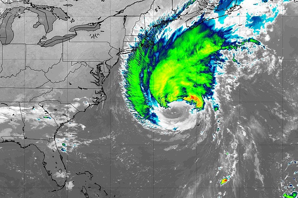
We have been talking about Hurricane Lee all week. And now, here we go — Lee's closest pass to New Jersey is coming up Friday night into Saturday. And we are still looking at indirect impacts from the storm here. Generally minor, although definitely noticeable.
Believe it or not, this is the final full weekend of summer. And the weather looks OK overall. There are three weather headlines you need to be aware of:
1.) The ocean remains angry.
2.) It will be breezy to windy.
3.) A chance of rain will develop late-day Sunday.
Humidity will stay nice and low for the duration, yielding cool mornings and comfortable afternoons.

Friday
Friday morning is starting out cool, with widespread temperatures in the 50s. If you opt for summertime apparel like a t-shirt, shorts, and sandals, you might be a little chilly.
On the western edge of Hurricane Lee's circulation, we will pick up a stiff northerly breeze today. Wind gusts will be in the neighborhood of 20+ mph. That will keep cool air in place — high temperatures will go no further than the lower 70s.
We will start the day with sunshine. But clouds will gradually creep in from the coast as the day goes on. Again, from Lee.
Friday also looks to bring the peak waves along the Jersey Shore, as Lee approaches. It has been a long time since I've seen a surf forecast this intense in NJ, with wave heights up to 10+ feet.
Overall, the coastal flooding picture is as good as it could be, considering a powerful hurricane is passing by. Minor category flooding is possible starting with Friday evening's high tide cycle. That translates to "the usual spots" — vulnerable, low-lying areas that "always" flood during a coastal storm.
Friday night will be partly cloudy, quiet, and cool. Lows will once again dip into the 50s overnight.
Saturday
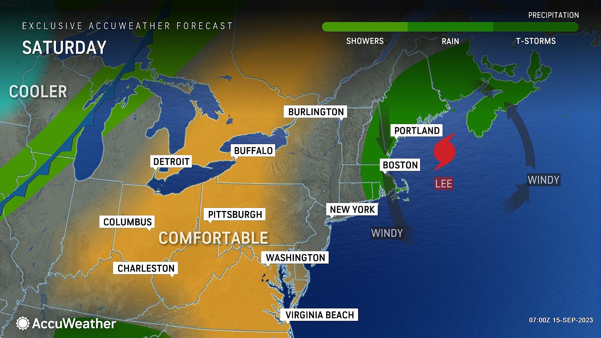
We will still feel the impacts of Lee on Saturday, as the storm makes landfall upon Nova Scotia, Canada.
The brisk wind will still be with us, shifting slightly to blow from the northwest (rather than straight north). Gusts may reach 30+ mph, especially along the coast.
Rough surf and big waves are expected on Saturday. But they will slowly start to subside.
Weatherwise, while Saturday may start with an abundance of high clouds, they will eventually give way to sunshine. It should be a seasonable start to the weekend, with highs around 75 to 80 degrees. (If you see sunshine earlier rather than later, you will be close to 80 degrees. Nice and warm.)
The chance of a sprinkle Saturday morning on the backside of Lee is not zero. But it's very low — I still favor a dry forecast here.
Sunday
No more Lee talk as of Sunday. Instead, we have one more hiccup in the forecast, before beautiful weather returns next week.
Sunday morning, with temperatures again in the 50s, skies will progress to mostly cloudy once again. That is ahead of an impulse riding set to through our atmosphere Sunday afternoon and evening. And that means rain is back in the forecast. But those raindrops will have to compete with some pretty dry air. (I could see a little dew point spike as rain arrives Sunday, but it absolutely will not feel "humid".)
I think everyone has the potential to get wet late-day Sunday, potentially putting a damper on some outdoor plans. The threat for prolonged heavy stuff, thunder and lightning, and severe weather seems low.
High temperatures will settle in the mid 70s. (Lower than we had been discussing, due to the increased chance of rain.)
The Extended Forecast
Monday may still be a bit unsettled, with more clouds than sun. There will be a shower chance too, especially early and late. High temperatures will stick in the mid 70s.
And then the middle part of next week looks fantastic, as a big dome of high pressure builds in. Sunny skies. Highs in the 70s. Low humidity. And no rain. Love it!
In fact, the entire second half of September looks quiet and generally pleasant. That's not a guarantee, with Atlantic hurricane season in full swing. But I do not see anything big brewing at the moment.
Have a great weekend!
LOOK: The 21 most popular ice cream flavors in America
Dan Zarrow is Chief Meteorologist for Townsquare Media New Jersey. Follow him on Facebook for the latest forecast and realtime weather updates.
Do You Remember These Nostalgic '90s Cartoons?
More From New Jersey 101.5 FM


