Chilly start to winter for NJ, White Christmas chance still alive
Thursday is the first day of winter, which will begin with cooler then warmer than cooler air.
Happy Winter Solstice, New Jersey! We'll officially ring in the new season at 11:28 a.m. Thursday. As the northern hemisphere experiences maximum tilt away from the sun, we'll only get about 9 hours, 18 minutes of daylight on Thursday. The good news? That number will only increase because now and the Summer Solstice in June.
Quite appropriately, Thursday going to be a cold day to begin Winter. Morning temperatures are mostly in the 20s, and afternoon highs will only reach the upper 30s to lower 40s. That's a few degrees below normal for this time of year. At least skies will be sunny, and winds will remain light.
A warm front is expected to start lifting northward through New Jersey Thursday night, although you won't really feel it immediately. Overnight lows will dip into the upper 20s to lower 30s, as clouds increase.
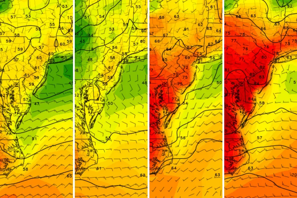
By Friday morning, skies will be mostly cloudy. Friday's high temperatures will be highly dependent on how far north the aforementioned warm front creeps, and how quickly. North Jersey may get stuck in the lower to mid 40s. Central Jersey should top out near 50 degrees. And South Jersey will almost certainly see lower 50s, quite a bit above normal for late December.
Friday could also be a bit unsettled, with scattered showers possible. The best (although non-exclusive) chance for raindrops will be in northern NJ, through the afternoon and evening hours.
I'm a little concerned that those showers will extend into Friday night. If temperatures drop fast enough, some sleet, freezing rain, and/or wintry mix could fall in North Jersey by Saturday morning. While impacts would be minimal, it doesn't take much ice accretion (accumulation) to cause problems on the roads.
The better chance for precipitation will come on Saturday, as a storm system rides along a slow-moving cold front through the northeastern United States. The end result for New Jersey will be a potentially rainy day, on the order of a half-inch by Saturday evening. I do not think it's going to pour all day. (In fact, the latest GFS model paints the heaviest rainfall just west of New Jersey.) It will be damp though, which may be a nuisance for any holiday weekend travel. At least it will be warm — highs will peak near 60 degrees on Saturday afternoon. That's why we're only talking about wet weather on Saturday, and nothing wintry.
The aforementioned cold front will swing through New Jersey late Saturday into early Sunday, and so a cooldown will kick in for Christmas Eve (Sunday). Highs will only reach the mid 40s — a full 15 degrees cooler than the day before. Skies will remain mostly cloudy, and there could be a few showers around on Sunday, mainly early and late.
And then along comes Christmas Day (Monday). We had been watching the potential for a storm system early Christmas morning. That possibility is absolutely still alive, and is even more interesting as temperatures continue to trend downward.
The Euro model continues to paint an inch or two of accumulating snow for NW NJ — that's north of Interstate 78, and west of the NJ Turnpike. According to the Euro, snowflakes may drift as far south as Interstate 195. But for most of central and all of southern New Jersey, this system would just be rainy.
Of course, that's "if" this system comes our way. It's important to note that the GFS is much drier and quieter for Christmas, putting nothing more than a flurry over North Jersey.
After Christmas, the big weather story will be another arctic blast. That refreshed cold air may limit high temperatures to the 30s at best for Boxing Day and beyond.
More From New Jersey 101.5 FM


