
Winter weather update: Snow expands, then exits NJ Monday evening
The Storm So Far
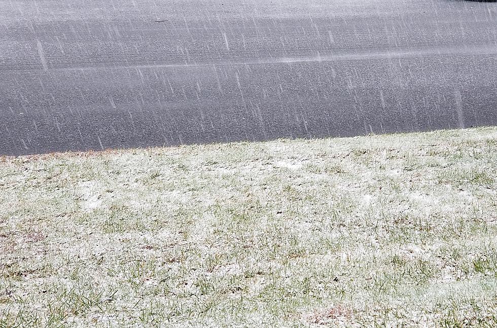
Happy December snow day, New Jersey. I think it's fair to say that most (definitely not all) of New Jersey has experienced quite the wintry day. As of this writing, the top snowfall total has been 5 inches at Highland Lakes, Sussex County. And it's still snowing there, of course.
I am generally pleased with how the storm has behaved according to expectations so far, with two notable exceptions:
1.) Monmouth County. Models hinted at overperformance there early this morning, and Mother Nature delivered. Once temperatures flipped below freezing, sleet and snow just poured out of the sky. There was a report of 1 inch of accumulation in about 45 minutes at Spring Lake Heights, Monmouth County. That is some heavy snow.
2.) SW NJ, from Trenton to the Delaware Bay. What goes up must come down. As snowfall intensified to the north and east, a marked slot of dry weather enveloped the Interstate 295 corridor. I mean, there was a whole lot of nothing throughout the afternoon. Snow will make a statewide resurgence Monday evening (keep reading), but I suspect our forecast will ultimately bust in and around Mercer and Burlington counties.
Numerous schools decided to close, dismiss early, and/or cancel afternoon activities Monday. I could see some scattered delayed openings for Tuesday morning too, as snow cleanup continues.
What Happens Next
All eyes are on the evening rush hour. Moderate to heavy snow and slippery roads will be problems. Luckily, we have the advantages of 1.) lighter-than-normal post-holiday travel, 2.) some smart New Jerseyans who stayed home, I'm optimstic, and 3.) a well-prepared state government. Although conditions will be treacherous, I am hopeful that it won't be an hours-long commuter nightmare (a la November 15, 2018).
After about 5 p.m., snow will make a southward push, enveloping southwestern and southeastern New Jersey where the weather has been dormant all day.
After about 9 p.m., any semblance of heavy snow bands should be done and snowfall becomes lighter and more scattered.
After about 2 a.m. Tuesday, snowfall should wrap up along the western edge of New Jersey.
After about 5 a.m. Tuesday, final snowflakes should come to an end completely across New Jersey as our storm system drives out to sea.
Per my usual policy, I do not create new snow forecast maps once an event has started. Other than the two surprises I noted above, I think my Monday morning forecast is still looking OK. Additional accumulations are likely through Monday night.
Advisory Update
A Winter Storm Warning continues until 4 a.m. Tuesday for Hunterdon, Mercer, Middlesex, inland Monmouth, Morris, Somerset, Sussex, and Warren counties.
A Winter Storm Warning runs until 7 a.m. Tuesday for western Bergen, western Essex, Passaic, and western Union counties.
A Winter Weather Advisory continues until 1 a.m. Tuesday for Camden and Gloucester counties.
A Winter Weather Advisory is posted until 4 a.m. Tuesday for Burlington, coastal Monmouth, and inland Ocean counties.
A Winter Weather Advisory goes through 7 a.m. Tuesday for eastern Bergen, eastern Essex, Hudson, and eastern Union counties.
A Coastal Flood Advisory expires at 4 p.m. along the Jersey Shore (from Middlesex to Cape May) as a round of minor tidal flooding wraps up along back bays and tributaries.
The Extended Forecast
I am happy to report there are no significant storm systems or snow chances in the forecast through the rest of this first week of December.
We'll kickstart the snow melt machine on Tuesday with mostly sunny skies, a stiff breeze, and highs in the lower 40s.
Early morning showers are possible Wednesday, followed by partial sunshine and highs in the mid 40s.
Thursday looks chilly and breezy, with a mix of sun and clouds and highs near 40.
Friday could be the warmest day of the workweek, with highs approaching 50. A cold front will bring some showers into the picture late-day Friday — mostly rain, but there could be some light snow to the northwest.
Saturday turns colder with highs only in the 30s, despite sunshine.
Final Thoughts
Forecasting this first winter storm of the 2019-2020 season has been arduous and complicated. The timing, at the tail-end of the Thanksgiving holiday weekend, was incredibly inconvenient. The three phases of the storm — from ice to rain to snow — were difficult to pinpoint and communicate, especially given such a dynamic and changing storm setup.
Once we have final snowfall totals, I'll do a post-mortem to analyze how our predictions compared to reality. In the meantime, I hope my analyses and ramblings helped you prepare and stay safe. Thanks for following along — I'm sure we'll do it again soon.
I'll have on-air updates through 7 p.m., then I'll be back at it again starting at 5 a.m. Tuesday morning. Have a great night, New Jersey — stay safe out there.
More From New Jersey 101.5 FM


