
Quick inch of snow possible overnight, as cold and wind arrive
The best chance for a snow squall Wednesday night through Thursday morning will be in southern New Jersey and along the coast.
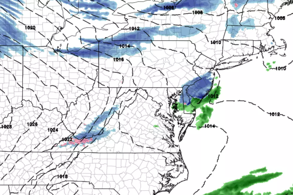
WHAT? The lift from a passing cold front is expected to fire off an area of snow over New Jersey late Wednesday night through early Thursday. This snowfall could be heavy for a brief time (a snow “squall”) potentially causing visibility issues and light accumulations.
WHEN? Best snow chance will occur from 11 p.m. Wednesday and 4 a.m. Thursday.
WHERE? Forecast models are in good agreement that the richest moisture and best forcing for snow will be in South Jersey (below I-195) and along the Jersey Shore.
HOW MUCH? A half-inch to an inch will be possible in the focal area of southern and coastal New Jersey. A trace of snow could be recorded anywhere in the state. I think it's going to be a mostly snow event - although some rain will be possible too, depending on temperatures.
SO WHAT? The snow may come down very hard for a short period of time, potentially making driving very difficult. Blowing snow could be a problem as well. It would be wise to plan overnight travel accordingly, and leave extra time in case roads are slippery and/or sight distance is poor.
WHAT'S NEXT? Arctic air will cause temperatures to plummet starting Thursday morning. The bitter cold will be accompanied by a fierce west-northwest wind, gusting to 40 mph. A Wind Advisory and High Wind Watch have been issued for five counties in northeastern New Jersey. Wind chills may approach dangerous levels through this cold snap, especially on Friday morning.
ANY MORE SNOW? Another storm system - a warm front - is forecast to lift through New Jersey from late Friday night through Saturday. Temperatures will be cold enough at first to sustain a period of snow, and light to moderate accumulations are possible, especially north and west of the Route 1 corridor. (Generally on the order of "a few inches".) Snow will transition to sleet/freezing rain and then all rain by noon Saturday.
Dan Zarrow is Chief Meteorologist for Townsquare Media New Jersey. Follow him on Facebook or Twitter for the latest forecast and realtime weather updates.
More From New Jersey 101.5 FM


