NJ’s quiet weather goes on, next snow chance is about a week away
The Bottom Line
I am absolutely loving the bright sunshine. Don't really care how cold it is — as long as the weather is bright and dry, I can be reasonably happy.
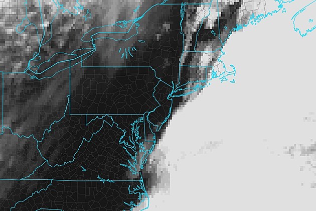
Having said that, it is pretty chilly out there. Tuesday will actually be New Jersey's coldest day of the week. Although most of the state will see lots of sunshine, a few clouds may kiss the coast.
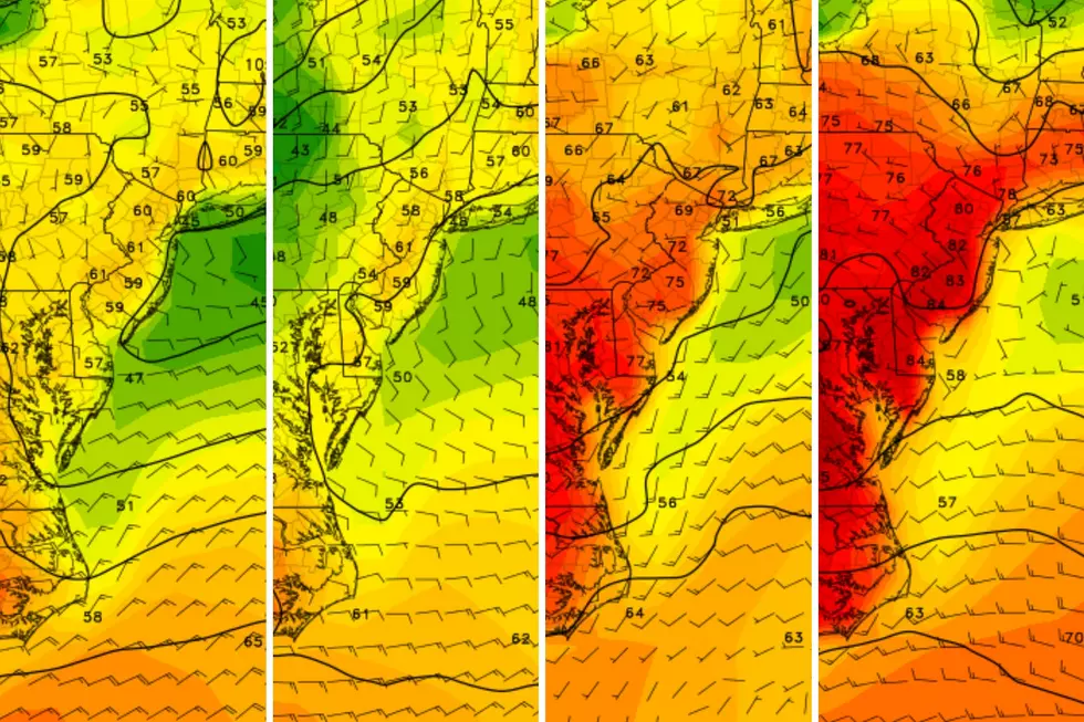
A warming trend will kick in through the rest of the week, putting thermometers well into the 50s by the weekend. Maybe even flirting with 60 degrees?
We have been talking about rain chances for the weekend too. Those have mainly fizzled according to the latest model solutions. Leaving us with mainly dry and mild — although cloudy — weekend on balance.
That also means our next substantial storm system in line is next week. Lots of questions about track and precipitation type — but this one could get wintry.

Tuesday
For almost all of New Jersey, Tuesday will be a continuation of our recent stretch of silent, sunny, seasonable weather. With two notable exceptions,
Number one, a coastal storm system is passing hundreds of miles southeast of New Jersey Tuesday. It will probably spit some clouds toward the Jersey Shore — just a layer of grey right over the ocean. Most of the sky will bask in blue skies and sunshine once again.
Number two, Tuesday's temperatures will end up 5 to 10 degrees cooler than Monday's. With highs only reaching about 40 degrees. Not bitterly frigid, just feeling like February. And probably the coldest day of the week.
A noticeable northerly breeze will diminish through the afternoon.
Tuesday night will be mainly clear and chilly, with lows around 30.
Wednesday
Wednesday will feature a similar sky to Tuesday — sunshine for most, as some clouds potentially kiss the coast. I am even including a slight flurry chance in the forecast, mainly at the Shore Wednesday morning.
Wednesday's high temperatures should bump into the mid 40s. Again, a pretty pleasant early February day.
Thursday
One very important transition will happen on Thursday: The wind direction will shift from northerly to southerly. That will really kick our warmup into high gear.
Highs on Thursday will reach about 50 degrees, notably above normal for this time of year. We will see filtered sunshine, through high clouds. Let's call it partly sunny — still a bright sky, and nice, dry weather all around.
Friday
Friday will bring even more clouds and even warmer temperatures.
Highs should push into the lower to mid 50s to close out the workweek. The daytime hours should see a mix of clouds and sun overhead.
With a few disturbances nearby, some very light showers — sprinkles — are possible Friday evening. I do not expect more than a Trace of precipitation though. And most of NJ should stay dry.
The Weekend & Beyond
I suspect Saturday will be the warmest day of the week, as temps flirt with 60. Similar to Friday, it will be mostly cloudy and probably dry.
The best chance of sprinkles may come early on Sunday, as a cold front sends temperatures in the other direction. Thermometers should still reach the 50s, but with an increasingly chilly breeze. Skies progress from clouds to sun.
That brings us to next week, which still looks to bring a return of colder, more active (read: wintry) weather. Both the GFS and Euro models are locked into a storm system sliding through New Jersey in the first half of next week. But will it be a Monday-Tuesday rainmaker? Or a Tuesday-Wednesday snowstorm?
At this point, I think it's prudent to give a heads-up of potentially wintry weather early next week. (Hence the headline of this post.) However, with a week to go until potential onset, there are still more questions than answers at this point. As always, we will provide daily updates as the forecast becomes clearer and the potential weather event gets closer.
POP QUIZ: Can you name all 10 interstate highways in New Jersey?
Gallery Credit: Dan Zarrow
Dan Zarrow is Chief Meteorologist for Townsquare Media New Jersey. Follow him on Facebook for the latest forecast and realtime weather updates.
NJ speaks: What is the end of a loaf of bread called?
Gallery Credit: Dan Zarrow
More From New Jersey 101.5 FM


