

NJ weather: Warming up for the first day (and week) of Spring
The Bottom Line
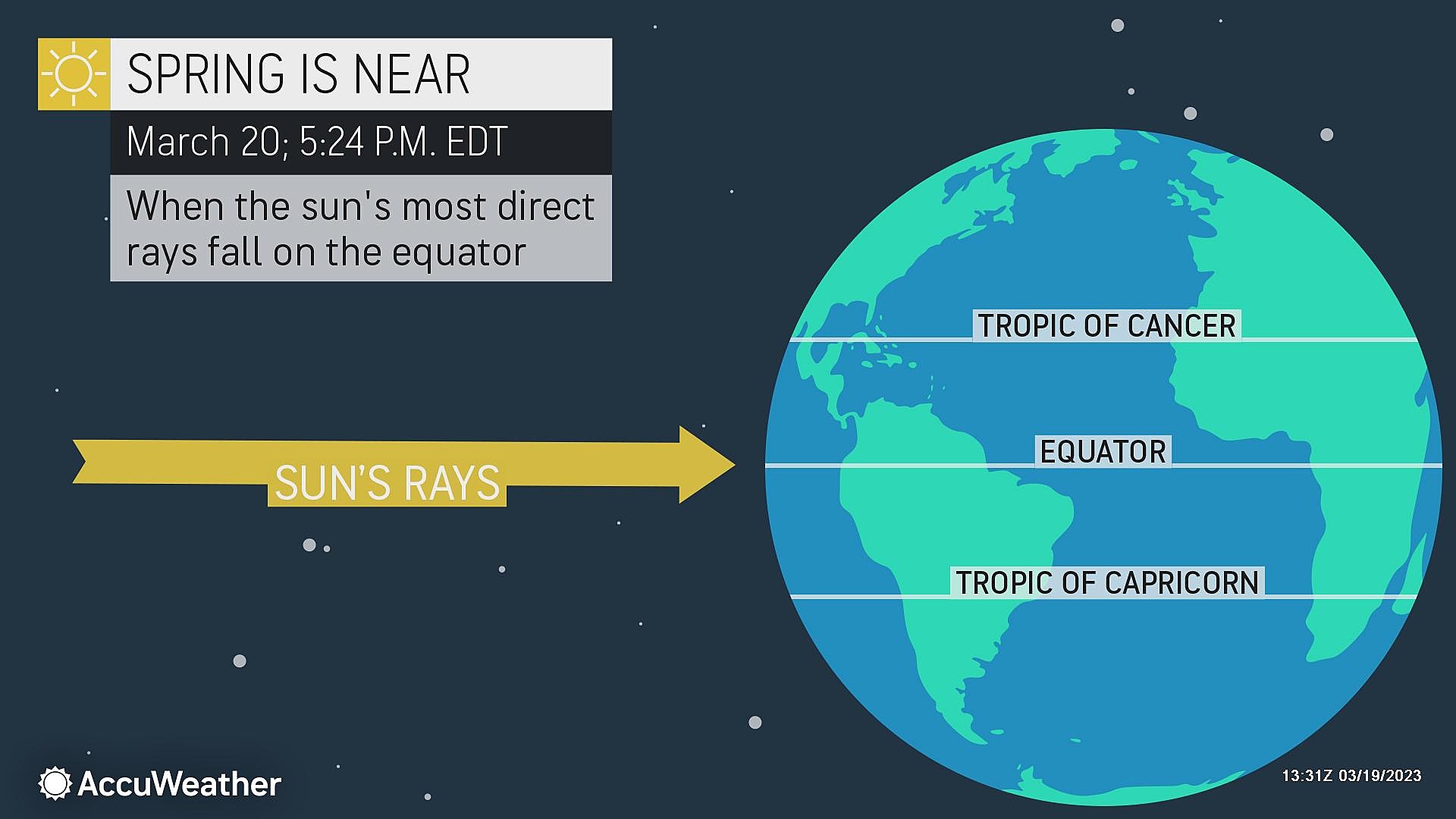
The Vernal Equinox — the official start of Spring — arrives at 5:24 p.m. Monday. That's right, we made it through another Jersey winter! (Not that there was much "winter" weather to suffer through this season, of course.)
Sunday was a chilly, blustery day. High temperatures across New Jersey ranged from 30 to 45 degrees. It felt more like a "dead of winter" sort of day, than winter's finale.
Monday will be better. As "warm air advection" takes over, we have a nice warming trend ahead. Winds will be much calmer throughout the week. And we have a couple days of dry weather and bright skies.
The second half of the week does turn unsettled, with shower chances on Wednesday and Thursday and then spurts of steadier rain Friday into Saturday. But could 70s also be in the cards?

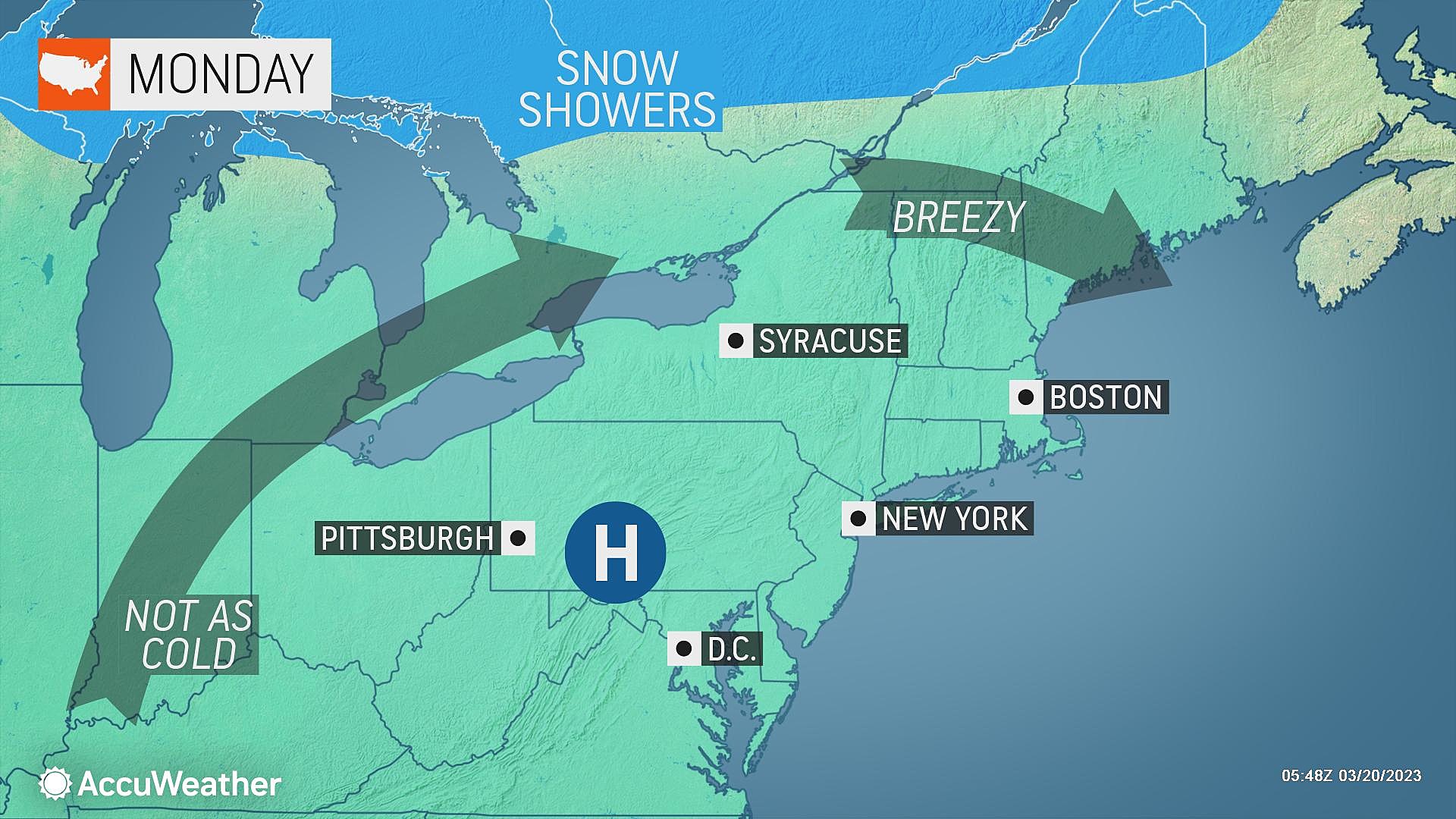
Monday
The final morning of winter is definitely a cold one. In fact, we haven't seen temperatures this low for about 3 or 4 weeks, since late February.
Thermometers are mainly in the 20s Monday morning, with a few 30s along the immediate coast. Skies are clear, the air is bone dry, and winds are light.
We should warm up quickly starting mid-morning. High temperatures should hit around 50 degrees Monday afternoon. That is par for the course for mid to late March.
Skies will stay bright and sunny all day, with light wind gusts no higher than about 15 mph.
Monday night stays quiet and boring. Clear skies and calm winds will allow for seasonably cool temperatures, dipping into the lower 30s. Around the freezing mark.
It's still a little bit too early to talk about the "last freeze" of the season. Across the state, the average last dip to 32 degrees occurs in early to mid April. Frosts can occur well into May.
Tuesday
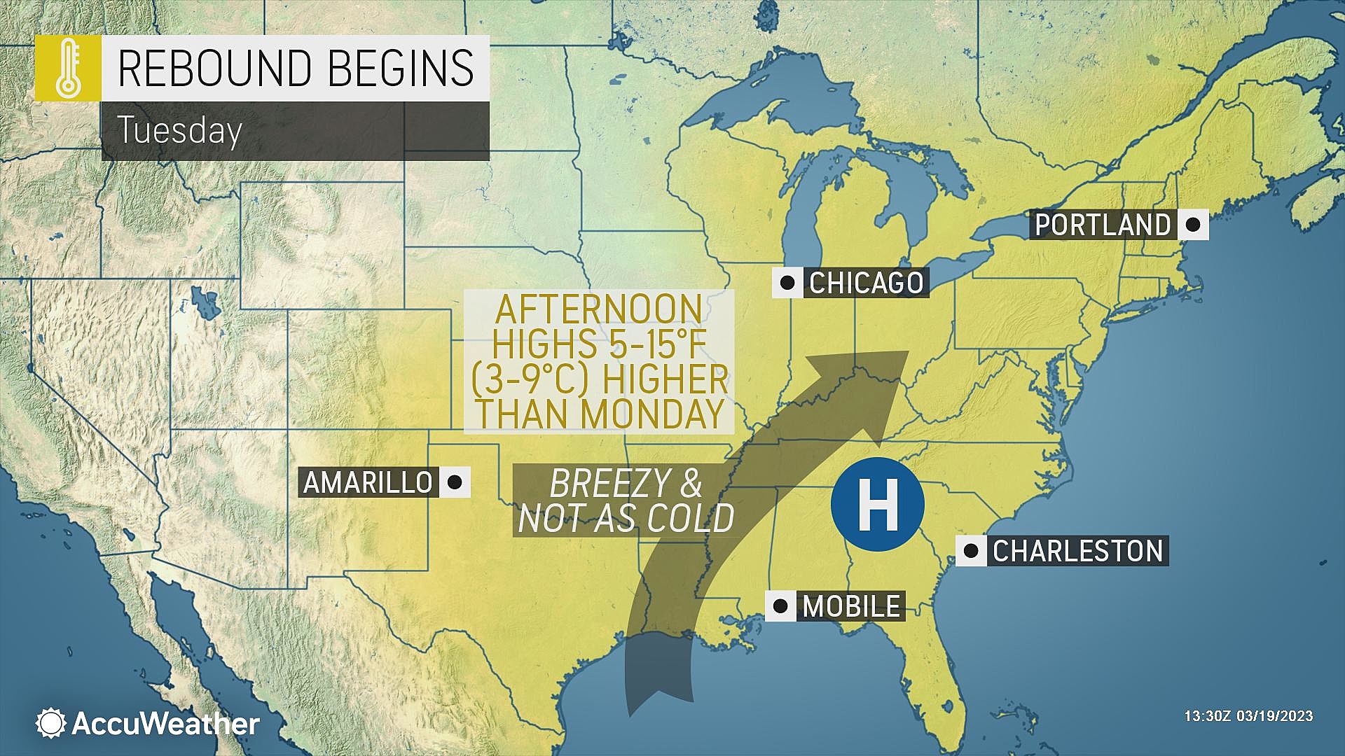
I'll just come out and say it: Tuesday looks like a gorgeous early spring day.
For all intents and purposes, it will look very similar to Monday. Plenty of sunshine, a light breeze, and dry weather. As our air mass continues to warm, high temperatures will push toward 60 degrees. Comfortable and pleasant.
Wednesday
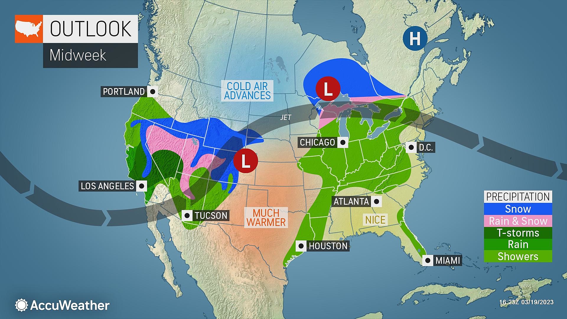
Wednesday has the potential to be an OK day. But we will start to see glimmers of unsettled weather too.
First, we lose the sunshine. Skies will be partly to mostly cloudy, still allowing for breaks of brightness. Because of that, and a shift from southwesterly to southerly winds, high temperatures will scale back a degree or two. Let's call it upper 50s Wednesday afternoon.
In addition, a very weak impulse could spark a few showers in the late afternoon to early evening time frame. Models show southern New Jersey would be the best place for a quick hit of raindrops.
I suspect most of the state will stay dry Wednesday. Rainfall will total a few hundredths of an inch, at the most.
Thursday
Turning cloudier, warmer, and wetter.
Most of Thursday should be fine, although sunshine will be limited as skies become mostly cloudy. Meanwhile, high temperatures will soar into the widespread 60s. The warmest day of March so far.
Spotty rain showers are likely around midday Thursday. It will not be an all-day thing, but a period of raindrops might dampen part of your Thursday. Total rainfall will range from hardly anything to over a half-inch.
Friday & Beyond
The forecast turns even more unsettled (read: wet) Friday into Saturday. But it's complicated. And forecast models do not have a good handle on any aspect of the forecast just yet (rainfall spread, intensity, temperatures, etc.) So I do not want to get into nitty-gritty details just yet.
I will say that things look pretty cloudy for Friday and the first half of Saturday. And there will be one or two narrow pushes of rain, which could be steady or even heavy for a time. I wouldn't call either day a washout at this point, but watch outdoor plans carefully.
At the same time, among the raindrops, there will be a good chance for a surge of warmth and humidity on Friday. Highs across most of the state might pop into the 70s?
Cooler, breezier weather will prevail for the weekend of Spring. Another pocket of showers could welcome us back to work and school on Monday.
Dan Zarrow is Chief Meteorologist for Townsquare Media New Jersey. Follow him on Facebook or Twitter for the latest forecast and realtime weather updates.
NJ street fairs return for the 2023 fall season
Gallery Credit: Mike Brant
Jelly bean vs marchmallow chick - See where each Easter staple is most popular
Gallery Credit: Mike Brant
More From New Jersey 101.5 FM


