

NJ weather: More sunshine, dry weather, and seasonably cool temps
The Bottom Line
What a weekend, huh? After literally weeks of dreary, soggy, depressing weather, Mother Nature flipped the switch and finally delivered golden sunshine. It was cool — it is February, after all. But it is nice to hit the "reset" switch and enjoy some crisp, cool, dry winter weather.
Quiet conditions will last pretty much all week, with a few speed bumps and hiccups along the way. Our next substantial storm system will arrive this weekend, spitting out a few rain chances between late Friday and Sunday. It will also spark a warmup, possibly to 60 degrees.
Long-range models still show a return of cold air and snow chances by the middle of next week. Winter is only half over, ladies and gentlemen.

Monday
For the third day in a row, we have sunny skies, dry weather, and seasonably cool temperatures in the forecast Monday.
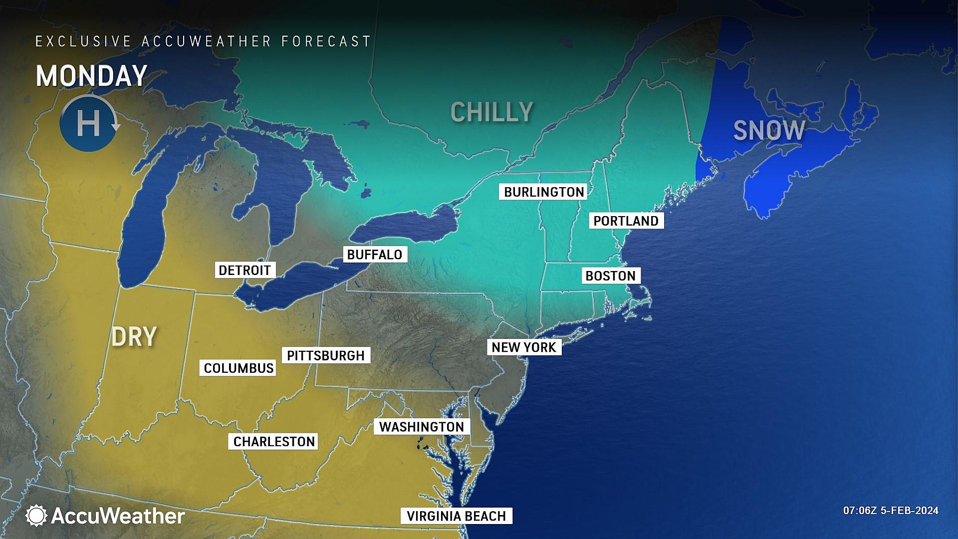
It is a cold start to the day, mainly in the 20s. High temperatures will reach the lower-mid 40s Monday afternoon. If I had to guess, it will be a couple degrees cooler than Sunday — but hardly noticeable. Expect a breeze blowing out of the north up to 15 mph.
That breeze may continue Monday night, adding a bite to the chilly overnight temperatures. Thermometers will bottom out in the upper 20s. Wind chills may end up closer to 20 degrees.
Tuesday
Two subtle changes are expected on Tuesday.
First, a coastal storm system way off the coast will shoot some clouds toward the Jersey Shore. Most of the state will remain mostly sunny. But the sky over the ocean could be gray for a time.
Second, statewide temperatures will take a dip as a reinforcing shot of cool air comes into play. High temperatures Tuesday afternoon are forecast to average only upper 30s across NJ.

Wednesday
As that coastal storm system shifts away on Wednesday, there is a chance for some flurries blowing ashore. I will believe it when I see it though.
Otherwise, Wednesday will be another bright and uneventful weather day. Skies will be partly to mostly sunny. And high temperatures will bounce back to about 40 to 45 degrees. Right on the normal for this time of year.
Thursday
The sixth and final day of quiet weather. Under mostly sunny skies, the wind direction will shift from northerly to southerly. And that will mark the beginning of a warmup. Highs on Thursday should reach the upper 40s.
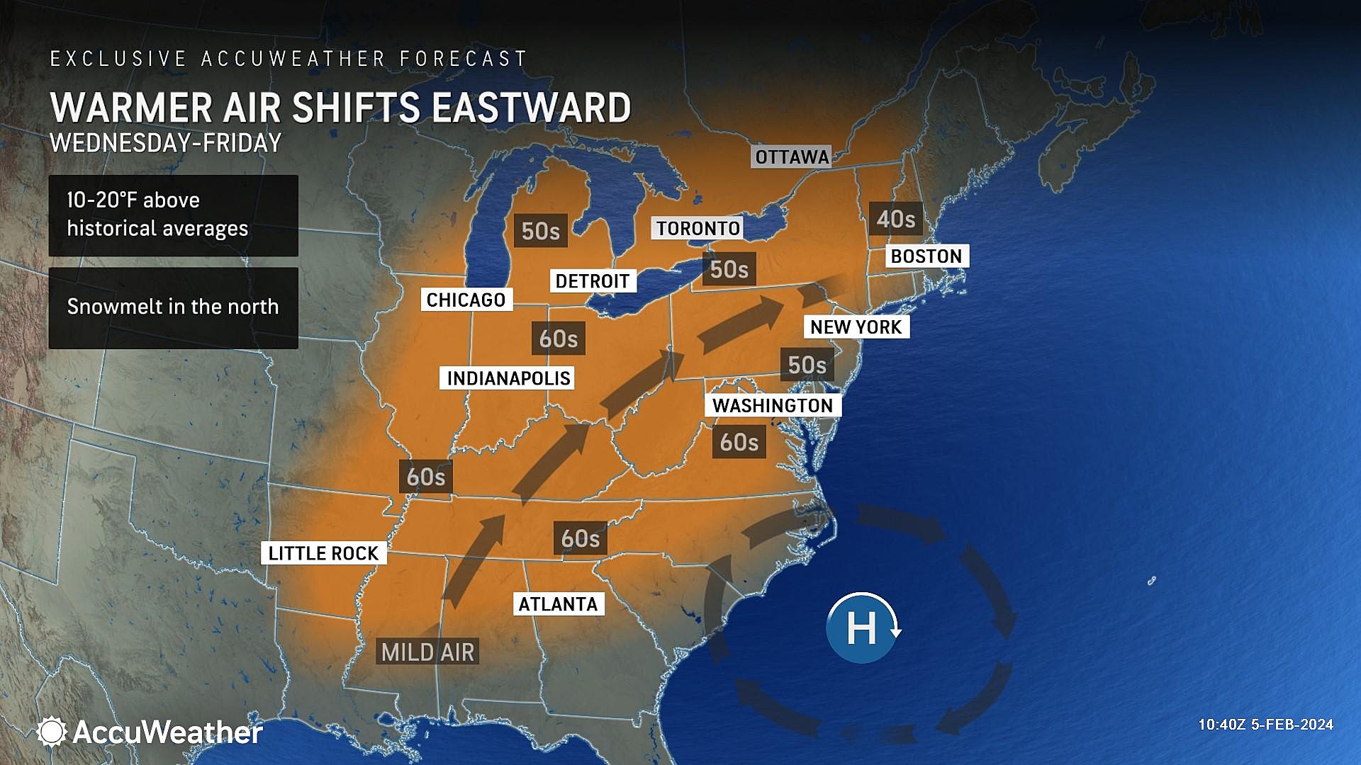
Friday & Beyond
As the weekend approaches, we will be watching two changes: A warmup, and some wet weather.
Most of Friday looks great. With a mix of sun and clouds, high temps bump to around 50 degrees. That's more like early March weather.
A few rain showers may dampen your Friday evening plans.
And a bit more spotty rain comes in around midday Saturday. The day will not be a total washout, although skies will become increasingly cloudy. Meanwhile, Saturday will likely be the warmest day of the week, firmly in the 50s. Parts of South Jersey could flirt with 60 degrees.
One more piece of energy arrives on Sunday, which looks to cause widespread scattered rain around New Jersey. Nothing traumatic or heavy — rainfall totals should end up between a quarter-inch and half-inch for most.
Looking ahead to next week, we are going to circle the Tuesday-Wednesday time frame as the next opportunity for cold air to return to our neighborhood. Therefore, that would be our next chance of snow too. However, you know a lot can change over the course of the next 200 hours. So we're not etching that potential winter storm in stone just yet — just scanning the horizon for wintry potential.
After all, winter is only halfway over.
LOOK: 50 cozy towns to visit this winter
Gallery Credit: Laura Ratliff
Dan Zarrow is Chief Meteorologist for Townsquare Media New Jersey. Follow him on Facebook for the latest forecast and realtime weather updates.
LOOK: The longest highways in America
Gallery Credit: Hannah Lang
More From New Jersey 101.5 FM


