NJ weather: Dry and cool Thursday, but the Mother’s Day weekend looks iffy
The Bottom Line
Can you believe we’re now at the halfway mark of Spring? Only 45 days to go until the Summer Solstice! We’re now getting more than 14 hours of daylight each day, as sunset pushes to about 8 p.m. And normal high temperatures are hovering around 70 degrees - although we’ll predominantly stay on the cool side of that number for the next 7 to 10 days.
Our latest stretch of unsettled weather is over. Having said that, a pair of rain chances are bookending the forecast for the Mother’s Day weekend. Paired with cool temperatures, I’m not sure we’ll do better than “50/50” this weekend overall.
Thursday
We’ll catch a breath of fresh air on Thursday. (By that, I mean dry air - there’s still a ton of pollen blowing around.) Morning lows are mainly in the 40s, so don’t be shy to grab a jacket. Afternoon highs will reach the mid 60s. That’s about 5 degrees below normal for early May - not bad. This would be more typical of a mid-April or mid-October day.
We’ll start the day with sunshine, blue skies, and a northwest breeze up to 20 mph. The afternoon looks calmer, with some fair-weather clouds eventually building in.
For Thursday night, I’ll call it partly cloudy and chilly. Low temperatures will dip into the mid 40s. The chance for some sprinkles isn’t quite zero, according to model guidance. But it’s so low that I’ve opted to leave that mention out of my on-air forecast.
Friday
Daytime hours still look dry. Partly to mostly cloudy skies will keep high temperatures in the lower 60s.
Our next storm system will push in from the west after about 5 p.m. Friday evening. This one will be a slow-mover - but available moisture will be somewhat limited, so I’m not concerned about flooding rains.
Saturday
The more problematic day of the weekend. Scattered rain from the aforementioned storm system will be with us through at least midday. There’s a chance raindrops and low clouds linger into the afternoon too. There’s reason to be optimistic for late-day clearing. And I do like our chances of a dry evening and overnight.
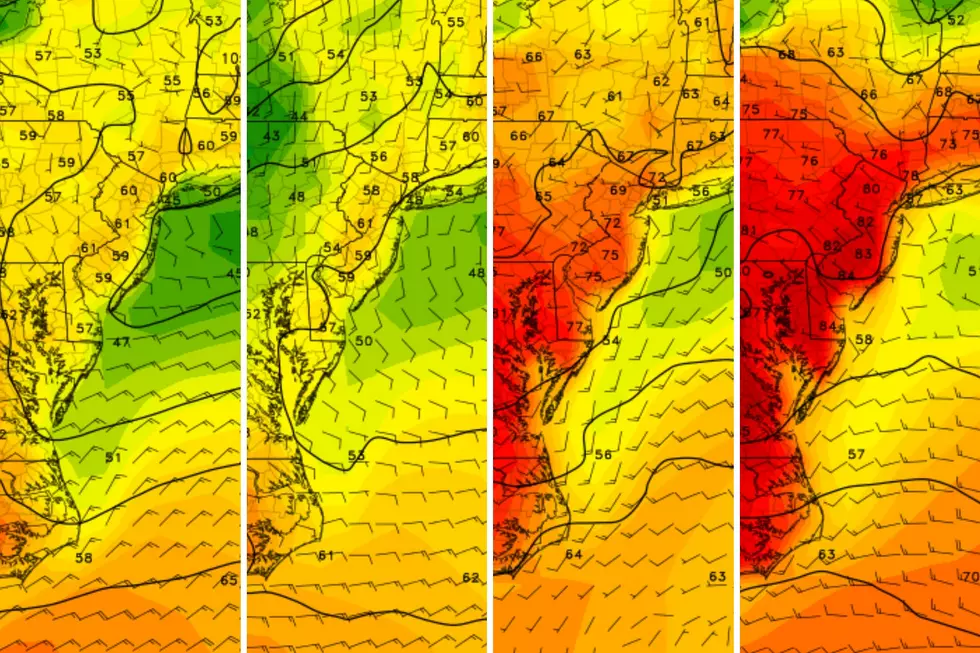
However, a northeasterly wind for most of the day will blow that cool marine air over New Jersey’s land mass. Keep in mind, the Atlantic Ocean is currently hovering around 56 to 61 degrees - still pretty cool. So Saturday’s high temperatures will struggle to reach the lower to mid 50s. The farther north and east you go, the more likely your thermometer will be in the 40s for most of the day. Not very May-like, at all!
Sunday
Sunday morning looks great, with early sunshine pushing high temperatures back into the lower-mid 60s.
However, things get iffy Sunday afternoon, as an approaching warm front eventually looks to push in some rain. The latest GFS model does hold off raindrops until 5 p.m. Sunday, so we may salvage a good part of the day.
The Extended Forecast
Unsettled, cloudy, and occasionally wet weather will continue on Monday. But at least the effects of that warm front will push temperatures well into the 60s (north and central) and 70s (south). At the moment, I can’t really guarantee drier weather until Monday evening.
The middle of next week looks pleasant, although still cool. Sunny, breezy, and lower 60s on Tuesday. Sunny and mid 60s on Wednesday.
Long-range models put our next rain chance next Friday. If that comes to fruition, I like our chances of clearer and warmer weather for the third weekend of May.
Dan Zarrow is Chief Meteorologist for Townsquare Media New Jersey. Follow him on Facebook or Twitter for the latest forecast and realtime weather updates.
The best cheesesteaks in New Jersey
New Jersey is one of the biggest exporters of this
More From New Jersey 101.5 FM


