

NJ’s delightful weather continues for now, as warming trend begins
If Tuesday felt like September with its sunshine, low humidity, and below-normal temperatures, Wednesday will trend more toward late August. Another nice day is on deck, although we will start to see temperatures and humidity levels increase through the rest of the week. 60s Wednesday morning, 80s in the afternoon with partly sunny skies. Thursday will be a pleasant summer-ish day, closer to 90 degrees. And then Friday will not be a nice weather day — ferociously hot plus a rising threat for strong late-day thunderstorms. It looks like the weekend will stay pretty steamy, with a chance of a spot thunderstorm each day too.

Wednesday NJ weather: Another very nice day
Wednesday will be another day where 99% of New Jersey stays high and dry and enjoys a wonderful summer day. (Of course, on Tuesday, the stray 1% saw some pretty dramatic weather at the Jersey Shore, as a waterspout turned landspout came ashore at Island Beach State Park.)
Could there be a shower somewhere in New Jersey Wednesday? Sure. Best chance would be to the south, along the Delaware Bay.
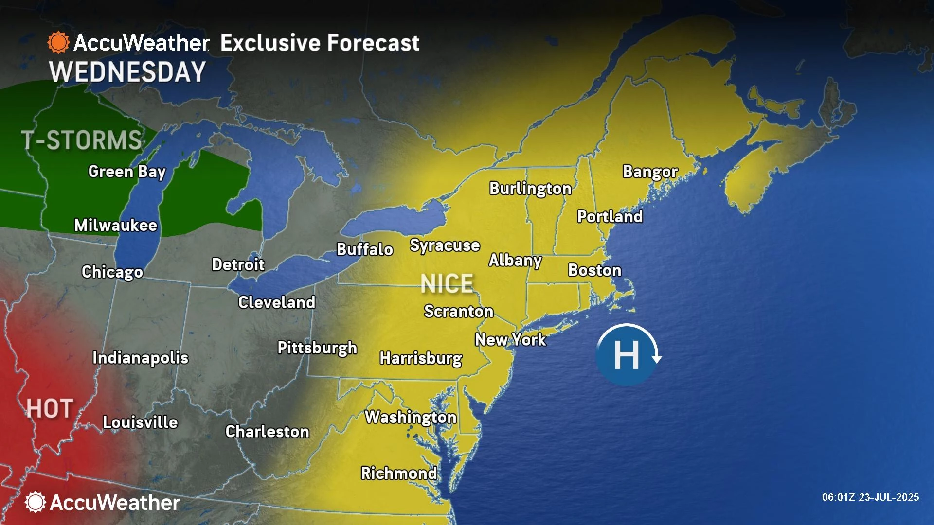
For the vast majority of the state, the day will be completely dry with partly sunny skies. 60s in the morning. 80 to 85 in the afternoon. That is actually a couple degrees below normal for this time of year.

I can not call humidity truly "low" anymore, unfortunately. Dew points have already risen into the 60s. Call it moderate, call it manageable, call it noticeable. It will feel a little stickier during the heat of the day, but at least the morning and evening hours will remain comfortable for now.
We will squeeze out one more comfortable night, with most low temperatures dipping into the mid 60s by Thursday morning. Urban and coastal areas will again be a few degrees warmer, probably at or just above 70.
Thursday NJ weather: Seasonably hot
On Thursday, temperatures will bump up another five degrees. That will be seasonable — typical, near-normal for this time of year. In other words, Thursday will be a nice, summerlike day.
Look for high temperatures around 85 to 90 degrees under mostly sunny skies. Little to no chance of rain.

Friday NJ weather: Ridiculously hot, watch for thunderstorms
Friday will not be a nice weather day, with two alarm bells to ring for heat and storms.
First of all, a surge of hot, humid air will push us into the danger zone once again. High temperatures are forecast to reach the mid 90s away from the immediate coast. Factor in high humidity, and the heat index will easily top 100 degrees. Get ready to find ways to keep cool, and stay extra hydrated.

We will see increasing clouds from Friday morning to the afternoon, with a "blast furnace" southwesterly breeze up to about 20 mph.
In this soupy atmosphere, thunderstorms are almost inevitable. And the threat for storms has actually increased quite a bit. Starting Friday afternoon, a weak cold front will spark a line of scattered thunderstorms storms which will generally charge from northwest to southeast across the state. Those storms will be quite strong initially, and then will likely fizzle around sunset.

Unsurprisingly, the biggest thunderstorm concerns will be gusty winds and flooding rains. There will likely be lots of lightning embedded in these storm cells too. Not everyone in New Jersey will necessarily see a thunderstorm late-day Friday. But everyone should be prepared to take shelter in case skies start to darken and thunder starts to roar.
The overall window for storms on Friday looks to be about 3 p.m. to 10 p.m.
Saturday NJ weather: Just like last weekend
Forecast models have been hemming and hawing over the weekend forecast, wet vs. dry, hot vs. cool. My read of the latest outlook, as things are finally coalescing on a confident solution, is that this weekend will look very similar to last weekend.
There will be clouds. It will be warm and humid. And there will be some thunderstorms — but likely more dry hours than wet ones.
If I had to guess, I would say Saturday is your better bet for drier weather this weekend. Although it is currently pegged to be the hotter weekend day, near 90 degrees. Expect mostly cloudy skies and a few isolated thunderstorms.
Sunday NJ weather: Definitely steamy, potentially stormy
The European model really goes heavy on Sunday's rain chance. While the GFS shows move of a "spotty showers" situation through the morning and midday hours. In either case, Sunday does look to be the wetter and therefore cooler day of the weekend as it stands now.
Along with abundant cloud cover and spotty rain, highs will come down to the lower-mid 80s.
Early next week dries out, but stays seasonably hot and humid near 90 degrees. Our next cold front is forecast to arrive around the first of August, with a chance of thunderstorms and then another taste of deliciously dry air. Until then, sultry summer weather is back on for the Garden State!
2025 National Night Out events in New Jersey
Gallery Credit: Dan Alexander
Dan Zarrow is Chief Meteorologist for Townsquare Media New Jersey. Follow him on Facebook for the latest forecast and realtime weather updates.
NJ DOT's Electronic Sign Safety Messages Summer 2025
Gallery Credit: Dan Alexander
More From New Jersey 101.5 FM


