Hello, February: NJ’s weather finally turns brighter and drier
The Bottom Line
After a week and a half of dismal weather — and two solid months of storm after storm — we can finally see light at the end of the tunnel. And that light comes in the form of splendid sunshine this weekend.
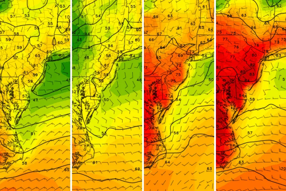
Even Thursday will be an improvement, as glimmers of sunshine break through the cloud cover. We will stay dry during the day. And temperatures will flirt with 50 degrees — this is the warmest it will get for a while, so soak it in.
A cold front will spark 1.) a round of rain from Thursday evening through Friday morning, 2.) kick up a brisk wind Friday afternoon, and 3.) drive in slightly cooler and drier air for the weekend.
The end result of that transition will be an extended period of quiet, dry, seasonable weather through next week.

Thursday
Welcome to February! On average, this is New Jersey's snowiest and driest month of the year. It is also our second coldest, behind only January.
We are coming out of the "dead of winter" now, as normal high temperatures have risen to about 40 to 44 degrees. New Jersey will exceed that benchmark Thursday, with forecast highs in the upper 40s to around 50 degrees. Not too shabby.
You should catch peeks of sun and blue sky among the clouds throughout Thursday. Winds stay light, and weather stays dry during the day.
As a cold front approaches Thursday evening, a band of rain will develop over New Jersey. Raindrops are possible as early as 7 p.m. Thursday, with the most widespread (statewide) rain likely after about Midnight.
Among the raindrops and clouds, overnight lows will average upper 30s. Those above-freezing temps will keep the risk of wintry weather very limited. I could see some snowflakes and/or freezing drizzle along the northern edge of New Jersey. But little to no travel impacts or accumulations are expected.
Friday
By around mid-morning Friday — let's say 8 or 9 a.m. — rain should dial back significantly across the Garden State. Total rainfall will probably average a quarter-inch. On the light side.
A shower or sprinkle may linger into part of the afternoon. But the bigger story will become a brisk northwesterly wind gusting over 20 mph, set to eventually carry cooler, drier air into New Jersey. That will be a chilly breeze, adding a blustery characteristic to the day.
High temperatures on Friday should reach the mid 40s, although I could see thermometers sliding backward a bit through the afternoon hours.
Saturday
Yes, it will be chilly. But temperatures in the 40s are seasonable — totally typical — for early February. And we will bask in real sunshine.
There may be a few remnant clouds early Saturday, then sunshine and blue sky will win the day. High temperatures will be limited to the lower 40s. A northerly breeze will be noticeable, but lighter than on Friday.
Sunday
Another sunny day. Sunday's temperatures look a degree or two warmer than Saturday's, reaching the mid 40s.
The Extended Forecast
The only potential hiccup next week is the close passage of a coastal storm system in the Tuesday-Wednesday time frame. Three potential impacts: 1.) A shot of chilly air, keeping Tuesday in the 30s, 2.) One or two mostly cloudy days, and 3.) Maybe a snow shower clipping the coast.
Luckily, the recent soggy weather and still-soggy ground will keep the threat for drought and fire danger low.
Our next chance for a big weather change will be next weekend, at the earliest. Cold air is recharging to the north. And once the storm track realigns, we could see our next blast of wintry weather around the midpoint of the month.
10 Nasty Illnesses You'll See This Winter Across New Jersey
Gallery Credit: Megan Carter
Dan Zarrow is Chief Meteorologist for Townsquare Media New Jersey. Follow him on Facebook for the latest forecast and realtime weather updates.
Cough, cough: NJ's favorite lost voice and sore throat remedies
Gallery Credit: Dan Zarrow
More From New Jersey 101.5 FM


