

Wednesday NJ weather: Not as steamy, still occasionally stormy
The Bottom Line
The unsettled weather rolls right along on Wednesday, as one or two rounds of showers and thunderstorms are set to soak the Garden State again. At least temperatures and humidity levels are running slightly lower, making for pleasant breaks in between the raindrops.
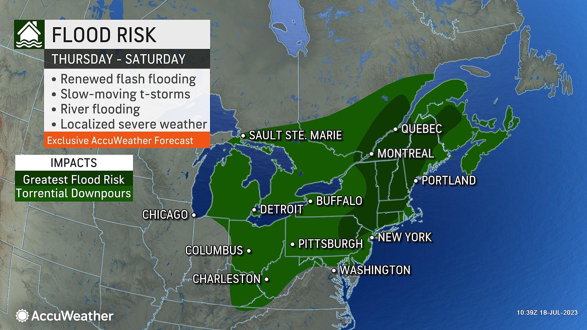
There is one more span of stormy weather coming up Thursday night through the first half of Friday. Once again, pockets of torrential rain and some gusty winds are possible.
And then something amazing happens — we get to enjoy an amazingly pleasant weekend. Dry weather. Seasonably warm temperatures. And best of all, (relatively) low humidity.

Wednesday
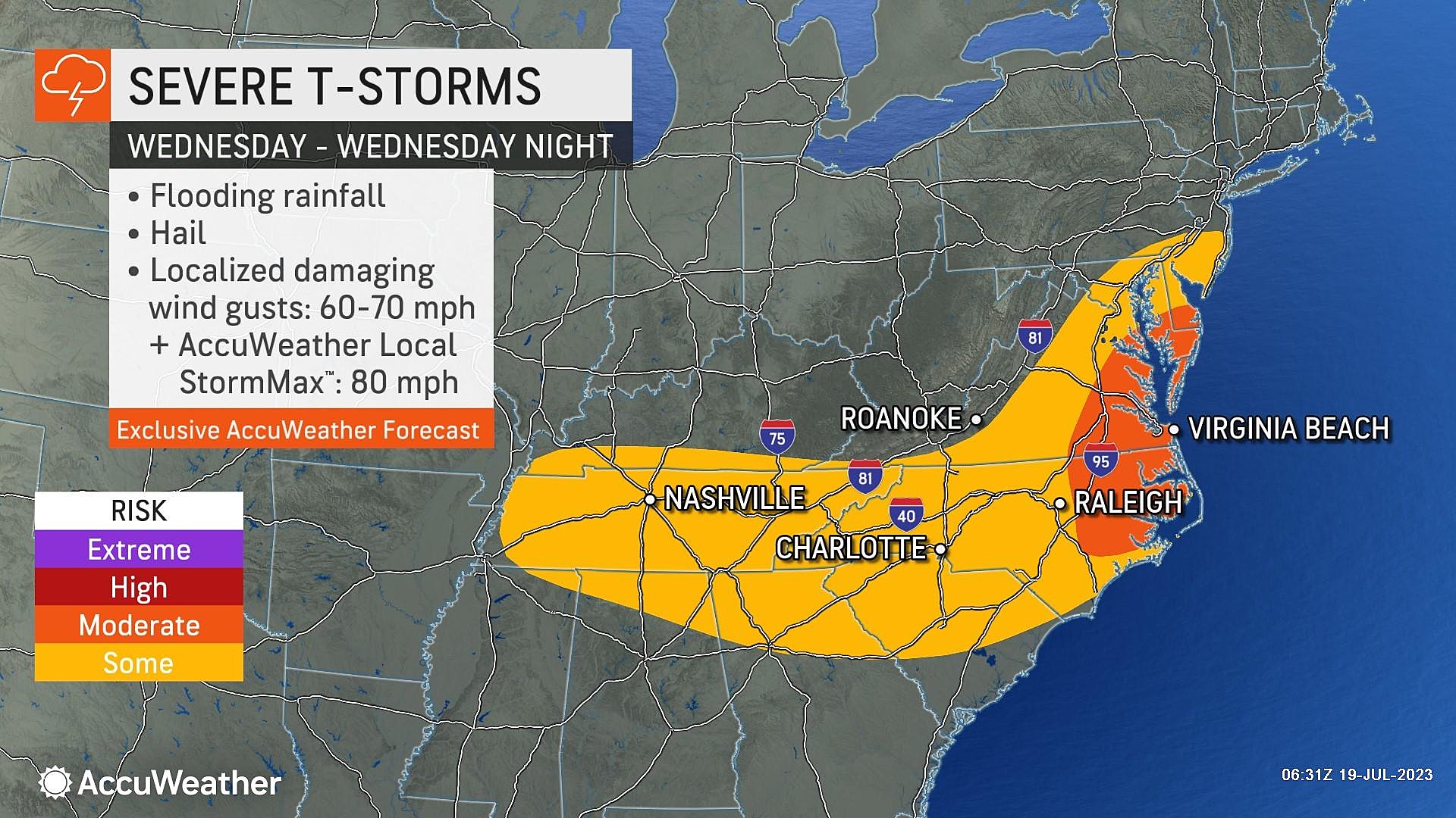
As of this writing (6:30 a.m.), scattered showers and thunderstorms are impacting southern and central New Jersey. This round of occasional rain will 1.) linger through the morning hours, and 2.) be limited to the area south of Interstate 78.
So far, there is nothing overly concerning. Pockets of heavy rain may slow you down. And some rumbles of thunder.
By late morning — let's say 11 a.m. or so — radar over New Jersey should turn much drier. We will even see some pops of sunshine, mixed with clouds. High temperatures will shoot for the lower to mid 80s. Notably not as hot and steamy as it has been lately.
Through Wednesday afternoon, isolated popup thunderstorms are expected. Given the increased energy (heat) in the atmosphere, these storm cells may have a little more power. Meaning localized downpours and flooding issues, and possibly some gusty winds. You will have to keep your eyes and ears on the sky pretty much all day here.
Any storm active should pulse down by sunset Wednesday evening, and then we'll see a dry and quiet overnight. Fog is possible, especially where it poured during the day. Meanwhile, overnight temperatures will be fairly comfortable, dipping into the upper 60s. (Anytime we can drop below 70 degrees in the middle of summer is a good thing.)
Thursday
The daytime hours look pretty good for the beach or pool. But there is another thunderstorm threat looming on the horizon.
Skies will range from partly sunny to mostly cloudy on Thursday. And high temperatures will warm into the seasonable mid to upper 80s. Humidity levels will be high, but not quite tropical. In other words, it's going to feel like summertime in New Jersey.
I am keeping Thursday's daytime forecast dry. As our next storm system creeps in from the west, a chance of showers will arrive starting Thursday evening. Heavier rain and thunderstorms may develop overnight.
Friday
As you wake up Friday morning, we could be in the midst of active weather, as scattered thunderstorms push through New Jersey. There is some question among model guidance just how widespread and how strong those storms will be. I do believe the dynamics look good for some rumbles of thunder and localized downpours.
By Friday afternoon, storms will start to break apart. Having said that, there could be one last line of rain pushing west to east around dinnertime Friday. Then we're done, as a new cooler, drier air mass arrives.
High temperatures on Friday will reach the mid 80s. Typical for late July. I think skies will stay mostly cloudy for the most part, even when it's not raining. We might start to feel a reduction in humidity late-day.
The Weekend
I am still optimistic about this weekend's forecast. Heck, I'm downright excited about it. So far, the summer season has presented challenging weather conditions just about every weekend, from steamy to stormy to smoky. But this should be a good one.
Cloud cover Saturday should give way to sunshine. It will be warm, with highs in the lower to mid 80s. And humidity will fall into the basement, with dew points potentially in the 50s. Rare for mid-summer, but definitely welcome.
Sunday will be the hotter day of the weekend, as highs surge to the mid to upper 80s. Again, skies should remain mostly sunny and our weather should stay dry.
The Extended Forecast
Next week, the final week of July, is trending warm and humid and unsettled. A familiar story. There are no major storm systems on the horizon, so we will continue this trend of occasional storms and frequent sweat.
CHECK OUT: All the free beaches in New Jersey
Dan Zarrow is Chief Meteorologist for Townsquare Media New Jersey. Follow him on Facebook or Twitter for the latest forecast and realtime weather updates.
Actions to take if you are caught in a rip current
Gallery Credit: Sophia Laico
More From New Jersey 101.5 FM


