
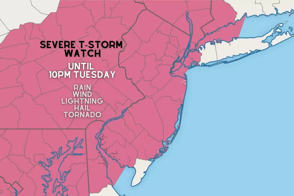
Severe Thunderstorm Watch until 10pm: Strong storms crashing into NJ
The National Weather Service and Storm Prediction Center have issued a Severe Thunderstorm Watch for 20 of New Jersey's 21 counties. (All but Cape May County to the south.) The watch is in effect until 10 p.m. Tuesday evening.

A watch serves as a formal heads up that dangerous thunderstorms may occur. The ingredients for severe weather are present in our juicy atmosphere. It is just a matter of 1.) where storms explode, and 2.) how long they last before fizzling out. If warnings are issued, that's the time to take action and seek shelter in a sturdy building as soon as possible.
It has been a hot and humid day across the Garden State, with daytime temperatures as high as 94 degrees. Humidity levels have already ramped up, with steamy dew points firmly in the 70s.
As of this writing (5:15 p.m.), broken storm cells are rolling through eastern Pennsylvania and eastern Maryland. Some of these thunderstorms have a history of wind damage (downed trees) and flooding rains.
Based on the latest radar trends, the strongest storms are aiming for northern NJ (along and north of Interstate 80) and southern NJ (along and south of the Atlantic City Expressway). However, those millions of New Jerseyans in the middle are not out of the woods for some showers and thunderstorms, especially given the charged up atmosphere.
While not everyone in New Jersey will see a thunderstorm Tuesday evening, all severe weather impacts remain on the table. Heavy rain, gusty winds, frequent lightning, hail, and even an isolated tornado are possible.
Storms are arriving a bit later than originally forecast, with "prime time" storm activity now expected between 6 p.m. and 10 p.m. The later timing is actually a good thing - the closer we get to sunset, the closer we are to cooler temperatures, and the less available energy storms will have to intensify. This is NOT a "slam dunk" severe weather outbreak.
As thunderstorms roll generally from west to east across New Jersey Thursday evening, they are expected to weaken. (Or in DZ language: fizzle.) Both because of the impending sunset, and because storms will be approaching cooler, more stable air along the Jersey Shore.
Final showers and thunderstorms should exit the NJ coast around 2 a.m. Wednesday morning.
Remember, the safest place to be during a thunderstorm is inside a sturdy building. Pay attention to changing weather conditions, and be prepared to alter your plans if things turn dangerous. Never attempt to walk, swim, or drive through flooded areas. In the end, common sense goes a long way — stay smart, be safe.
Dan Zarrow is Chief Meteorologist for Townsquare Media New Jersey. Follow him on Facebook or Twitter for the latest forecast and realtime weather updates.
11 reasons why storm chasing in NJ is a very, very bad idea
Gallery Credit: Dan Zarrow
BEEP BEEP BEEP: These are the 13 types of Wireless Emergency Alerts auto-pushed to your phone
Gallery Credit: Dan Zarrow
More From New Jersey 101.5 FM


