

NJ weather: Some rain and humidity for NJ, then turning wonderful
Can you smell that in the air? No, not the charming aroma of the North Jersey refineries. No, not the dead and/or radioactive fish floating in the Raritan River. It's change! After a summer in which nearly every day has been plagued by either heat or rain (or both), it's nice to see a more docile and pleasant weather pattern setting up by the end of the week!
Over the past two days (Sunday and Monday), high temperatures were limited to the 70s across the vast majority of New Jersey. (73-75 at EWR, 72-79 at TTN, 78-78 at ACY.) By my calculation, it's the coolest stretch of days we've seen in almost two months — June 22-23.
The cooler-than-normal streak looks for continue for Tuesday, as we're still tapped into a relatively cool, relatively dry air mass for now. Tuesday morning looks partly sunny, with temperatures climbing out of the 60s for most. By Tuesday afternoon, we'll probably see mostly cloudy skies, with high temps in the upper 70s to around 80 degrees. To that point, Tuesday looks very similar to Monday.
However, as a warm front pushes northward into the Garden State, we could see a few showers pop up in the mid to late afternoon hours. Best chance to see this first round of raindrops will be in the southwest corner of the state.
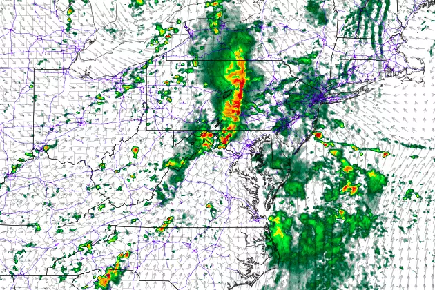
Your better chance of getting wet will arrive Tuesday night, as scattered showers and thunderstorms spread northward across New Jersey. Nothing major, just some rain with a few rumbles of thunder possible. Overnight lows will fall to about the 70 degree mark.
That batch of rain will exit the coast by mid-morning Wednesday, to be followed by mostly cloudy skies and warmer, more humid conditions. High temperatures for Wednesday will shoot into the mid 80s, at or just above normal for late August.
I'm happy to declare that the warmth, humidity, and unsettled weather will be short-lived this time around. A cold front will sweep across the state late Wednesday. While it could spark a few strong-ish thunderstorms, the latest model guidance is suggested a dry frontal passage. Behind the front, skies will clear Wednesday evening> as cooler, drier air returns to the Garden State.
And then along comes Thursday. Oh, Thursday. How I love your forecast! It looks to be a beautiful sunny day, with dry weather and (very) low humidity all day. Morning low temperatures may touch the 50s in the usual cool spots. We'll see highs in the upper 70s to around 80 degrees. More reminiscent of a September day, perhaps, but I think the change of pace will be welcome and wonderful.
Friday looks good too, with more sunshine and slightly warmer temperatures. Forecast highs bump into the lower to mid 80s.
And for the first time since early July, I believe we have a real shot at dry weather throughout the weekend too! It won't be perfect though, as models suggest skies will become mostly cloudy. Our warming trend will continue, with highs in the lower to mid 80s on Saturday, nudging into the mid to upper 80s on Sunday.
Next week is also trending mostly dry, although hot. We could kickoff a new heat wave on Monday, with more 90s on the way through much of August's final week.
Dan Zarrow is Chief Meteorologist for Townsquare Media New Jersey. Follow him on Facebook or Twitter for the latest forecast and realtime weather updates.
More From New Jersey 101.5 FM


