

NJ weather: Another mild week with minimal rain chances
The Bottom Line
There is a lot to like about this week's weather forecast. No humidity. No scorching heat (like Friday). No miserably cool days (like Saturday). And minimal rain chances — although things are looking pretty parched around the Garden State right now.
With high pressure situated to the northwest, we'll get another pleasant day with seasonable 70s for Monday.
Tuesday looks even warmer, closer to 80 degrees. And then a storm system well to our north will swing a weak cold front our way. Along with an isolated shower or little thunderstorm at some point Tuesday, temperatures will scale back to the 70s on Wednesday.
There is another chance for spotty showers in the second half of the week. And signs are pointing toward another warmup through the second weekend of June.

Monday
If you liked Sunday's weather, you should be a fan of Monday too. Even as temperatures increase by about five degrees.
We are starting off with a chill in the air. Most towns across inland NJ have dipped into the 40s, a symptom of dry air and calm winds. We should warm up quickly starting mid-morning, reaching highs in the mid 70s. That is very close to normal for early June.
The day will start with sunshine, before a bank of clouds arrive in the midday hours. And then the sun pokes out again through the afternoon. Overall, a pleasant and dry start to the workweek.

We also bid farewell to the persistent on-shore breeze for a while. With northwesterly winds in the forecast throughout this week — a land breeze — even coastal communities have a shot at 70+ degrees.
However, ocean models are still painting some elevated tide levels for a couple more days. Evening high tide cycles may continue to cause pockets of minor flooding along the Shore, especially along back bays and tributaries.

Monday night will stay quiet and mainly clear, with lows dipping into the 50s.
Tuesday
It could be the warmest day of the week. But that does raise concerns for a popup storm.
Highs will push into closer to 80 degrees on Tuesday. Humidity levels still nice and low, so it will be a comfortable warmth. It will be partly sunny and breezy.
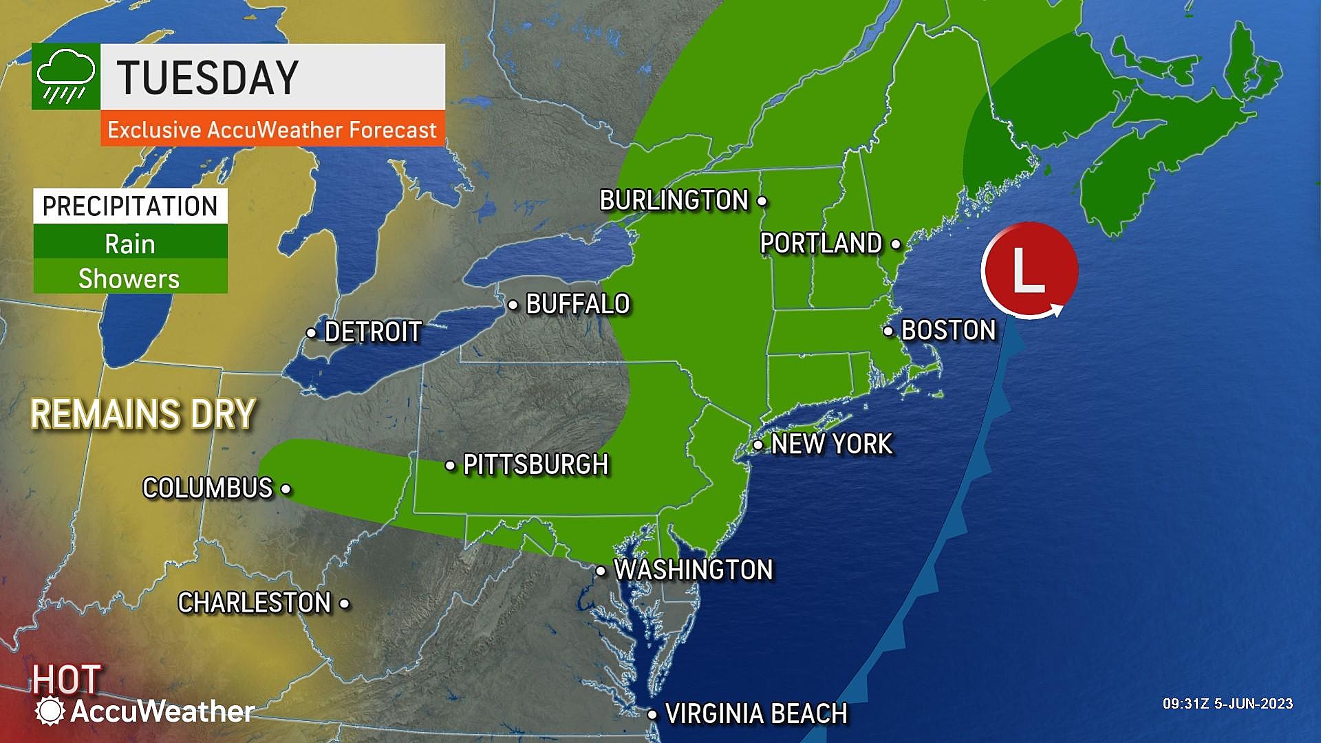
I can't really pinpoint the timing or geography of Tuesday's showers and thunderstorms. But I can tell you that, given the weak forcing and dry air, any pockets of rain will be very isolated. Most of the state should stay completely dry.
Wednesday
Following Tuesday's hit-or-miss showers and weak cold front action, Wednesday turns a few degrees cooler. But it still looks pretty pleasant.
Skies will progress from partly sunny to mostly sunny. And a continuing stiff breeze is likely. Highs on Wednesday will scale back to the mid 70s.
Thursday
The cooling trend will continue into Thursday, as highs settle in the lower 70s. Largely due to increased cloud cover. A few showers are possible Thursday afternoon too.
The Extended Forecast
Friday's skies will probably remain murky, keeping temperatures at or below the 70-degree mark. Likely the coolest day of the week.
Then the wind shifts to blow from the west and southwest. And temperatures will jump upward in response. My latest outlook puts Saturday in the mid 70s and Sunday firmly in the 80s.
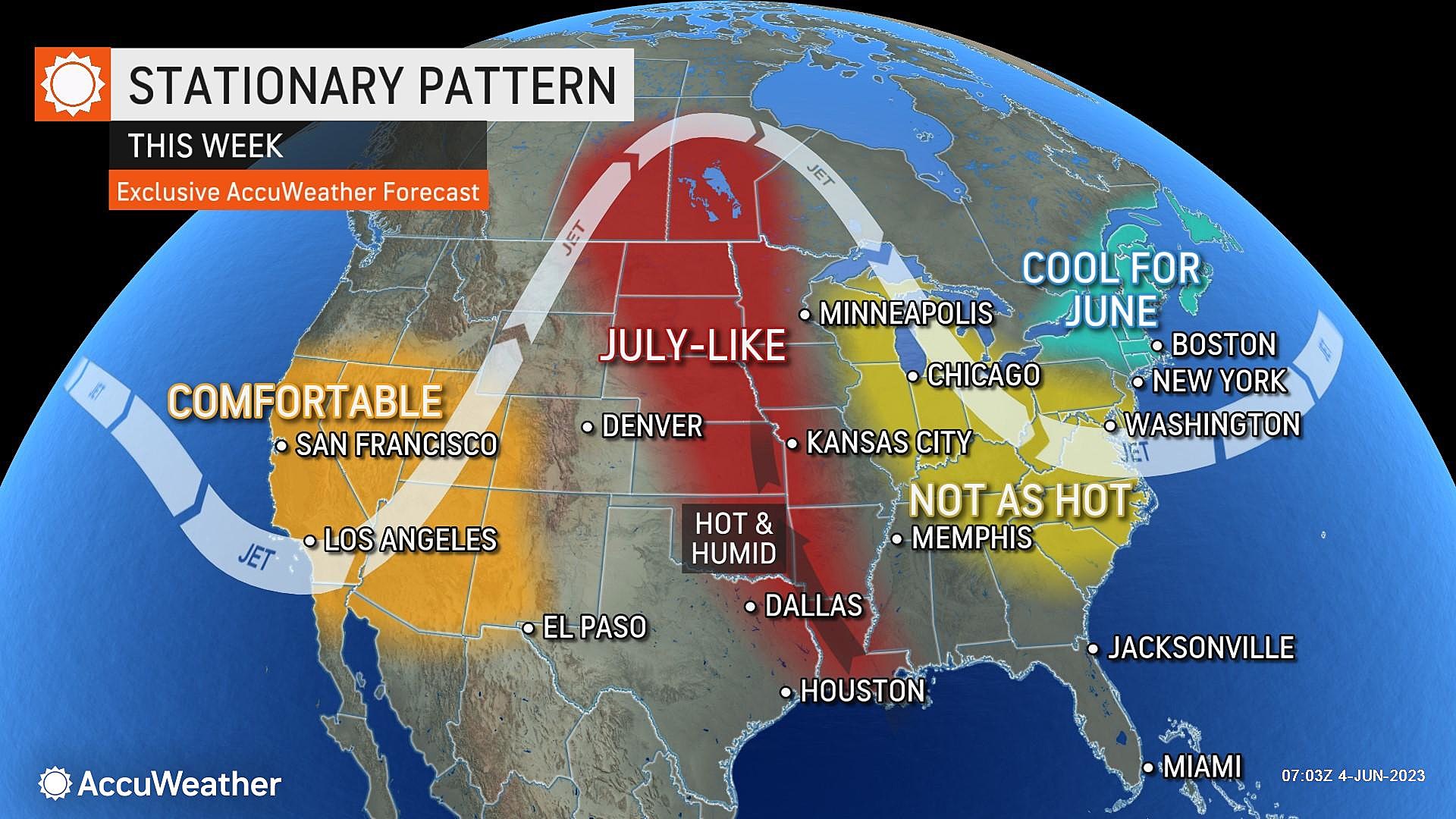
Long-range models point to a warmer and stormier midpoint of June. It is now hurricane season. And the official start of summer is coming up soon. I have a feeling the "weather switch" is suddenly going to flip, and we'll begin our usual hot, humid, stormy weather pattern.
LOOK: The most popular dog names of 2022 in every state
Gallery Credit: Amber Spencer-Knowles
Dan Zarrow is Chief Meteorologist for Townsquare Media New Jersey. Follow him on Facebook or Twitter for the latest forecast and realtime weather updates.
WOOF: These are the most popular dog breeds in America
Gallery Credit: Sabienna Bowman
More From New Jersey 101.5 FM


