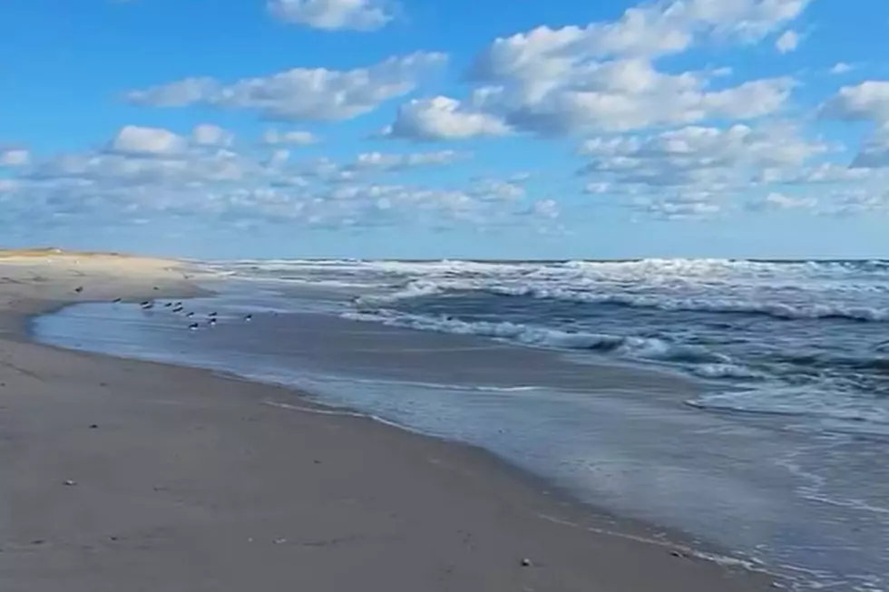
NJ beach weather and waves: Jersey Shore Report for Wed 8/30
Advisories
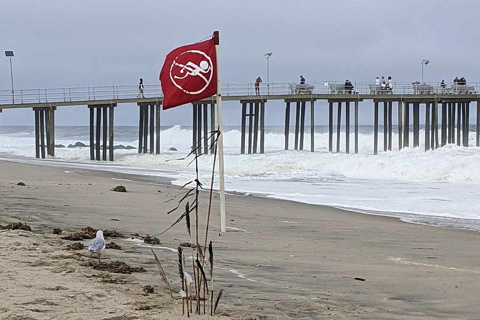
HIGH RISK OF RIP CURRENTS. Life threatening rip currents are likely. The surf zone is dangerous for all levels of swimmers. Stay out of the water. Remember to heed the advice of the local beach patrol and flag warning systems.
SMALL CRAFT ADVISORY in effect until 6 p.m. Thursday. Northwest winds increasing to 15 to 20 kt with gusts around 25 kt. Seas continuing to build 4 to 6 ft. Inexperienced mariners, especially those operating smaller vessels, should avoid navigating in hazardous conditions.
At the Shore
Current conditions and forecast as of Wed morning
| Rip Current Risk | High |
|---|---|
| Waves | 2 - 6 feet |
| Winds | From the Southwest 9 - 22 mph (Gust 28 mph) 8 - 19 knots (Gust 24 knots) |
| Ocean Temperature | 73° - 75° (Normal 73° - 79°) |
| Air Temperature | 80° - 86° |
| Sunrise/Sunset | 6:21am - 7:34pm |
| UV Index | 7 (High) |
Tide Times
| SANDY HOOK Sandy Hook Bay | High Wed 7:45a | Low Wed 1:59p | High Wed 8:07p | Low Thu 2:37a | |
| LONG BRANCH Atlantic Ocean | High Wed 7:19a | Low Wed 1:23p | High Wed 7:41p | Low Thu 2:01a | |
| MANASQUAN INLET Atlantic Ocean | High Wed 7:33a | Low Wed 1:35p | High Wed 7:55p | Low Thu 2:13a | |
| SEASIDE HEIGHTS Atlantic Ocean | High Wed 7:15a | Low Wed 1:27p | High Wed 7:37p | Low Thu 2:05a | |
| SEASIDE PARK Barnegat Bay | Low Wed 5:52a | High Wed 11:25a | Low Wed 6:04p | High Wed 11:47p | |
| BARNEGAT INLET Barnegat Bay | High Wed 7:36a | Low Wed 1:55p | High Wed 7:59p | Low Thu 2:37a | |
| MANAHAWKIN BRIDGE Manahawkin Bay | Low Wed 5:26a | High Wed 10:32a | Low Wed 5:38p | High Wed 10:54p | |
| LITTLE EGG INLET Great Bay | High Wed 8:32a | Low Wed 2:23p | High Wed 8:56p | Low Thu 3:11a | |
| ATLANTIC CITY Atlantic Ocean | High Wed 7:24a | Low Wed 1:25p | High Wed 7:48p | Low Thu 2:10a | |
| OCEAN DRIVE BRIDGE Townsends Inlet | High Wed 7:51a | Low Wed 1:48p | High Wed 8:24p | Low Thu 2:35a | |
| WILDWOOD CREST Atlantic Ocean | High Wed 7:29a | Low Wed 1:31p | High Wed 7:55p | Low Thu 2:18a | |
| CAPE MAY Delaware Bay | High Wed 8:30a | Low Wed 2:23p | High Wed 8:56p | Low Thu 3:08a |
Marine Forecast
From the National Weather Service, Mt. Holly
TODAY: SW winds around 5 kt, becoming 5 to 10 kt late this morning and afternoon. Seas 4 to 5 ft. SE swell 3 to 5 ft at 10 seconds. Scattered showers this morning. A chance of tstms late this morning, then isolated showers early this afternoon.
TONIGHT: NW winds 15 to 20 kt, becoming N after midnight. Seas 4 to 6 ft. SE swell 3 to 5 ft at 10 seconds.
THU: N winds 15 to 20 kt with gusts up to 30 kt, becoming NE 10 to 15 kt in the afternoon. Seas 4 to 6 ft. NE swell 3 to 6 ft at 10 seconds.
THU NIGHT: NE winds 5 to 10 kt, increasing to 10 to 15 kt after midnight. Seas 4 to 5 ft. NE swell 3 to 5 ft at 8 seconds.
FRI: NE winds 10 to 15 kt. Seas 4 to 5 ft. E swell 3 to 5 ft at 7 seconds.
FRI NIGHT: SE winds 5 to 10 kt. Seas 3 to 4 ft. E swell 3 to 4 ft at 7 seconds.
SAT: NE winds around 5 kt, becoming S in the afternoon and evening, then becoming SW after midnight. Seas 3 to 4 ft.
SUN: SW winds 10 to 15 kt. Seas around 3 ft. Winds and seas higher in and near tstms.
Plan Your Trip
Data on this page amalgamated from several sources, including the National Weather Service (weather), National Ocean Service (tides), U.S. Naval Observatory (sun), and the U.S. Environmental Protection Agency (UV index).
Dan Zarrow is Chief Meteorologist for Townsquare Media New Jersey. The Shore Report is generated semi-automatically daily at 5 a.m. from mid-May to late September. Follow Dan's weather blog, Facebook page, and Twitter feed for your latest forecast and realtime weather updates.
Jump on these waterfront NJ Shore home rentals for summer 2022
Gallery Credit: Judi Franco
Gorgeous views: 13 NJ lake house rentals in North Jersey
Gallery Credit: Erin Vogt
What Is This Foam I Spotted On A Jersey Shore Beach
Gallery Credit: Nicole Murray
More From New Jersey 101.5 FM