

Heads up, NJ: Two days of steamy temps and strong thunderstorms
Have you been craving warmer, more summerlike weather? Here you go. 80s and partial sunshine return to New Jersey Wednesday, along with high humidity. A Heat Advisory goes into effect at 11 a.m. for the Philadelphia metro area. We will also have to watch for spotty thunderstorms starting around mid-afternoon, which could produce some gusty winds and heavy downpours. Hot and humid tomorrow, near 90, with an even greater risk of strong to severe thunderstorms late-day. Friday is the Summer Solstice, and our weather looks beautiful. This weekend heats up, although rain chances are minimal for a change.
Wednesday NJ weather: Finally warming up
Just like "that" Mother Nature flips the switch from "blah" to summerlike weather. We are talking about temperatures 10 to 15 degrees warmer than Tuesday. Plus really high humidity, raising the "sweat" factor of the air.
Early Wednesday morning, we have been tracking some showers and thunderstorms pushing through New Jersey. There are pockets of fog and mist around too. After about 8 a.m., the rest of the day should be mainly dry, with a mix of clouds and some sun.
Temperatures are starting the day in the 60s. And we will top out around 80 to 85 degrees Wednesday afternoon. That is typical for mid-June.
Not typical for this time of year is the huge influx of humidity we will experience by this afternoon. As dew points surge into the 60s, it is going to get really steamy. Get ready to sweat!
This is the time of year we have to start talking about the "heat index" — also commonly called the "feels like temperature" or "apparent temperature". It is an estimate of how the combination of heat and humidity will affect human health — the higher the index, the more dangerous conditions are. Even though highs will "only" reach the 80s Wednesday, that pea soup air could push the heat index close to 100 degrees. Especially in urban areas, the air could be particularly stifling and suffocating.
The other thing to watch Wednesday will be a round of spotty thunderstorms from about mid-afternoon through early evening. Let's call it 2 p.m. to 8 p.m., with the biggest risk right in the middle of that range.

Given the heat and humidity in the air, any storms that do form could produce heavy downpours, gusty winds, and/or lots of lightning. So if you have outdoor plans or will be driving around this afternoon/evening, it will be very important to "keep an eye on the sky". That means stay alert to changing weather conditions, and be prepared to change plans and/or seek shelter if storms are rolling in to your area.
Storms should fizzle out shortly after sunset Wednesday evening. The rest of the overnight will be partly cloudy and sticky, as low temps only dip into the lower 70s.
Thursday NJ weather: Steamy then stormy
Same story, different day. Even hotter, even stormier.
High temperatures on Thursday will push toward 90 degrees. The one exception will be the immediate coast — although with a "blast furnace" 20 mph breeze out of the southwest, even mainland beaches will likely be toasty.
Most of Thursday will be mostly sunny. But once again, we will be on the lookout for late-day thunderstorms. I'd say the dinnertime hours are most precarious here — 5, 6, 7 o'clock.
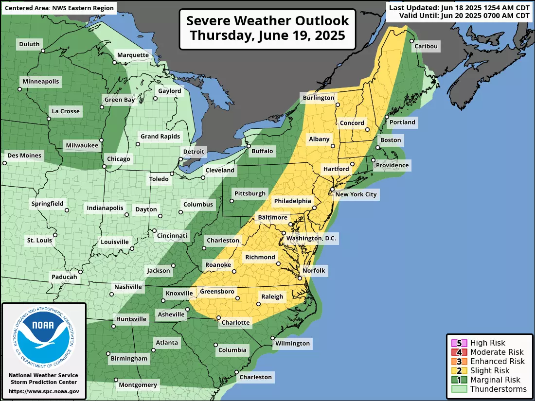
Thursday's storms will probably be widespread, as they will be sparked by an approaching cold front. I have no doubt that storms will reach strong to severe limits, with an even greater risk of gusty winds, torrential downpours, and dangerous cloud-to-ground lightning. A tornado or two also can not be ruled out in this kind of highly unstable atmosphere.
Friday NJ weather: Perfect first day of summer?
Friday is the Summer Solstice, officially set to arrive at 10:41 p.m. Eastern Daylight Time.
And the start of the new season will be beautiful. Easily the nicest day of the week.
Friday looks mostly sunny, breezy, dry, and seasonably warm. High temperatures in the lower to mid 80s will be pleasant, especially as humidity drops.
Saturday NJ weather: Finally a dry, warm weekend
We actually get a weekend this time around! Yes, the first weekend of summer looks way better than our recent string of gloomy weather.
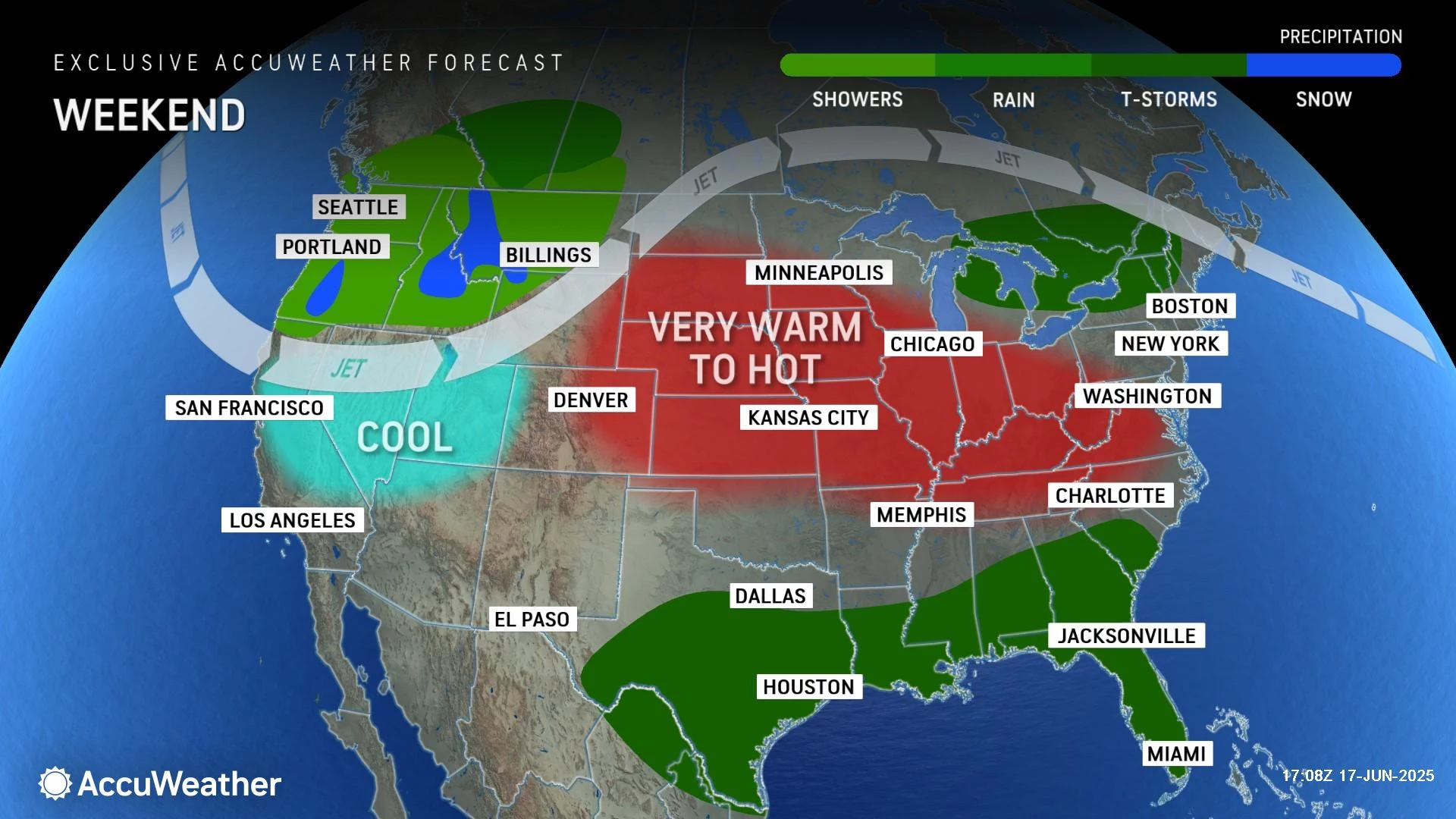
Saturday reads like a typical mid-summer kind of day. With a mix of sun and clouds, high temperatures will push into the mid 80s on average. Humidity levels will be moderate, and there will be a light breeze. Enough to keep the warm air moving around inland. But not strong enough to prevent a sea breeze from developing at the Jersey Shore — beaches will likely be 10 to 15 degrees cooler than inland areas.
Sunday NJ weather: First heat wave of the season
Models start to diverge starting with Sunday forecast. I'm maintaining a call for a hot day. But there is a chance for a few spot showers late-day, especially to the north.
Highs on Sunday will once again push toward 90 degrees.
Temperatures for early next week will remain above normal for this time of year. I think there is some question whether we're looking at 80s, 90s, or even 100s next week — it is highly dependent on cloud cover and wind direction. Just get those air conditioners ready to roar, and be prepared to sweat a lot. Rain chances will remain minimal through at least the first half of next week.
This is one of NJ's best pizza joints
Gallery Credit: Dennis Malloy
Dan Zarrow is Chief Meteorologist for Townsquare Media New Jersey. Follow him on Facebook for the latest forecast and realtime weather updates.
NJ DOT's Electronic Sign Safety Messages Summer 2025
Gallery Credit: Dan Alexander
More From New Jersey 101.5 FM


