
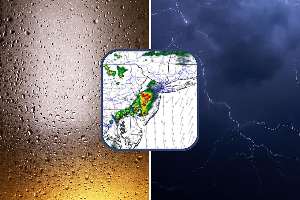
Tuesday NJ weather: Final push of high humidity and strong storms
The Bottom Line
Four times in the last eight days, we have had to deal with strong to severe thunderstorms rolling through New Jersey. Monday night's storms had some bark, but little bite — no warnings were issued. And now we are staring down one more round of stormy weather, before quieter, happier conditions resume.
Humidity and thunderstorms will be the big weather stories on Tuesday. Then rain will be close on Wednesday and Thursday, although I am opting for a dry forecast. Friday will be a big transition day, as a cold front drives in a shower then much drier, much more comfortable air.

Tuesday
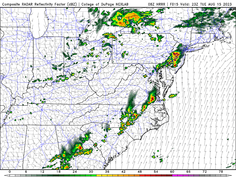
As of this writing (6 a.m.), one final push of thunderstorms is driving west to east across New Jersey. Within the next hour or two, we will dry out — a trend that will continue for the rest of Tuesday morning and most of the afternoon.
We will see clouds and some sun throughout Tuesday. Humidity will stay high. And temperatures will be warm. 70s in the morning, mid to upper 80s in the afternoon. (North Jersey, above I-78, is in a different air mass, and will end up slightly less humid and cooler, in the 70s.)
Now let's talk about thunderstorms once again. Starting around 5 p.m. and lasting through about 11 p.m., we will have to watch the sky as scattered storms develop.
When forecasting thunderstorms, there are many pieces of model data and indices that we look at to determine 1.) how strong storms will be, 2.) how numerous they will be, and 3.) what the primary threats are.
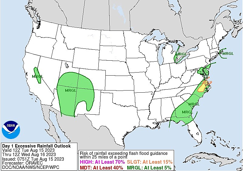
Unsurprisingly (given the humidity in the air), heavy rain and flooding will be our biggest concern Tuesday evening. With "precipitable water" (PWAT) values well over 2", some models are pumping out multiple inches of rainfall in a short period of time. That is more than sufficient to overcome storm drainage systems and cause big puddles (i.e. flooding).

Gusty winds are also a possibility. The most unstable air, most conducive to severe weather, will be over southeastern New Jersey this time around. The NAM model in particular paints upwards of 2000 CAPE (Convective Available Potential Energy) along the southern edge of the state, indicating air that is very conducive to rising motion. (Key for thunderstorm development.)
The tornado threat is low this time around, owing to more "linear" than "supercellular" storms. But it's not zero.
Once storms wrap up, fog will likely develop overnight. Humidity should dial back a little bit too. Look for low temps around 70 degrees.
Wednesday
It will be less tropical. But still pretty sticky.
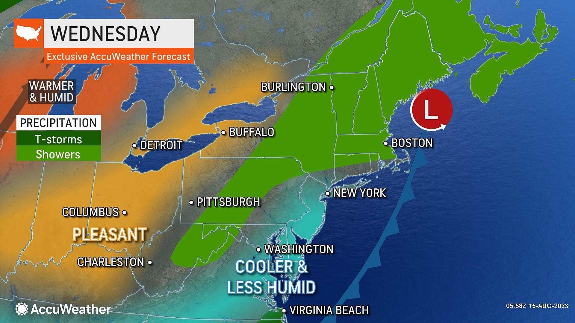
A band of rain will be stalled just off the coast. Some model solutions over the past few days have suggested a stray shower brushing past New Jersey at some point Wednesday. (And Thursday too.) But I am opting for a dry forecast for now.
Wednesday will bring partly sunny skies. High temperatures will be seasonable, in the lower to mid 80s.
Thursday
Thursday looks cloudier than Wednesday. And more humid. And a degree or two warmer, thanks to a flip in wind direction (from southeasterly to southerly). I'll call it mostly cloudy, with highs in the mid 80s.
Friday
A cold front will arrive Friday morning, bringing a welcome transition from horrendously humid to ... not humid at all!
A shower is possible early Friday, although latest guidance suggests a moisture-starved, uneventful frontal passage. Morning clouds will give way to sunshine. Meanwhile, dew points will drop from the 70s to the 50s. That will be a big "ahhh" moment, as the air becomes much more comfortable and downright refreshing.
Friday afternoon should be bright and breezy. High temperatures will still be seasonably warm, with highs in the mid 80s. If all goes well, Friday should turn into a beautiful summer day.
The Extended Forecast
And again, if the short-range forecast plays out as expected, this weekend's weather will be spectacular.
Saturday looks sunny and dry. With dew points potentially dipping into the 40s, it will be ridiculously dry. The only snag is that temperatures will end up below normal. But with highs around 80, and the abundant sunshine, I think it will still be warm and pleasant.
Sunday warms up into the 80s. Monday heats up into the 90s. Our next chance of rain will come in the Monday-Tuesday time frame.
One more item worth mentioning. I have not talked about the tropics in a while, because things have been very quiet so far this season. However, there are now a couple of tropical waves coming off Africa that are being monitored for development. And the climatological peak of the Atlantic hurricane season is coming up within the next month. The ocean is very warm at this point of the summer.

BEEP BEEP BEEP: These are the 13 types of Wireless Emergency Alerts auto-pushed to your phone
Gallery Credit: Dan Zarrow
Dan Zarrow is Chief Meteorologist for Townsquare Media New Jersey. Follow him on Facebook or Twitter for the latest forecast and realtime weather updates.
A tornado's rapidly approaching - what should you do?
Gallery Credit: Sophia Laico
More From New Jersey 101.5 FM


