More rain for NJ: Wednesday even wetter than Tuesday, flooding possible
The Bottom Line
More rain. And Wednesday's storm system will be stronger, wetter, and longer-duration than Tuesday's sog-fest.
Let's recap: On Saturday, NJ got soaked by just over an inch of rain. On Tuesday, widespread rain totals were just over a half-inch. I think we will all agree that the ground is thoroughly soaked and saturated. So now, with 1 to 2 inches of rain back in the forecast for Wednesday, it is time to start talking more seriously about flooding.
Not intense, biblical, "build an ark," property-damaging kind of flooding. Instead, big puddles and high streams will cause road closures and other travel disruptions.
There are some glimmers of dry weather coming up, especially on Friday. But one more storm system over the weekend could be a nuisance for parade-goers across New Jersey.

Wednesday
Radar is all clear to start Wednesday morning, as we catch a brief break of dry weather. There are some patches of fog around New Jersey, as temperatures have met the dew points in the mid 40s.
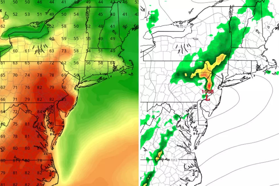
By late morning — 10 or 11 a.m. — rain will return to New Jersey, spreading from southwest to northeast through early afternoon. These will not be light/brief/hit-or-miss "showers" we talk about so often. This is going to be full-on, widespread rain. Heavy at times. Flooding will be a growing concern during and after any downpours.
So you will get wet through the afternoon and evening commute. A Flood Watch has been issued for much of NJ from 1 p.m. Wednesday through early Thursday morning, given the risk of "big puddles" and flooding-related slowdowns.
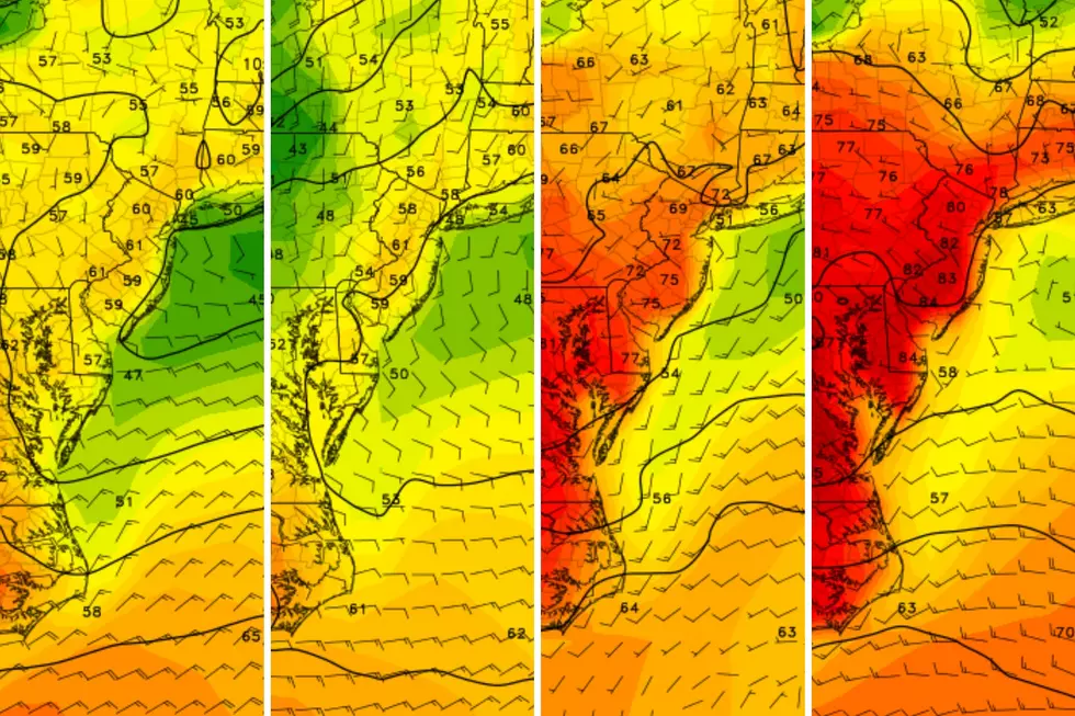
The rain should largely break part by late Wednesday evening, although showers may linger through the overnight. Temperatures will stay well above freezing, only falling a few degrees into the upper 40s.
Thursday
Thursday's forecast is still tricky. And still unsettled.
While there could be a few showers and pockets of drizzle around the Garden State, I could see a scenario where little rain actually falls. It will definitely be drier than Tuesday and Wednesday. But cloudy and increasingly breezy.
High temperatures on Thursday should reach the lower 50s again, although thermometers may start slowly sliding backwards in the afternoon.
By Thursday night, a slightly cooler and drier air mass will be in place. I could see a few spots in far northern New Jersey dipping down to the freezing mark Friday morning. But it does not look like a widespread statewide freeze.
Friday
What's this, a dry and mild weather day?! Friday is the shining start of the rest of the week, your best chance to be outside with nothing falling from the sky.
As the sun pops out to say hello, high temperatures are forecast to reach the mid 50s. Yes, we are technically in a cooler air mass. But the clearer, drier sky will make all the difference.
No weather problems whatsoever on Friday. Enjoy the day.
Saturday & Sunday
I have to lump both weekend days together here, as this week's third and final storm system will dampen our spirits one more time.
This is the time of year when the weekend weather forecast becomes way more important. I count no fewer than ten St. Patrick's Day parades scheduled for Saturday and Sunday.
I like what I see here, as models are converging on late Saturday through early Sunday morning as prime time for raindrops. Mainly during the overnight hours. Plus, nothing too heavy or wintry to worry about.
I am sure parade organizers are on the edge of their seats, four-leaf clover in hand — I really do think there's a shot of dry weather for parade time both days.
Saturday is going to be pretty raw, as skies turn cloudy and high temperatures get stuck in the upper 40s. Sunday looks like the nicer day, once we dry out. Look for a mix of sun and clouds, a brisk wind, and highs in the lower 50s.
The Extended Forecast
Our weather settles down next week, as we approach the midpoint of March.
Early next week looks partly sunny and seasonable, with daily low temperatures in the 30s (possible freezes) and afternoon highs aiming for the upper 40s.
Most of next week should be dry, aside from a stray shower or flurry. The next storm system to watch arrives next weekend — the last weekend of winter, by the way.
So that begs the question, once again. Are we done with snow? I think it is safe at this point to say that "big" winter storms are unlikely. But it can absolutely still snow in New Jersey well into April and even early May.
BEEP BEEP BEEP: These are the 13 types of Wireless Emergency Alerts auto-pushed to your phone
Gallery Credit: Dan Zarrow
Dan Zarrow is Chief Meteorologist for Townsquare Media New Jersey. Follow him on Facebook for the latest forecast and realtime weather updates.
LOOK: The most expensive weather and climate disasters in recent decades
Gallery Credit: KATELYN LEBOFF
More From New Jersey 101.5 FM
