

From stormy to spectacular: Big weather transition for NJ Friday
UPDATE as of 8 a.m. Friday...
The National Weather Service has allowed the Severe Thunderstorm Watch to expire, as the strongest storms move off the coast.
As Friday morning's round of heavy rain wraps up, remember that additional thunderstorms are possible through the afternoon and early evening hours. They will be spotty — more broken apart — but still capable of producing downpours and severe weather.
ORIGINAL POST from 6:10 a.m. Friday...
The Bottom Line
The grand finale of this active week of weather is on Friday. Two rounds of stormy weather are expected across New Jersey. Widespread in the early morning, then spotty through the afternoon. Heavy rain and flooding could be big issues. And there could be some severe weather concerns too.
But the big payoff arrives this weekend, as we transition away from soupy air and a stormy pattern. Sunshine, dry weather, warm temperatures, and low humidity are in the forecast, with no weather issues whatsoever.

Friday
As of this writing (6 a.m.), our initial round of thunderstorms is more than halfway through the state. This line is 1.) flying, and 2.) fizzling, as it charges from west to east. The initial burst of rain, wind, and light could be intense. (Especially in North Jersey and South Jersey.) But the really heavy stuff will fade quickly.
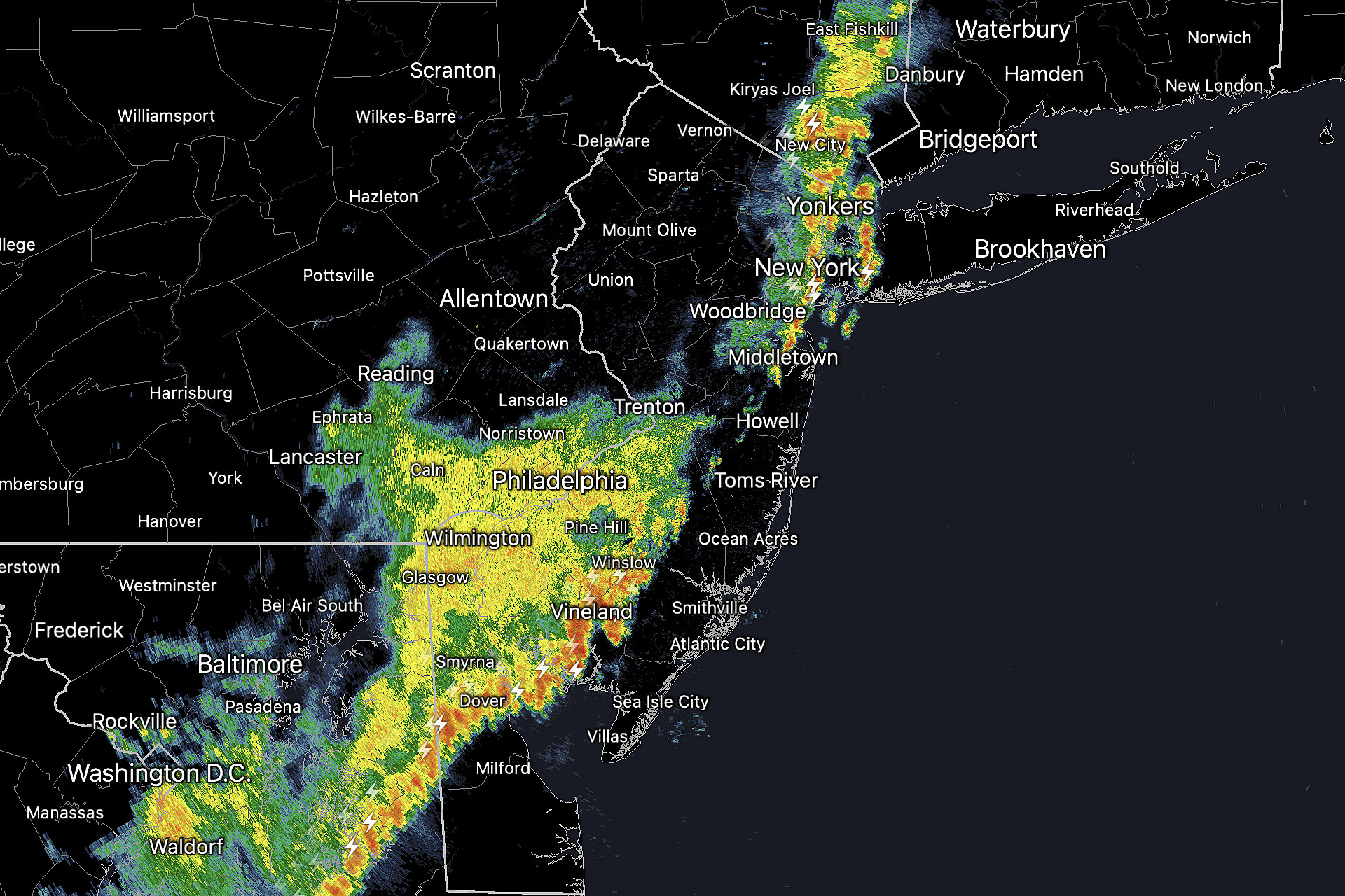
A Severe Thunderstorm Watch is in effect until 8 a.m. Friday morning for 10 counties in southern and coastal New Jersey. A watch means conditions are ripe for severe weather (wind, hail, and tornado) is possible, but dangerous storms are not a guarantee. It serves as an official "heads up" to keep a close eye on the forecast and changing weather conditions.
Bottom line: Everyone in the state will get wet during the AM commute. Heavy rain and big puddles are the biggest concern.

By late morning — around 10 a.m. — we should see big improvements, as the main band of thunderstorms drifts off the coast. Through the midday, afternoon, and evening hours, we will have to watch for spotty showers and thunderstorms around. The threat for strong storm cells with downpours will remain. But again, they will be widely scattered.


In between raindrops, it will be a mostly cloudy day. Still humid. High temperatures will average lower 80s by Friday afternoon.
Once sunset passes (after 8 p.m.), the chance of rain drops to zero and skies will start to clear. Humidity levels will fall too, leading to a comfortable night. Low temperatures will end up in the 60s.
Saturday
I still maintain this will be one of the best weather weekends of the entire summer, devoid of any significant weather issues.

We may have some residual clouds Saturday morning, but skies will quickly become mostly sunny. It will be dry, with a nice breeze. And dew points will end up in the lower 60s — that is pretty low humidity for the middle of summer.
Temperatures will max out around 80 to 85 degrees Saturday.
Saturday night will once again dip well into the 60s.
Sunday
Sunday will be the warmer day of the weekend, as highs push to around 85 to 90 degrees. But humidity goes even lower, as dew points probably drop into the 50s. So it will be another beautiful, comfortably warm summer day.
Expect more sunshine with fair weather clouds on Sunday. Once again, no rain, storms, or air quality issues.
Monday
Monday gets hot, with highs near 90 away from the coast. And we'll see a bit more cloud cover and humidity in play. But you'll still fare well, if you're adding an extra day of beach or pool time to your weekend.
There is a slight chance of a shower or storm late-day Monday. Current forecast models keeps that chance northwest of New Jersey. But it's something we will have to watch through the weekend.
The Extended Forecast
July will end on a hot note, as temperatures surge back to at-or-above normal levels. We will probably see widespread 90s by the end of next week. Hopefully humidity levels stay out of the "tropical" category, so we won't swelter and suffer too badly.

Of course, along with heat and humidity comes an almost-daily chance of popup strong thunderstorms too. However, there's no big, organized storm systems forecast to impact New Jersey within the next 7 to 10 days.
BEEP BEEP BEEP: These are the 13 types of Wireless Emergency Alerts auto-pushed to your phone
Gallery Credit: Dan Zarrow
Dan Zarrow is Chief Meteorologist for Townsquare Media New Jersey. Follow him on Facebook or Twitter for the latest forecast and realtime weather updates.
LOOK: The most expensive weather and climate disasters in recent decades
Gallery Credit: KATELYN LEBOFF
More From New Jersey 101.5 FM


