
Tropical Storm Ophelia: What I’m most worried about for NJ
Hello, Ophelia
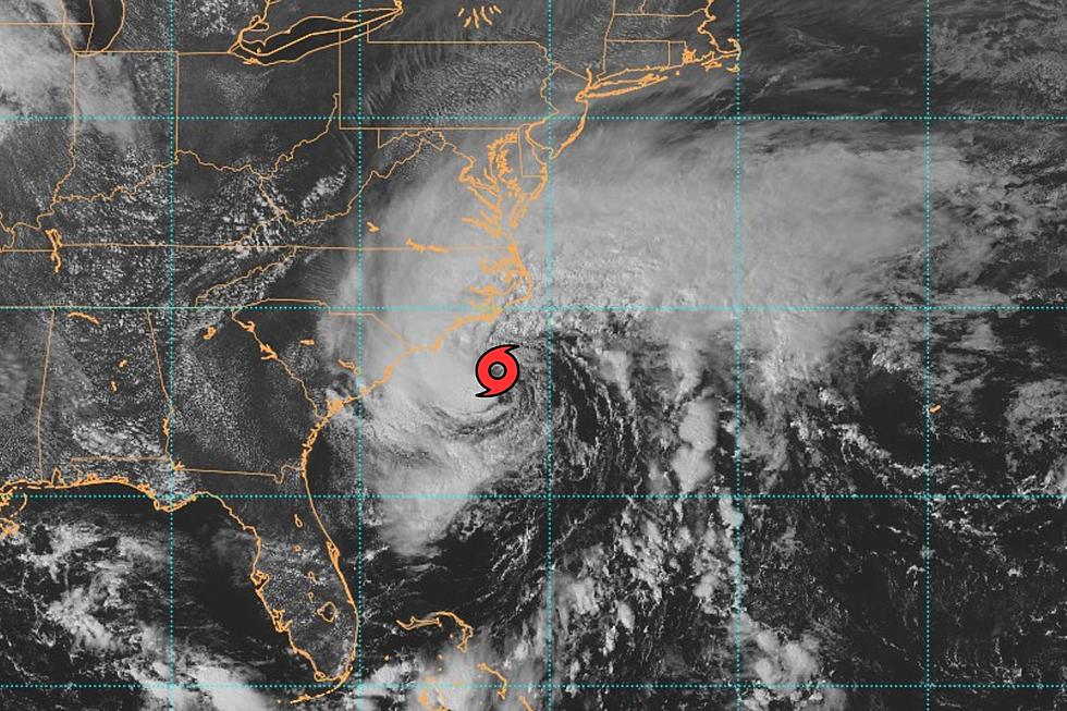
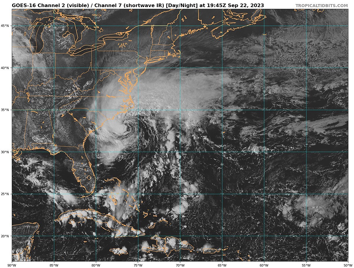
The first piece of news to report: We have a tropical storm. As of Friday afternoon, an area of circulation about 150 miles off the North Carolina coast was deemed to have a closed circulation and sustained winds over 40 mph. Organized enough to call it Tropical Storm Ophelia. In fact, the storm continues to strengthen - sustained winds are up to 70 mph, with a well-defined center and circulation. Ophelia could become a low-end hurricane just before landfall.
It is the 16th tropical storm of the 2023 Atlantic hurricane season. And the third to directly impact the mainly United States. (After Harold and Idalia.)

Forecast Is Locked In
Ophelia will not be at tropical storm strength any longer when it reaches New Jersey. (It's important to note that Tropical Storm Warnings have NOT been issued for NJ.)
Technically, Ophelia is forecast to become a "subtropical depression" by the time it reaches our latitude- feeding off the atmosphere rather than the warm ocean, and with sustained winds below 39 mph.
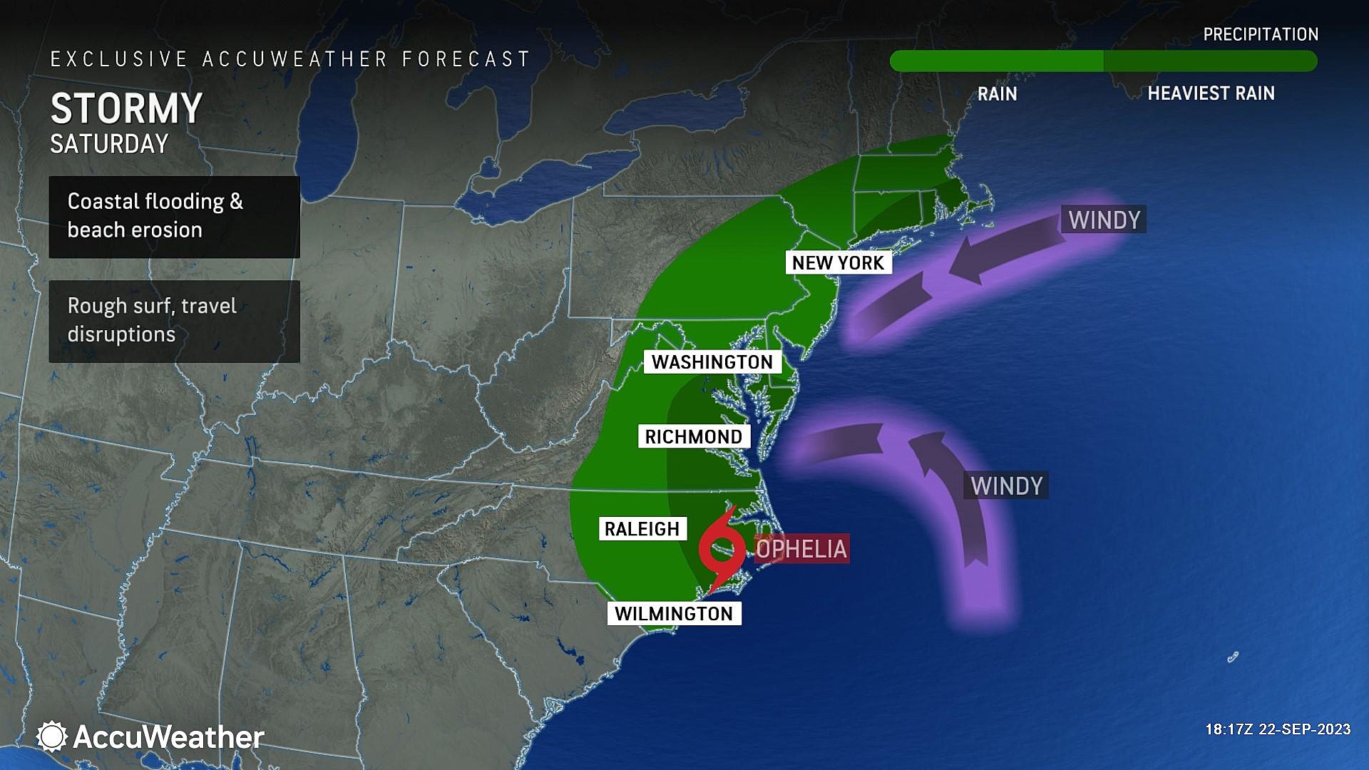
The new name doesn't change New Jersey's stormy weekend forecast at all. To recap:
--Showers arrive in South Jersey around sunset Friday. Statewide weather progressively goes downhill late Friday night into early Saturday morning.
--Brunt of the storm - the time of the most widespread heavy rain and strongest winds - will be Saturday morning through midday.
--Rain dials back a bit Saturday afternoon, but wind continues to howl.
--Widespread moderate coastal flooding at high tide Saturday. (2 p.m. oceanfront, 5 p.m. back bays)
--Rain picks up again early Sunday, another wet and windy day. (Although less dramatic and crazy than Saturday.)
--Rain may linger into Monday too. (There's still considerable uncertainty regarding the "end time" of Ophelia's impacts on NJ.)
Storm impacts, by the numbers:
--Rainfall: 1 to 3 inches
--Wind gusts: 30 to 50 mph
--Storm surge: 1 to 3 feet (moderate category flooding of tidal waterways)
--Ocean waves: 4 to 8 feet
For a full, more specific rundown of how this nasty weekend storm will play out, check out my comprehensive Friday morning weather blog post.
And keep an eye on the Jersey Shore Report this weekend for info on wave heights, rip currents, and high tide times.
What I'm NOT So Worried About
I was reminded on a call with colleagues just now that in Act 4, Scene 7 of William Shakespeare's Hamlet, the character os Ophelia died from drowning. Is that a sinister omen of what her namesake tropical storm will do to New Jersey this weekend?
I do have a mantra when it comes to forecasting storms with tropical origins: Never underestimate the rainfall potential of tropical moisture.
Yes, it's going to rain this weekend. A lot, with multiple inches of rainfall likely.
However, based on the latest guidance, it is clear this is NOT another "Ida" or "Irene" situation. We are NOT talking about double-digit rainfall over a very short period of time. Ophelia is going to deliver 3-ish inches of rain, spread over a period of 48 hours. While locally higher amounts are possible, this level of rainfall does not qualify as catastrophic or historic. It's just really wet.
Obviously, we have to be vigilant about spotting tropical downpours and areas of flooding/ponding during the storm. But rain, flash flooding, and river flooding are (surprisingly) not my biggest concerns heading into the brunt of the storm Saturday.
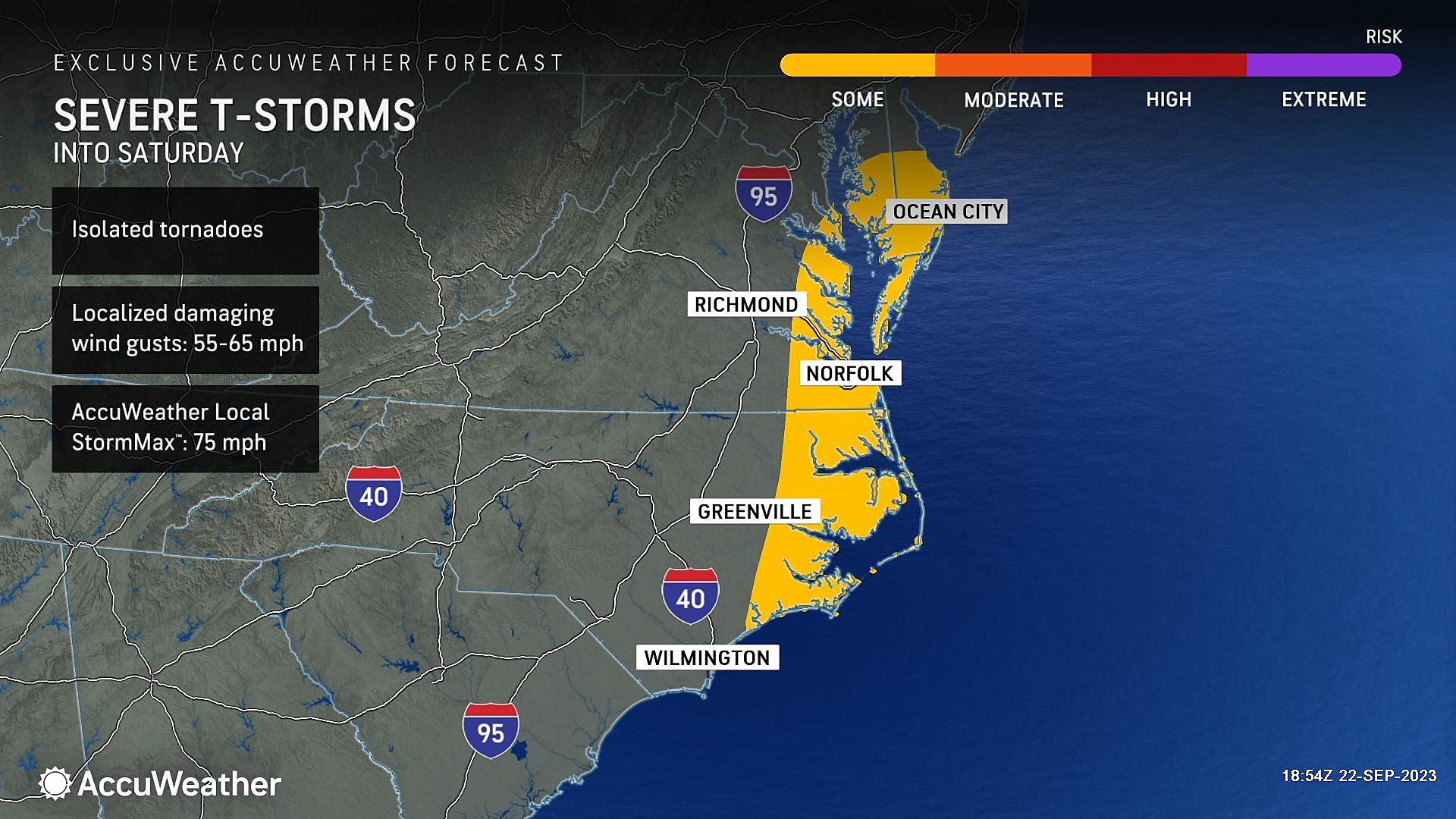
Nor is severe weather a front-of-mind problem. While an isolated spin-up is possible, the parameters just aren't coming together for the storm to cause widespread, long-track tornadoes.
What I AM Worried About
So that leaves the other storm impacts - the wind and coastal flooding threats - as the things to worry about.
Strong northeasterly winds will kick up early Saturday morning, gusting to 30-40 mph inland and 40-50+ mph along the coast. That is more than enough to bring down tree branches, cause power outages, and cause driving difficulties.
That strong on-shore wind will also push a massive amount of water toward the Jersey Shore. We call this storm surge.
1 to 3 feet of surge is sufficient to cause widespread moderate flooding of tidal waterways at high tide.
That is NOT Sandy-level flooding, but pretty significant - akin to the strongest coastal storms (nor'easters) that pass by New Jersey. Water will rise and streets will be closed. Southern beaches - from LBI to Cape May - will be impacted the most.
Needless to say, you should stay off the beaches for the duration of the storm too. Big waves and dangerous rip currents will continue through the weekend.
Final Thoughts
I have had so many people reach out and ask whether to cancel, postpone, or relocate outdoor events this weekend. From sporting events to weddings to parties to charity events, etc.
At the very least, the entire weekend is going to be inclement. At worst, conditions may become troublesome if power outages or significant flooding come into play.
The biggest dangers here are ignorance and complacency. Even though this forecast largely reads as "a wet and windy weekend," it is still important to know the impending threats and take them seriously. (Reading this far down in my weather blog is an outstanding start!) This is not a "bread and milk" storm. It's a "common sense" storm - hopefully you have a nice, safe, dry place to be on Saturday in particular.
Our Townsquare Info & Weather Network team is mobilized across the state, ready to keep you informed and safe throughout the weekend. I will be on-air starting at 6 a.m. Saturday, with regular updates through the morning and afternoon. (Expect my next weather blog entry around the 7 a.m. hour Saturday.)
TIPS: Here's how you can prepare for power outages
Dan Zarrow is Chief Meteorologist for Townsquare Media New Jersey. Follow him on Facebook for the latest forecast and realtime weather updates.
25 costliest hurricanes of all time
More From New Jersey 101.5 FM


