NJ weather changes ahead: Chilly to mild, dry to wet, and back again
The Bottom Line
Over the course of the next week, New Jersey will see a wide variety of weather conditions. From highs in the 30s, to highs in the 60s. From sunny and dry, to cloudy and wet. From calm to windy. The one thing missing? Accumulating snow — we are probably done with significant wintry weather through the rest of February at this point.
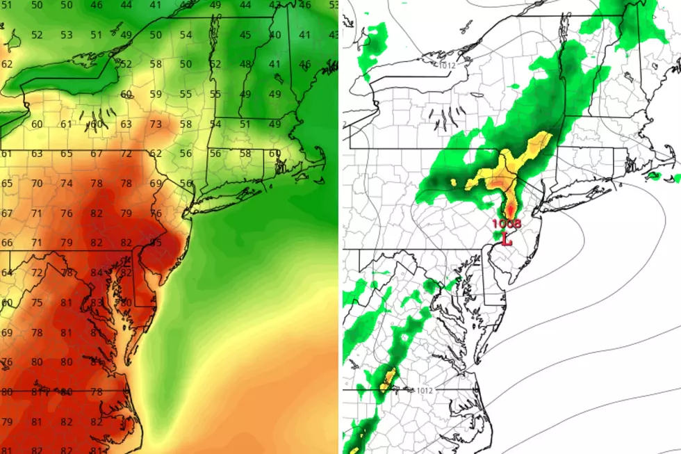
The biggest stumbling block in this forecast is a storm system set to arrive late Thursday into Friday. While a brief hit of wintry mix (snow and freezing drizzle) is possible in far northern New Jersey, this will be primarily a rainmaker for New Jersey.
Will it rain the entire time, from Thursday late afternoon through Friday afternoon? No way. But you will need the umbrella at times, especially during the daytime hours on Friday. I do not see anything too heavy or dramatic. Just wet and dreary.
This weekend will bring a day of blustery sunshine on Saturday, followed by friendlier weather on Sunday. The warming trend will continue next week, with 60s a good possibility for the final few days of February.

Wednesday
Unlike the past few days, which featured a crystal clear blue sky and brilliant sunshine, there will be clouds in NJ's sky Wednesday. Especially near the coast, as a powerful coastal storm churns harmlessly many hundreds of miles away.
So we will call it a "partly sunny" day overall. Cold morning temperatures range from the teens (where snow is on the ground) to the 30s (for the water-insulated Jersey Shore). Afternoon highs will reach about 40 to 45 degrees. Slightly warmer than Tuesday. Slightly below normal for late February.
Wednesday night will stay dry and uneventful. A hint of moisture in the air should prevent temperatures from really bottoming out this time around. My latest forecast puts the average low temperatures in the upper 20s.
Thursday
Most of the day wil fare OK, but our next storm system will approach as the hours roll on.
Skies will turn mostly cloudy (and maybe even overcast) from Thursday morning to afternoon. High temperatures will bump into the mid 40s. So far so good.
Starting Thursday late afternoon — after about 3 p.m. — spotty showers are expected to move into New Jersey. Hit-or-miss, here-and-there stuff. Almost all rain.
I will keep a chance for wintry mix in the forecast for far northern New Jersey, above I-80. If you're driving around Sussex County Thursday evening, you might see one or two snowflakes. Or, more likely, you may encounter some slippery spots due to freezing drizzle.
Temperatures will dip into the lower-mid 30s Thursday evening, before slowly rising through Friday morning.
Friday
Friday may begin with a period of steady rain, necessitating umbrellas and windshield wipers on the way to work/school. Again, there's no threat of downpours or severe weather here. Just plain rain.
Showers will likely persist into Friday afternoon, before coming to a final end by sunset. It will not be a total washout, but everyone in the state will probably see about a quarter-inch of fresh rain. One minor concern is that gutters and storm drains still blocked by ice, from last week's winter weather, could overflow.
Despite the clouds and the raindrops, Friday will be mild. High temperatures are expected to hit 45 to 50 degrees across the state.
Behind the rain, skies will clear Friday night and colder air will return. At least one model has temperatures nosediving into the teens by Saturday morning. But I prefer more conservative 20s — seasonably cold, not brutally cold.
Saturday
Saturday will be a one-day burst of blustery weather — cold and wind. High temperatures will only hit the mid 30s. (Maybe 40 degrees in South Jersey.) Meanwhile, wind gusts over 20 mph will add a big bite to the renewed chilly air. I could see a flurry or little snow shower at some point. Otherwise, we will see the return of bright sunshine.
Sounds like perfectly frigid weather for the Polar Bear Plunge in Seaside Heights. Good luck, brave souls!
Sunday & Beyond
Sunday will be the nicer day of the weekend, as temperatures moderate into the 40s. Expect a mix of sun and clouds, with dry weather.
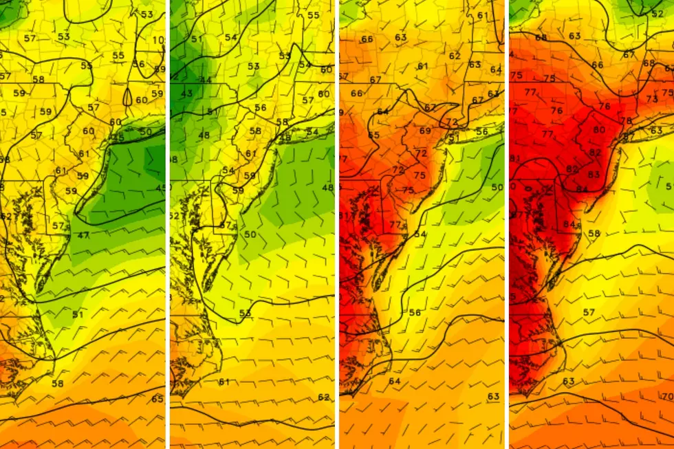
And then next week, the big weather story will be warmth. We will see some 50s around on Monday and Tuesday, potentially rising into the 60s on Wednesday and Thursday. Way above normal for this time of year, but no records.
There will likely be some batches of rain and bouts of fog along the way. And then, the inevitable cold front set to arrive Thursday the 29th will be a strong one. I would not be surprised to see some thunderstorms, followed by a sharp cooldown (arctic blast style). A few snowflakes are possible on the backend of that system. But that is over a week away — we'll deal with it later.
So March roars in like a lion, with another cooldown in progress. March is, in general, a temperamental and volatile weather month. I think we will see more wide swings in weather as the new month begins. From cold to warm, and from dry to rainy/snow.
Cough, cough: NJ's favorite lost voice and sore throat remedies
Gallery Credit: Dan Zarrow
Dan Zarrow is Chief Meteorologist for Townsquare Media New Jersey. Follow him on Facebook for the latest forecast and realtime weather updates.
Final flakes: When does snow season end in NJ?
Gallery Credit: Dan Zarrow
More From New Jersey 101.5 FM
