

NJ weather: Another cooldown is coming, and this time it’ll stick
The Bottom Line
57° Saturday. 67° Sunday. 58° Monday. 65° Tuesday. 53° Wednesday. Those are the high temperatures at the Trenton-Mercer Regional Airport weather station so far this week. What a wild ride.
Following one last mild day on Thursday, this flip-flopping week of weather will end with chilly air arriving on Friday. We will see a few raindrops with this transition too — but not the good soaking we really need.
The end result of this week's temperature roller coaster: The second weekend of November looks chilly, with morning frost/freeze potential and afternoon highs barely in the 50s. At least it will be bright and sunny, right?

Thursday
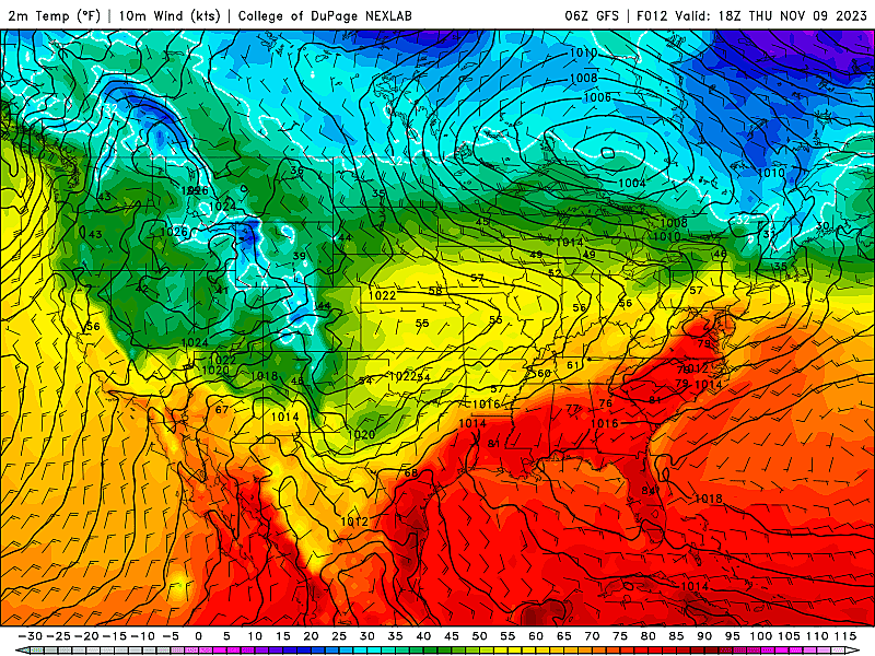
This will be our last day of above-normal temperatures for a week. At least a week.
Thursday morning temperatures are mainly in the 40s. (30s north and west, 50-ish along the coast.) Thermometers have actually risen a bit overnight, as clouds have thickened up.
Highs on Thursday will reach into the mild 60s for most of the state. Northern New Jersey is a notable exception, stuck in the cool mid 50s. On the flip side, South Jersey will probably hit 70 degrees one more time.
Expect abundant cloud cover, with limited peeks of sun. And it looks like we will see some light showers around this afternoon. (Which I fondly call sprinkles.) I doubt it will be enough to need an umbrella, but it will add a dreary and damp aspect to part of the day.
A dry cold front will arrive Thursday evening, opening the door to colder air. As we keep mostly cloudy skies overnight, temperatures will not nosedive immediately. We will see mid 40s or so by Friday morning.
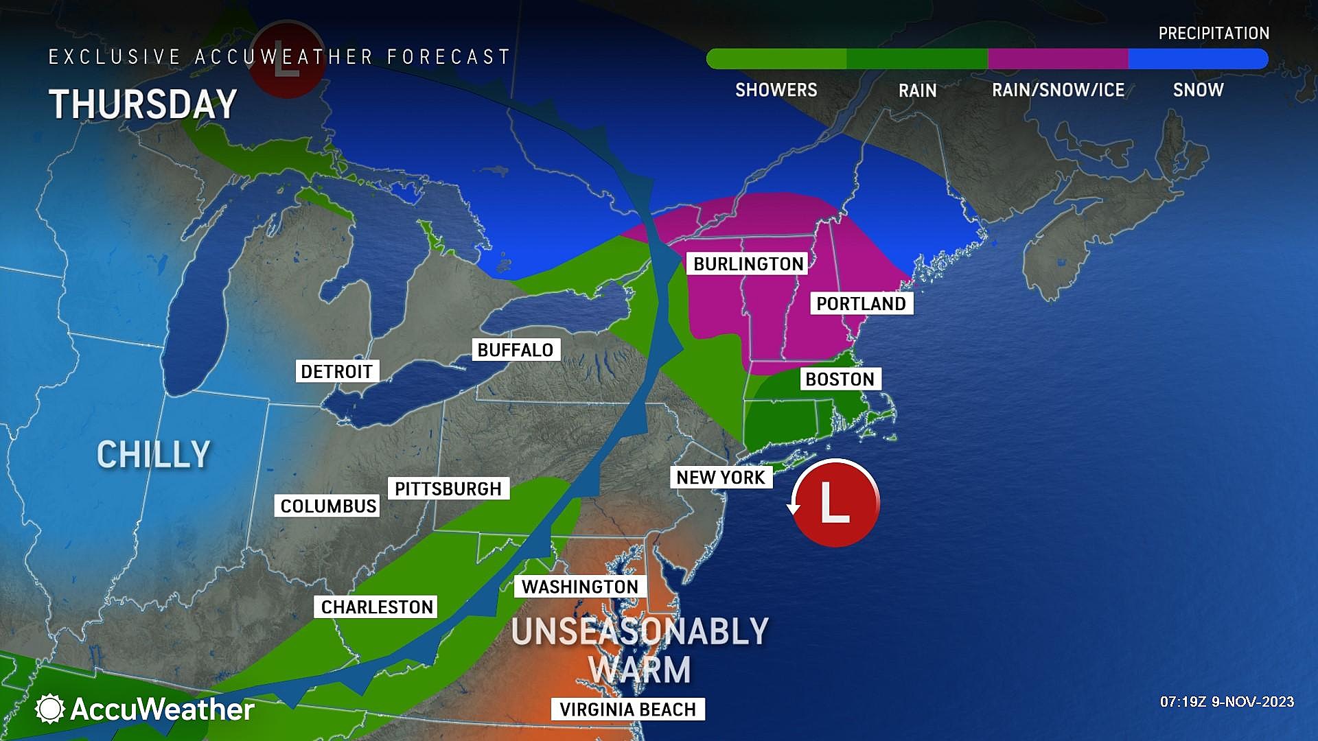
Friday
Definitely cooler. And still cloudy and breezy too.
High temperatures on Friday will only hit the lower 50s. That is about 15 degrees cooler than Thursday. And 5 to 10 degrees below seasonal normals.
As a storm system rides up from the southwest, we will likely see some rain spread into New Jersey during the daytime hours on Friday too. It is not going to rain all day, and rainfall will be on the light side. But nuisance raindrops may have you reaching for the umbrella and/or windshield wiper. The wettest area looks to be the southern half of New Jersey.
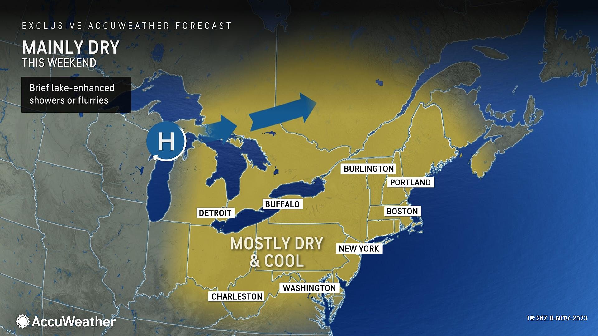
Saturday
This weekend's weather headlines are 1.) sunshine, and 2.) chilly temperatures.
Widespread frost is likely Saturday morning across inland New Jersey, as temperatures dip into the 30s.
And thermometers will once again only reach the lower 50s Saturday afternoon. Skies will be mostly sunny, and both our air and weather will stay completely dry.
Sunday & Beyond
Sunday will be the "bottom of the barrel" in terms of temperatures. A widespread freeze looks probable, away from cities and coast. My latest forecast puts high temperatures only in the upper 40s Sunday afternoon — positively December-ish.
We should settle back into the lower 50s for the first half of next week. And with high pressure controlling New Jersey's atmosphere, skies will remain bright and weather stays dry.
Temperatures should moderate by late next week, possibly back into the 60s by the weekend. That will be our next opportunity for some rain showers. And — inevitably — another cooldown heading toward Thanksgiving. (Which is only two weeks away!)
Most popular grocery stores in America
Gallery Credit: Stacker
Dan Zarrow is Chief Meteorologist for Townsquare Media New Jersey. Follow him on Facebook for the latest forecast and realtime weather updates.
LOOK: Groceries that dropped in price in the Northeast Last Month
Gallery Credit: Stacker
More From New Jersey 101.5 FM


