North Carolina warily watching 2 tropical weather systems
Forecasters say a tropical weather system off the North Carolina coast is expected to pass near the Outer Banks by the evening.
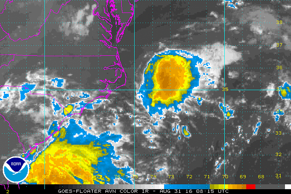
An 11 a.m. update on Tuesday from the National Hurricane Center says the tropical depression could become a named storm later in the day. Its center is also expected to pass near the North Carolina barrier islands in the afternoon or evening.
Top sustained winds were 35 mph (55 kph) with higher gusts, and the storm was centered about 70 miles (115 kilometers) south of Cape Hatteras. A tropical storm warning is in effect for much of the Outer Banks.
A slow stream of cars is heading north on the main highway off Hatteras Island in North Carolina as crowds of visitors thin ahead of the approach of a tropical weather system.
Dozens of cars with tags from places including Maryland, New York and Ohio were seen headed Tuesday morning toward a bridge to the mainland. There was light, intermittent rain and mostly cloudy skies.
A tropical depression off the Atlantic Coast is expected to become a tropical storm and bring rain and wind to North Carolina's Outer Banks as it passes by early Wednesday.
A public beach near Rodanthe was nearly empty, save for two parents enjoying the morning with their 11-year-old son. Joe and Kelley Walker of Virginia say they plan to stay through the weather and watch movies inside when it gets rainy.
In the Gulf of Mexico another tropical depression was about 340 miles (550 kilometers) west of Key West, Florida. Forecasters expect it to become a tropical storm later Tuesday and make a turn to the northeast toward Florida the next day.
(Copyright 2016 The Associated Press. All rights reserved. This material may not be published, broadcast, rewritten or redistributed)
More From New Jersey 101.5 FM