NJ weather: From 50s and showers, to 40s, to heavy rain and wind
The Bottom Line
Welcome to the first full day of Spring! There is a lot of weather to talk about in the coming days. A brief summary of what to expect:
—Wednesday will be a brief break from the unseasonable chill.
—However, scattered rain showers and an increasing wind will kick in Wednesday afternoon and evening.
—Back to blustery, cold, quiet weather for Thursday and Friday.
—A powerful coastal storm will make for a nasty start to the weekend on Saturday, with 1 to 3 inches of rain, 40 mph wind gusts, and minor/moderate coastal flooding looking likely.
Now let's dive into the details, so you know what to expect and can plan accordingly.

Wednesday
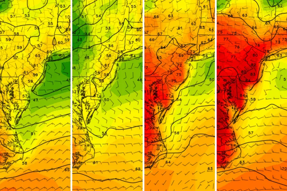
Wednesday will be a fairly mild day, especially compared to the rest of the week. With a mix of sun and clouds, we are starting off with temperatures near 40 degrees. (A bit colder, close to the freezing mark, across the hilltops of NW NJ.) And high temperatures will reach the 50s across most of the state. 60 is a possibility in South Jersey. Not bad at all.
However, Wednesday carries two weather nuisances too.
First, a batch of scattered showers will progress from west to east Wednesday afternoon and early evening. The best chance for raindrops will be the northern half of New Jersey. With those mild temperatures, there is a better chance for rumbles of thunder than for snowflakes. Rainfall totals may exceed a tenth of an inch — just a spurt of damp weather.
The second issue is an increasing wind through the day, possibly gusting to 30-ish mph.
As showers wrap up Wednesday evening and skies start to clear, temperatures are going to tumble again. Wednesday night will be cold, with low temperatures bottoming out in the lower 20s. Add in the breeze, and you get wind chills flirting with the teens. Brrr, we will be bundling up against another February-ish night.
Thursday
Back to blustery. Thursday will be a cold, breezy day. But at least we will have plenty of sunshine. High temperatures will only reach the lower 40s — about 10 degrees below normal for late March.
Friday
Friday will also be on the chilly side, although dry during the daytime hours. We will progress from early sunshine to late-day clouds. High temperatures are forecast to only hit mid 40s.
Rain chances will start to increase Friday evening, as our next storm system approaches. I suspect wet weather will hold off until about Midnight.
Saturday
Your outdoor plans for Saturday are in trouble.
We continue to track a coastal storm system that will impact New Jersey throughout the day on Saturday. In my last weather blog entry, I laid out three potential scenarios for this storm:
1.) Just Showers
2.) Rainy, Windy, Nasty Day
3.) Storm Gets Stuck
Model guidance is heavily trending toward #2 now. Wet and windy, although not quite a worst-case scenario. (The UKMET model now favors prolonged downpours and up to 6" of rain, so we can not completely rule out #3.)
By the numbers, rainfall totals on Saturday are expected to range from 1 to 3 inches, with the coast picking up the most. Wind gusts may exceed 40 mph. And minor to moderate coastal flooding is possible at high tide. That magnitude will depend on the exact wind direction and timing — we will have a clearer picture of that within the next day or two.
I could see some ponding and flooding issues out there, especially as the heaviest rain arrives midday Saturday.
High temperatures amid the rain and thick clouds on Saturday should reach the lower 50s, on average. Perhaps a little cooler to the north, but nowhere near cold enough for substantial winter weather.
Sunday & Beyond
Sunday clears out, aside from a lingering early morning shower along the coast. We should see good sunshine for the second half of the weekend, with some clouds along the eastern edge of the state.
High temperatures on Sunday will settle around the 50-degree mark.
Early next week looks quiet and dry. Expect partly sunny and breezy conditions for Monday and Tuesday, with highs in the lower-mid 50s. Right around or just below seasonal averages.
You know warmer 60s and 70s will return eventually. However, any chance of a big springtime warmup is still over a week away.
Get Your NJ 101.5 Merch
Gallery Credit: Nicole Todd
Dan Zarrow is Chief Meteorologist for Townsquare Media New Jersey. Follow him on Facebook for the latest forecast and realtime weather updates.
Final flakes: When does snow season end in NJ?
Gallery Credit: Dan Zarrow
More From New Jersey 101.5 FM


