
NJ beach weather and waves: Jersey Shore Report for Sat 9/30
Advisories
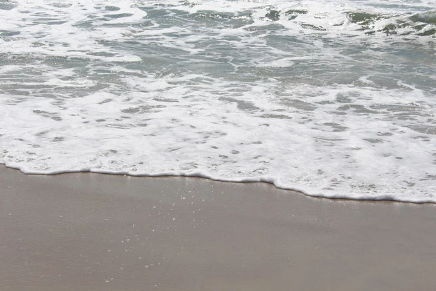
--A high risk of dangerous rip currents and rough surf is posted once again for the Jersey Shore.
--A Coastal Flood Advisory remains in effect. Widespread minor flooding is expected at high tide Saturday.
At the Shore
Current conditions and forecast as of Sat morning
| Rip Current Risk | High |
|---|---|
| Waves | 3 - 7 feet |
| Winds | From the North 13 - 24 mph (Gust 29 mph) 11 - 21 knots (Gust 25 knots) |
| Ocean Temperature | 64° - 66° (Normal 67° - 72°) |
| Air Temperature | 65° - 66° |
| Sunrise/Sunset | 6:51am - 6:44pm |
| UV Index | 1 (Low) |
Tide Times
| SANDY HOOK Sandy Hook Bay | High Sat 9:01a | Low Sat 3:28p | High Sat 9:23p | Low Sun 3:41a | |
| LONG BRANCH Atlantic Ocean | High Sat 8:35a | Low Sat 2:52p | High Sat 8:57p | Low Sun 3:05a | |
| MANASQUAN INLET Atlantic Ocean | High Sat 8:49a | Low Sat 3:04p | High Sat 9:11p | Low Sun 3:17a | |
| SEASIDE HEIGHTS Atlantic Ocean | High Sat 8:31a | Low Sat 2:56p | High Sat 8:53p | Low Sun 3:09a | |
| SEASIDE PARK Barnegat Bay | Low Sat 7:01a | High Sat 12:41p | Low Sat 7:33p | High Sun 1:03a | |
| BARNEGAT INLET Barnegat Bay | High Sat 8:53a | Low Sat 3:25p | High Sat 9:16p | Low Sun 3:36a | |
| MANAHAWKIN BRIDGE Manahawkin Bay | Low Sat 6:35a | High Sat 11:48a | Low Sat 7:07p | High Sun 12:10a | |
| LITTLE EGG INLET Great Bay | High Sat 9:50a | Low Sat 3:56p | High Sat 10:09p | Low Sun 4:09a | |
| ATLANTIC CITY Atlantic Ocean | High Sat 8:40a | Low Sat 2:56p | High Sat 9:04p | Low Sun 3:08a | |
| OCEAN DRIVE BRIDGE Townsends Inlet | High Sat 9:10a | Low Sat 3:19p | High Sat 9:36p | Low Sun 3:33a | |
| WILDWOOD CREST Atlantic Ocean | High Sat 8:47a | Low Sat 3:02p | High Sat 9:11p | Low Sun 3:14a | |
| CAPE MAY Delaware Bay | High Sat 9:49a | Low Sat 3:56p | High Sat 10:14p | Low Sun 4:09a |
Marine Forecast
From the National Weather Service, Mt. Holly
SMALL CRAFT ADVISORY IN EFFECT THROUGH MONDAY EVENING
TODAY: NE winds 15 to 20 kt with gusts up to 25 kt. Seas 5 to 7 ft. E swell 3 to 5 ft at 7 seconds. Patchy drizzle early this morning. A chance of showers until late afternoon, then a slight chance of showers late. Vsby 1 to 3 NM early this morning.
TONIGHT: N winds 10 to 15 kt with gusts up to 25 kt. Seas 5 to 6 ft. E swell 3 to 6 ft at 7 seconds.
SUN: N winds 10 to 15 kt with gusts up to 25 kt. Seas 4 to 6 ft. E swell 3 to 6 ft at 8 seconds.
SUN NIGHT: N winds 5 to 10 kt. Seas 4 to 5 ft. E swell 3 to 5 ft at 8 seconds.
MON: NE winds 5 to 10 kt. Seas 4 to 5 ft. E swell 3 to 5 ft at 8 seconds.
MON NIGHT: E winds around 5 kt. Seas 3 to 4 ft. E swell 3 to 4 ft at 8 seconds.
TUE: NW winds around 5 kt, becoming E in the afternoon, then becoming S in the evening, becoming W after midnight. Seas 3 to 4 ft.
WED: N winds 5 to 10 kt, becoming E. Seas 3 to 4 ft.
Plan Your Trip
Data on this page amalgamated from several sources, including the National Weather Service (weather), National Ocean Service (tides), U.S. Naval Observatory (sun), and the U.S. Environmental Protection Agency (UV index).
Dan Zarrow is Chief Meteorologist for Townsquare Media New Jersey. The Shore Report is generated semi-automatically daily at 5 a.m. from mid-May to late September. Follow Dan's weather blog, Facebook page, and Twitter feed for your latest forecast and realtime weather updates.
Stunning Jersey Shore rentals steps from the beach
Gallery Credit: Erin Vogt
Inside Island Waterpark coming soon to Atlantic City
Gallery Credit: Joe Votruba
Sharks you'll find at the Jersey Shore
Gallery Credit: Dino Flammia
More From New Jersey 101.5 FM


