

When will NJ’s nor’easter ease up?
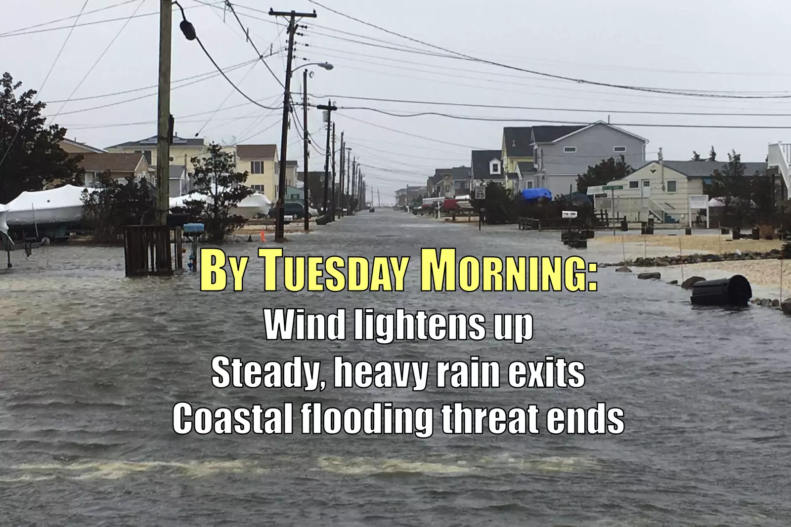
There are still plenty of wind, rain, and surf problems yet to come Monday night, but the Garden State should see some significant improvements by Tuesday morning.
The Nor'easter So Far
Top rainfall totals have been about 1.75-2.25" in coastal Ocean County.
Top wind gusts have ranged between about 55 and 63 mph along the entire coast.
The Atlantic City tide gauge briefly popped into the moderate flood category during Monday afternoon's high tide cycle. That equates to about 4 feet of surge.
Severe beach erosion has been observed up and down the Jersey Shore, with estimated 12 to 16 foot waves battering the coast.
When Will the Wind Die Down?
By about 2 a.m. winds will start to lighten up, as gusts drop below 40 mph.
By about 7 a.m. winds will be significantly and noticeably lighter, as gusts fall below 30 mph.
Winds will remain brisk but less gusty throughout the day Tuesday, sustained at about 15 to 30 mph.
When Will the Rain End?
The rain has largely ended already for South Jersey. Additional bands of rain will be possible, but the peak of the storm has passed.
Through about 4 a.m. bands of heavy steady rain will continue to impact central and northern New Jersey. Visibility and traction will be poor in these torrential downpours.
Residual rain showers will probably persist through Tuesday morning, afternoon, and evening.
Overnight Winter Weather?
Even now, models are indecisive regarding the winter weather potential. While sleet and freezing rain have tried to spread into NJ, the effects have been minimal at best so far.
As of this writing, the surface temperature at High Point is 30 degrees, with other stations in North Jersey reporting 33 to 34 degrees. So I wouldn't rule out a bit of snow and ice overnight, potentially making roads extra slick through part of the state. However, any real accumulation will be limited to the area in and around Sussex County. At maximum, models suggest up to a quarter-inch of ice accretion and/or 3" of snow accumulation will be possible. But again, it's still not a guarantee.
Even though temperatures overall are trending a few degrees colder than anticipated, I do believe the vast majority of New Jersey will see mostly rain overnight.
Down the Shore
We have one more precarious high tide cycle coming up early Tuesday morning. We'll continue to experience 2 to 4 feet of surge along the Atlantic Ocean, Raritan Bay, and Delaware Bay. Tidal waterways are likely to peak at or just above the level experienced during Monday afternoon's high tide.
The next high tide will occur at 5:04 a.m. at Sandy Hook, 4:50 a.m. at Atlantic City, and 5:24 a.m. Remember, high tide for back bays and tributaries are generally a couple hours later than the high tide along the oceanfront.
I'm happy to report that the surge forecast drops to near zero for Tuesday afternoon's high tide.
Good Night
This has been one heck of a storm. And it's almost over! Continue to stay smart and stay safe, New Jersey!
More From New Jersey 101.5 FM


