

Wet weekend, no washout: About 24 hours of rain and wind for NJ
The Bottom Line
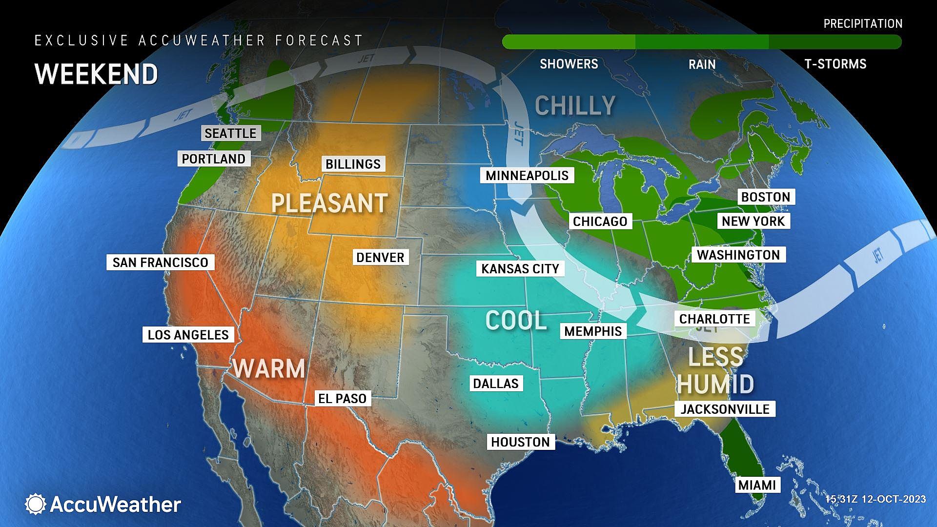
Here we go again. More wet weather, coinciding with a fall weekend. This will be the 6th weekend in a row with measurable rain in New Jersey. Along with some elevated wind and coastal flooding concerns.
I have been consulting with folks all week about what to do with outdoor events this weekend. It's a tough call, but here's the bottom line. If you have something going on before Noon on Saturday, and don't mind a potential shower, I say go for it. Sunday afternoon looks even better, as we dry out and even catch some peeks of sun. However, in the middle, the entire state will get soaked.
By the numbers, we are looking at about an inch of rain for most of the state between Saturday and early Sunday. A little less to the north and west. And possibly approaching two inches along the coast. Wind gusts may top 30 mph, again at the Shore. And tidal guidance does suggest a round of minor category flooding during Sunday morning's high tide cycle.
Let's dive into the details, so you can plan your weekend accordingly.

Friday
We close out this overall pleasant workweek with one more nice day.
Technically, we are under the influence of a cold front on Friday. This new air mass is slightly cooler than the old one. So we're talking mid 60s, instead of 70s. Not bad, just 5 to 10 degrees cooler than the past couple of days.
Skies will be mostly sunny for the bulk of the day, with clouds potentially creeping in late. We will stay completely dry. You may notice an occasional light breeze, out of the northwest up to 15 mph.
Friday night stays quiet, although cool. As clouds increase, we will see thermometers dip into the mid 40s or so.
Saturday
Turning wet. But not necessarily dangerous.
Early Saturday morning (probably starting just before sunrise), showers will spread into the northern half of New Jersey, as the first of two storm systems drives in from the west. Initial rainfall will be light and scattered. No matter how the day starts, it will be cloudy and cool with temperatures stuck in the 50s at best.
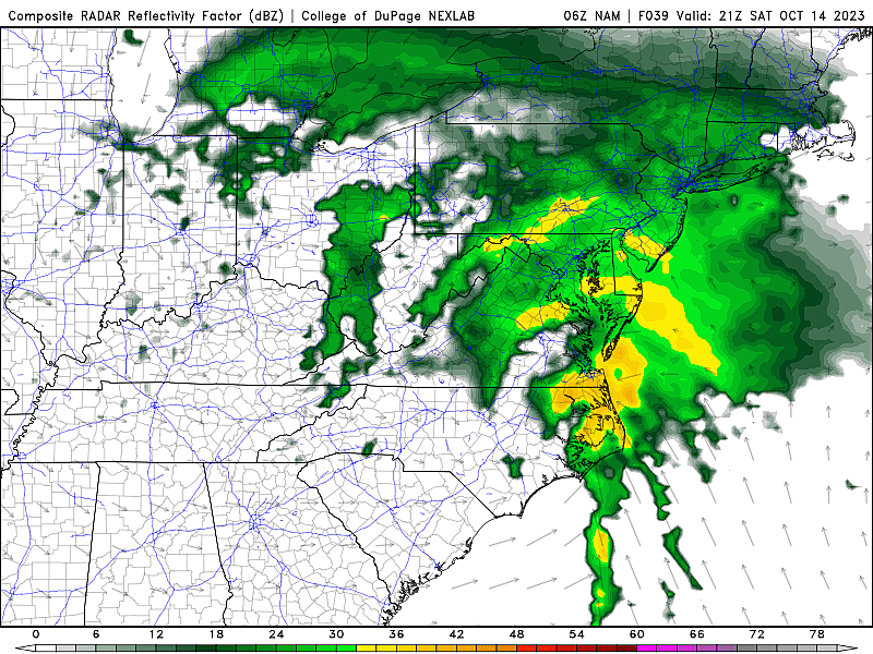
Once we get past about 1 or 2 p.m. Saturday, the threat of steady rain will rise dramatically. (As the second, more potent coastal low pressure system gets fired up.)
The wettest, stormiest part of the day will come around dinnertime / early evening Saturday, when pockets of heavy rain will be possible. Watch out for big puddles. But there's no substantial wind or severe weather concern. Maybe a rumble of thunder in far southern New Jersey only.
The wet weather will continue into Saturday night, eventually dialing back after Midnight. Overnight low temperatures will dip to around 50 degrees.
Sunday
Light rain may linger through 9 or 10 a.m. Sunday, especially along the coast. But the rest of the day looks dry.
There are a couple new concerns unique to Sunday. First, it will become windy for a few hours Sunday morning along the coast. Second, that on-shore breeze will fuel at least one round of minor category tidal flooding at the Jersey Shore.
If all goes well, we could even see some peeks of sun by Sunday afternoon. High temperatures will improve to around 60 degrees — still cool, but not miserable.
Monday
The soggy storm system from the weekend will linger just off-shore for a couple more days, keeping our weather unsettled, damp, and cool.
Monday's rainfall will be limited. But I think we could see some spotty sprinkles around, especially in the afternoon. It will be mostly cloudy with highs again around the 60-degree mark.
Tuesday & Beyond
One more round of scattered showers is possible Tuesday, and then this storm system will become a non-issue. Skies should clear late-day, as high temperatures once again get stuck around 60 degrees.
Wednesday and Thursday look like pleasant weather days, with abundant sunshine and warming temperatures in the 60s.
We will wait and see when our next rain chance comes along. The GFS model keeps quiet weather around New Jersey through next weekend. (Fingers crossed!) But the European model favors another burst of rain in the Friday-Saturday time frame. (Boo!) Neither one of them will have a good handle on the forecast until this first complicated storm system clears out. So I am not too worried nor focused on the long-range forecast right now.
Wipers on, lights on. And try to have a great weekend, New Jersey!
LOOK: Most common jobs 150 years ago in New Jersey
Gallery Credit: Stacker
Dan Zarrow is Chief Meteorologist for Townsquare Media New Jersey. Follow him on Facebook for the latest forecast and realtime weather updates.
LOOK: Which movies were filmed in New Jersey?
Gallery Credit: Stacker
More From New Jersey 101.5 FM


