

Wet NJ weather: 3 to 4+ inches of rain likely over the next 5 days
The Bottom Line
By the end of this wet and active week, I think we will all be yelling "Enough already!" at the sky. Rain, rain, and more rain in the forecast from 3 distinct storm systems, over the next 5 or 6 days, likely pushing rainfall totals beyond 3 or 4 inches. That is enough to ring some flooding alarm bells, as big puddles envelop low-lying areas and roadways.
For today's weather blog entry, I really want to focus on the timeline of the rain and flooding potential. In other words, when you'll get wet, when you'll get really soaked, and when you have a shot at some dry weather in the coming days.
In a nutshell, there are three rainy periods coming up:
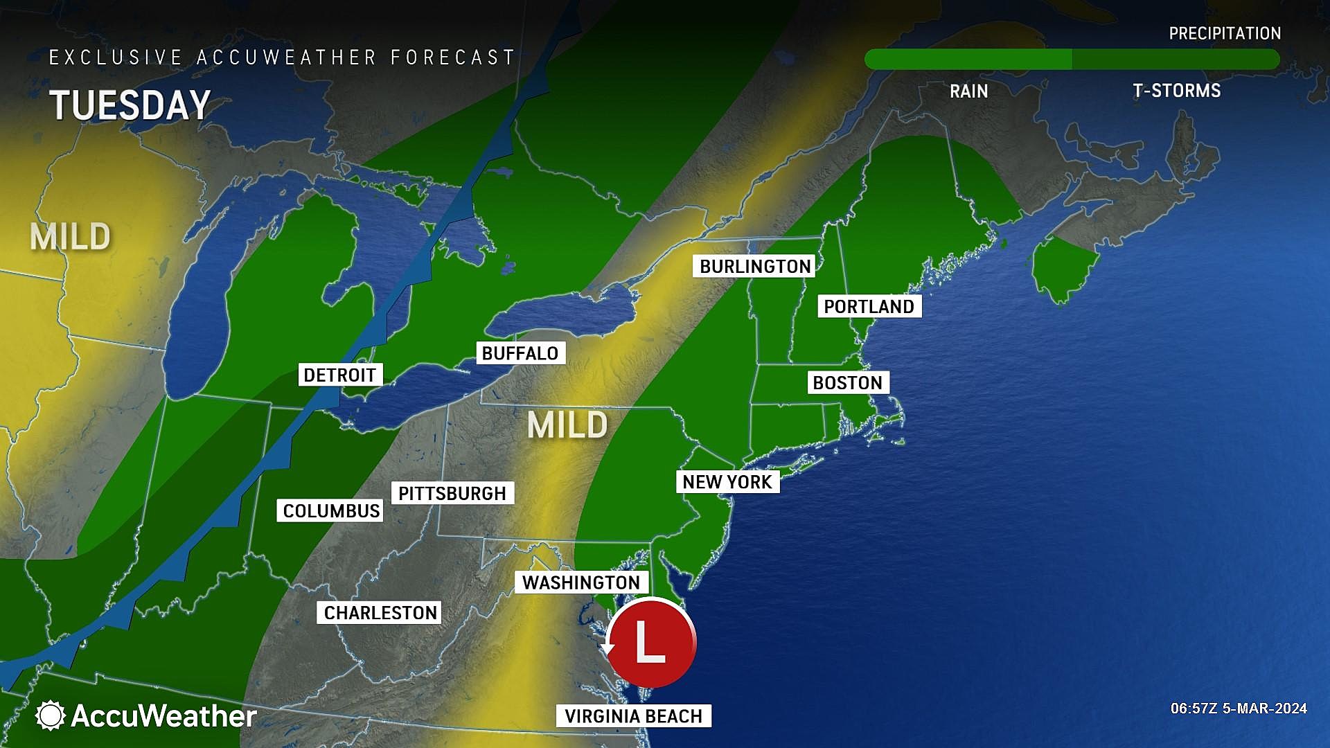
1.) Tuesday, as steady rain dials back to scattered showers and drizzle
2.) Wednesday to Thursday, with pockets of heavy rain possible
3.) This Weekend, a period of cold rain
For the record, #1 is already here and #2 will be the most impactful of the bunch with the most torrential rain.
Grab the umbrella and warm up the windshield wipers. Let's dive in to the detailed damp and dreary forecast.

Tuesday
As of this writing (7 a.m.), a block of steady rain is lifting from south to north through New Jersey. This will be the wettest time of the day, with widespread light to moderate rain making for a wet and potentially slowed AM commute.
By Tuesday midday into the afternoon, the rain should start to break apart. And we'll just see some scattered showers, drizzle, and mist around for the second half of the day. It is still going to look and feel damp and dreary overall. And skies will stay overcast.
Despite the raindrops and the clouds, temperatures will be very close to normal, with highs around 50 degrees. Way above freezing too.
By about 8 p.m. Tuesday evening, final raindrops should exit the Garden State. And then we will dry out overnight. Skies will remain cloudy, as low temperatures only descend a little bit into the lower 40s.
Wednesday
Another storm system will lead to another wet day.
Model guidance is a bit unclear regarding the start time of this next batch of rain. I would guess raindrops will return around late morning — but you may catch a few dry hours early on Wednesday.
The chance of heavy, driving rain only goes up through Wednesday afternoon and evening. This time around, 1 to 2 inches of rain is expected, with the highest totals along the coast. Given our already-saturated ground, that is enough to cause some "big puddles". Flooding of low-lying areas and roadways is possible, so please be careful and stay alert.
High temperatures on Wednesday will reach about 50 to 55 degrees. Once again, don't expect much sunshine amidst the gloom.
Thursday
Thursday's forecast is a coin flip. Latest model guidance has flipped from dry to wet, showing rain showers potentially lingering across most of the day. I am not sure how entirely realistic that is, as an early morning cold front should funnel in (slightly) cooler and drier air. The rain machine should shut off eventually — but I would prepare for most wet weather, just in case.
Thursday will turn windy too, with 30+ mph gusts possible. We should still see high temperatures in the 50s, although thermometers may slide backward in the afternoon as cooler air returns.
Friday
You want a dry weather day this week? Friday is your choice. Your only choice.
In between storm systems, Friday will remain mostly cloudy. But that description does allow for some peeks of sun. High temperatures will settle in the lower 50s or so, just a hair above seasonal normals.
And that's it. The ground will still be wet, but it will be nice to end the workweek with a quiet weather day.
The Weekend & Beyond
There is one more storm system in this sequence, and it is set to arrive this weekend. I am comfortable backing off the idea of any widespread snow accumulation from this one, as previously advertised. While snowflakes may mix with rain along the higher elevations of North Jersey, this will predominantly be another rainmaker. A cold uncomfortable rain, with some temperatures in the 40s for the duration.
However, uncertainty is quite high regarding the timing of potential rain. The GFS favors a Saturday washout. But the Euro likes a Saturday night to Sunday morning affair. That timing is especially important, given all the outdoor events and St. Patrick's Day parades scheduled for the weekend.
The low confidence is not surprising, with two other significant storm systems in the way. I do not think we will have good resolution on the weekend forecast until late Wednesday or Thursday. So be patient, hold your horses, and stay tuned as we try to piece this together.
Next week trends noticeably cooler, with the return of subfreezing low temperatures and highs in the 40s. However, there are no winter storms in sight at this time.
LOOK: The most expensive weather and climate disasters in recent decades
Gallery Credit: KATELYN LEBOFF
Dan Zarrow is Chief Meteorologist for Townsquare Media New Jersey. Follow him on Facebook for the latest forecast and realtime weather updates.
BEEP BEEP BEEP: These are the 13 types of Wireless Emergency Alerts auto-pushed to your phone
Gallery Credit: Dan Zarrow
More From New Jersey 101.5 FM


