

Weekend snow update: Winter Weather Advisory for NJ
UPDATE as of 4 p.m. Friday...
ORIGINAL POST from 7:38 a.m. Friday...
The Bottom Line
For the second time this week, there's snow in the forecast for New Jersey. This time around, it's a "South Jersey Special" as snow totals and travel difficulties will be greatest in the southern half of the state. Also, it will be dry, fluffy, powdery snow, instead of the heavy, wet stuff that fell on Tuesday. And the snow comes during a weekend overnight — sorry kiddies, no "snow day" this time around.
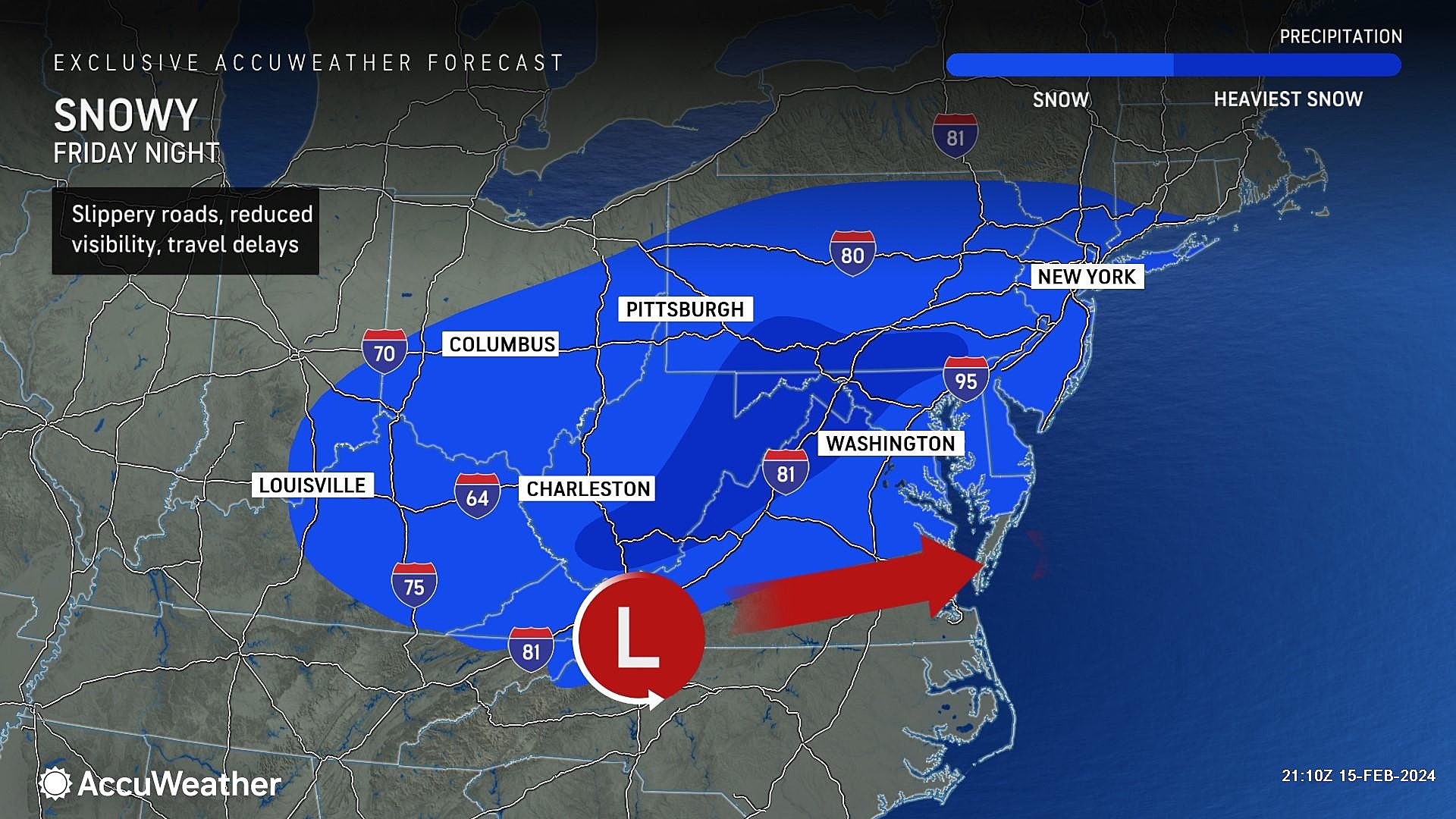
Given that "fluff factor" and an almost perfect clipper storm track, we have increased snowfall expectations for southern and central New Jersey. Let's dig deeper into the timing and impacts of what will likely be New Jersey's 6th winter storm of the 2023-24 season.

Blustery Friday
Other than a flurry, the daytime hours Friday will be dry. But there's another weather problem: Wind.
As of this writing, we are seeing regular wind gusts over 30 mph, blowing out of the northwest. Adding a definite blustery characteristic to the day. It looks like conditions will turn calmer and more comfortable by Friday afternoon.
Expect mostly sunny skies. It will be another day where temperatures go nowhere fast. We're in the 30s Friday morning. And highs might reach the lower 40s in the afternoon.
Snow Timeline
Start... First snowflakes may push into western New Jersey as early as 10 p.m. Friday evening, spreading west across the state by about 2 a.m. Saturday morning.
Brunt... The steadiest snow, with bands of heavier stuff, is expected just before daybreak on Saturday, around 4 or 5 a.m.
End... Steady snow will wrap up by 8 a.m. at the latest, with residual (non-accumulating) snow showers possible through about Noon.
Snow Accumulations
The southern half of the state, from about Mercer-Middlesex-Monmouth counties down, carries the best chance for bands of steady to heavy snow. The latest guidance suggests 3 to 5 inches of snow will accumulate in that area by Saturday morning. Certainly enough to cause widespread travel difficulties, by road and by air. And enough to be plowable and shovelable.
Based on what I have seen, I would guess the bullseye — the highest snowfall potential in the state — will be in SW NJ, somewhere between Camden/Philadelphia and Trenton.
For northern New Jersey, it is still going to snow, but fresh accumulations will be less impactful. Expect snowfall on the order of 1 to 3 inches. Leaning toward the 1" side of that range for the northern edge of the state, falling right on the northern edge of this storm system.
Winter Weather Advisory
The National Weather Service opted to expand their original Winter Weather Advisory to now include 15 counties in central and southern NJ. The advisory cautions of treacherous travel conditions between 10 p.m. Friday and 10 a.m. Saturday.
The following counties fall under the latest advisory: Atlantic, Burlington, Camden, Cape May, Cumberland, Gloucester, Hunterdon, Mercer, Middlesex, Monmouth, Ocean, Salem, Somerset, Union, and Warren.
Additional Snow Notes
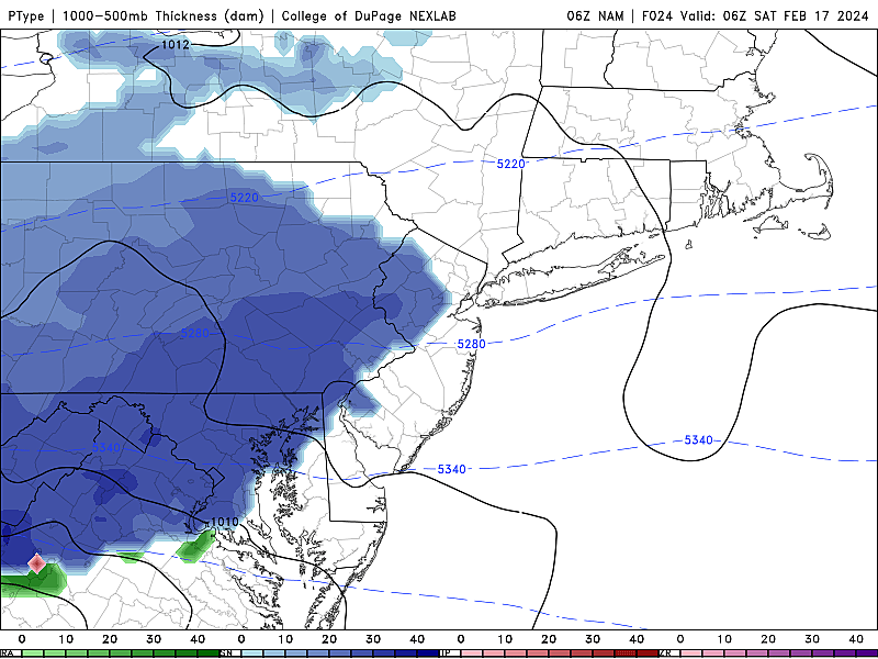
—Air temperatures will be cold enough for this to be an all-snow event. There is very little threat of mixing or icing.
—Having said that, some forecast models show the warmer core of this storm system coming perilously close to the Cape May peninsula. That is the only place where some sleet and/or rain could mix in, reducing the overall snow accumulation number. I leaned to the colder side on my snow map, and opted not to include that lower possibility in my official forecast.
—Similarly, I think the immediate coast has just as much snow potential as inland areas. There is no on-shore breeze component in play to warm up barrier islands and beaches to cause mixing and/or non-sticking. So again, I am purposefully blanketing the southern half of NJ with the greatest snow potential.
—I ramped up my latest forecast because 1.) the trajectory looks good, 2.) the timing is prime for all-snow, and 3.) the fluff factor. This is going to be some dry, powdery snow — which will accumulate faster and higher than the heavy, wet stuff from earlier this week. By the numbers, almost every model shows the potential for some 5" snow totals in NJ. So a 3-5" range made sense given the dry snow ratio.
—Many meteorologists, including myself, are branding this a "South Jersey Special". Our first such storm in a while, that produces more snow in South Jersey than North Jersey. (Kind of a rarity!) I do want to make it crystal clear that every corner of New Jersey should expect accumulating snow Saturday morning. It's just that the steadiest stuff and biggest totals will be to the south.
—I would quantify this as a "minor to moderate impact" weather event. As with any winter storm, the big concern is on the roads. Travel will be tricky for a few hours Saturday morning. The weekend overnight timing helps, as there will be very few people on the roads early Saturday morning. (Compared to a weekday morning, for example.)
—There are really no other impacts to talk about. This is a fast-moving clipper system, not a powerful nor'easter. No wind, no blizzard conditions, no coastal flooding, no flash flooding. Just snow.
The Extended Forecast
Partial sunshine should break out by Saturday afternoon, and skies will become totally clear at night.
The combination of fresh snow cover, a cold/dry air mass, and calm winds will lead to some frigid temperatures Sunday morning. I've put forecast lows in the teens and 20s.
Sunday will fare OK overall, once things warm up a little. Under mostly sunny skies, highs recover to around 40 degrees. The day looks breezy too.
A warming trend kicks in next week. Lower 40s Monday, mid 40s Tuesday, upper 40s Wednesday, lower 50s Thursday. Quiet, sunny, seasonable weather — you can't complain too much about that.
Our next storm system worth watching will come at the end of next week, on Friday. Models keep flip-flopping between rain and snow (or a little bit of both). We will not really sweat about that one until early next week.
Glossary of NJ winter weather words and phrases
Gallery Credit: Dan Zarrow
Dan Zarrow is Chief Meteorologist for Townsquare Media New Jersey. Follow him on Facebook for the latest forecast and realtime weather updates.
Cozy winter getaway rentals in NJ
Gallery Credit: Erin Vogt
More From New Jersey 101.5 FM


