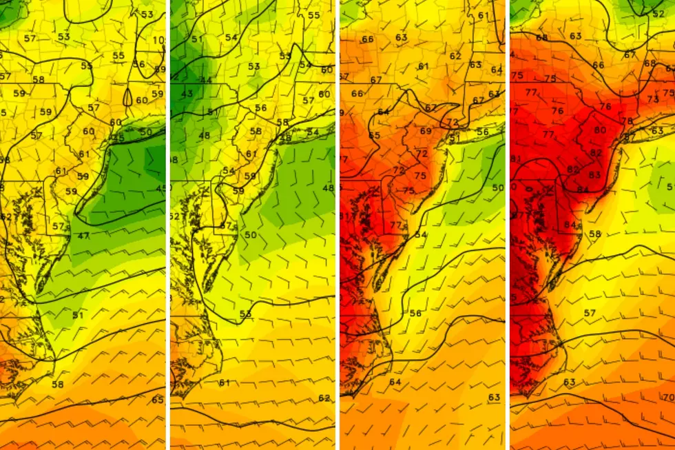
Three storms systems set to soak New Jersey this week
The Bottom Line
Wow, what a spectacular weather day Sunday, huh? Temperature records were broken, as a few spots hit 70 degrees for the first time in 2024.
Monday still looks fairly pleasant, although cooler and cloudier than Sunday. It is probably the nicest day we have left this week, as things turn active and quite soggy.
Over the next seven days, a trio of storm systems will produce about 2 to 4 inches of total rainfall. (Remember, that is on top of the inch or two from Saturday.) Ponding and flooding will become mounting concerns, especially since we already have high-water issues in especially vulnerable spots.
Here is a quick preview of what to expect:
—Monday night to Tuesday... Light rain.
—Wednesday to Thursday... Heavier rain.
—Saturday... Cold rain, with a limited chance of snow.
Ready to get water-logged? Let's jump into the details of this week's active forecast.

Monday
We're starting the new week fairly comfortably, with most temperatures across New Jersey in the 40s. I see a few pockets of upper 30s on the temperature map too. You'll almost certainly be reaching for the jacket on your way out the front door.
Monday's high temperatures will generally reach the 50s, but there will be some variety across the state. North and coast will end up closer to 50 degrees. Meanwhile, inland South Jersey could flirt with 60. It is important to note that all of those numbers are above normal for early March.
While you should notice some good sunshine early on, cloud cover will increase steadily through Monday afternoon. I think we will stay almost totally dry through the evening commute.
Inclement weather returns Monday evening, as showers drift in from south to north. Start time for raindrops will probably be around 6-7 p.m. for SW NJ and closer to midnight along the northern edge of the state.
By daybreak Tuesday morning, widespread light rain seems likely. The AM rush hour will probably be wet. Keep in mind though, we are not talking about snow or wind or severe weather or massive flooding here. Just rain.
Tuesday
Overall damp and dreary, as a compact coastal storm system swings through New Jersey.
After a round of steady rain in the morning, there will be some drier breaks. But it looks like rain showers will linger over New Jersey through the midday and afternoon hours too. Total rainfall will be up to a half-inch.
Amid the raindrops and cloudy skies, high temperatures will settle around 50 degrees. It may be breezy at times, especially in or near those clusters of rain.
By sunset Tuesday, showers should be gone and we will dry out overnight. I would only expect partial clearing of skies, with low temperatures in the 40s. Still well above freezing.
Wednesday
Wednesday turns wet again, eventually, as a slow-moving cold front comes into view.
We have a shot at some dry weather in the morning. It will be cloudy. High temperatures should push into the mid 50s. Again, I would not rule out a couple of 60-degree readings, especially if a peek of sun can break through the overcast.
By the afternoon, we will have to watch for rain to push in from the west. And that rain looks steady to heavy through the evening and overnight hours. There could even be some rumbles of thunder in South Jersey.
Given our saturated ground from Saturday's and Tuesday's rainfall, I could see some ponding and flooding issues develop. Total additional rainfall is forecast to exceed an inch by Thursday morning.
Thursday
Final showers from that storm system will wrap up by mid-morning Thursday. And then the rest of the day looks dry.
The problem with Thursday's weather is wind. In the wake of Wednesday's cold front, a northerly breeze may gust to 30 or even 40 mph. That will be pretty brisk.
Thursday's temperature forecast is tricky. Model guidance is holding on to near-60 degrees temperatures for another day. But I don't buy it, especially given the chilly wind. I'll put forecast highs in the lower 50s for Thursday, but I was really tempted to go cooler. (By the way, still warmer than normal for early March.)
Friday
Friday looks dry from start to finish. With calmer winds. And high temperatures still on the mild side, in the lower 50s or so. No complaints, no concerns. Enjoy a decent early March day.
The Extended Forecast
The third and final storm system in this sequence is another coastal storm set to arrive on Saturday. Yes, I know, weekend rain is not fun. Since we are still 5+ days away, models do have differing opinions about the timing of potential raindrops. The GFS favors all-day rain, while the European puts an end to the wet weather by mid-morning. Don't cancel your plans just yet — let's see whether we can salvage a piece of Saturday's daytime hours.
I can tell you Saturday's rain will be of the cold and uncomfortable variety, with most high temperatures in the 40s. We have been talking about a chance of snow too. And that is still alive — but I'm now thinking it's a "higher elevations of NW NJ" kind of thing, with limited accumulation potential. We will see how timing and temperatures continue to trend.
After this weekend, we should get a break of dry (although colder) weather next week. With just 15 days to go until Spring, I am still not ready to bang the gavel and close the book on potential wintry weather. I still believe there is a chance for cold air and accumulating snow around the midpoint of the month. That window is rapidly closing though, especially as cold air to the north diminishes, the ground warms up, and the sun angle continues to rise.
New Jersey's St. Patrick's Day Parades 2024 (by date)
Gallery Credit: Dan Alexander
Dan Zarrow is Chief Meteorologist for Townsquare Media New Jersey. Follow him on Facebook for the latest forecast and realtime weather updates.
Top 21 fastest growing towns in New Jersey
Gallery Credit: New Jersey 101.5
More From New Jersey 101.5 FM


