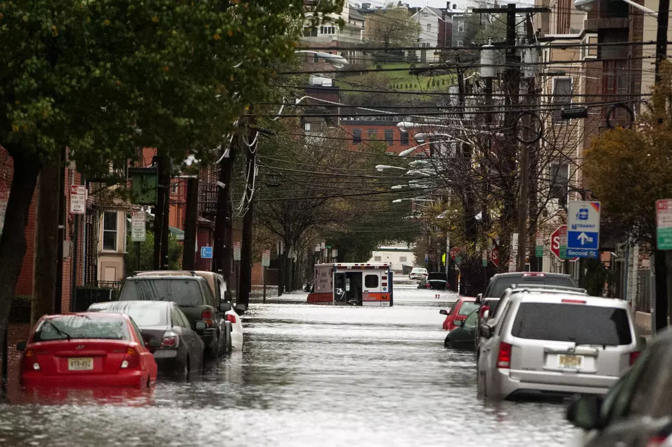
It's hard to believe Superstorm Sandy hit the Garden State almost a year and four months ago. It has been a very stressful time for the thousands of people trying to pick up the pieces of what Mother Nature left behind.
New Jersey residents with questions about National Flood Insurance Program policies, and the latest round of flood maps, have a helpline to call for the most up-to-date information.
The Federal Emergency Management Agency’s (FEMA) is set to release updates to the Advisory Base Flood Elevation maps for Middlesex County. The updated “work maps” will reduce the amount of acreage designated in high-flooding risk V-zones by approximately 80 percent.
Superstorm Sandy victims in New Jersey who are weighing whether to rebuild or relocate will soon get more information that should help them decide what to do.
This week marks seven months since Superstorm Sandy, and many victims have been left to wait on Federal Emergency Management Agency (FEMA) flood maps before they decide whether or not to rebuild.
A number of New Jersey business owners looking to elevate their properties and avoid another disaster like Superstorm Sandy are at risk of facing yet another hurdle.
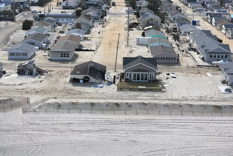
This is the fifth and final part of a series titled, Revisiting the Jersey Shore After Sandy. In this part we look at the future of the Shore, including rebuilding, zoning and protecting the area from future storms.
Since shortly after Superstorm Sandy pummeled the Jersey shore last October, homeowners up and down the coast have agonized over whether to raise their homes to survive future storms.


![When Will FEMA Release New Flood Maps? [AUDIO]](http://townsquare.media/site/385/files/2013/05/156803668.jpg?w=980&q=75)
![Is ADA Handicapping Some Businesses? [AUDIO]](http://townsquare.media/site/385/files/2013/05/Ramp.jpg?w=980&q=75)
![Homeowners Remain Frustrated With Sandy Rebuild [AUDIO]](http://townsquare.media/site/385/files/2013/04/Mantoloking.jpg?w=980&q=75)
![Brick Takes Action Against FEMA Maps [AUDIO]](http://townsquare.media/site/385/files/2013/02/20121115_1050001-630x472.jpg?w=980&q=75)
