
Snow north, rain south: Latest update on NJ’s return to ‘winter’
UPDATE... This article is outdated...
For the latest storm forecast information, please refer to my newest weather blog post.
The Bottom Line
—New Jersey's extended stretch of dry, sunny, mild weather is over. The state's 5th winter storm of the 2023-24 season is set to arrive Monday night into Tuesday.
—Over the last 24 hours, model guidance has trended in a warmer and wetter direction. I am no longer thinking most of the state will transition from rain to snow as the heaviest precipitation bands develop Tuesday morning. Therefore, New Jersey's overall snow forecast has gone down. (By 2-3 inches almost statewide.)
—However, there are still big concerns about messy weather and road conditions. Especially during Tuesday morning's commute.
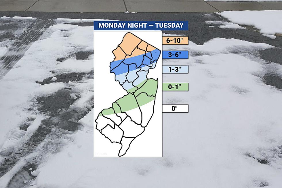
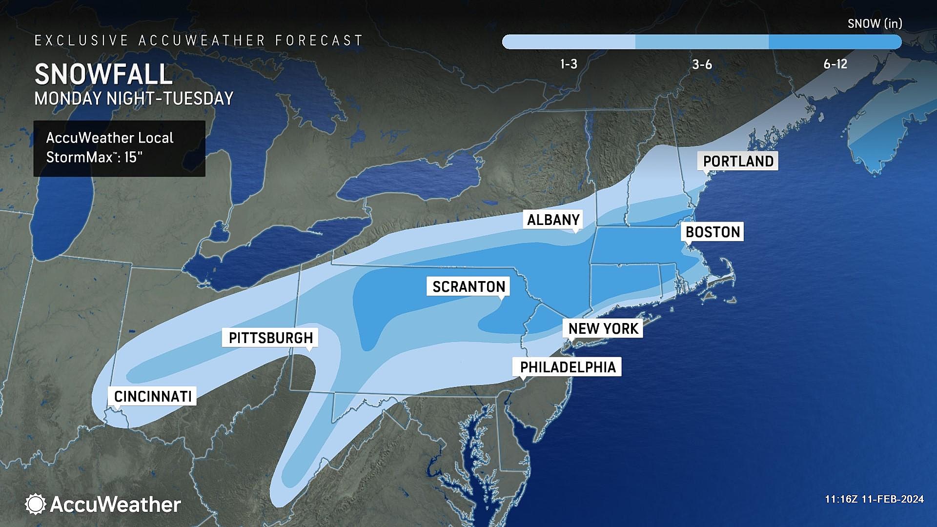
—Snow totals in the Garden State are expected to literally range from 0 to 10 inches, from south to north respectively.
—Coastal flooding is also a growing concern along the Jersey Shore, as tide levels potentially exceed "moderate" flood stage.
Timeline
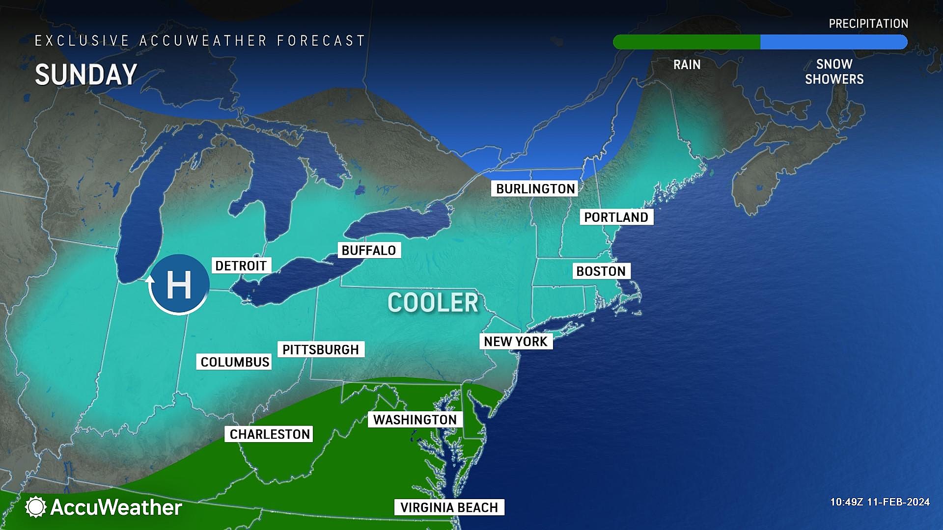
Sunday will be fine, although unsettled. Lots of clouds, and a few rain showers clipping southern NJ. Temperatures will be cooler than the past couple of days, maxing out around 50 degrees.
Monday daytime also still looks OK. Mostly cloudy and upper 40s.
Monday evening, rain will creep into New Jersey from the southwest, starting around 7 p.m. and spreading statewide by about Midnight. The only location in NJ that may see snow or wintry mix to start is north of Interstate 80.
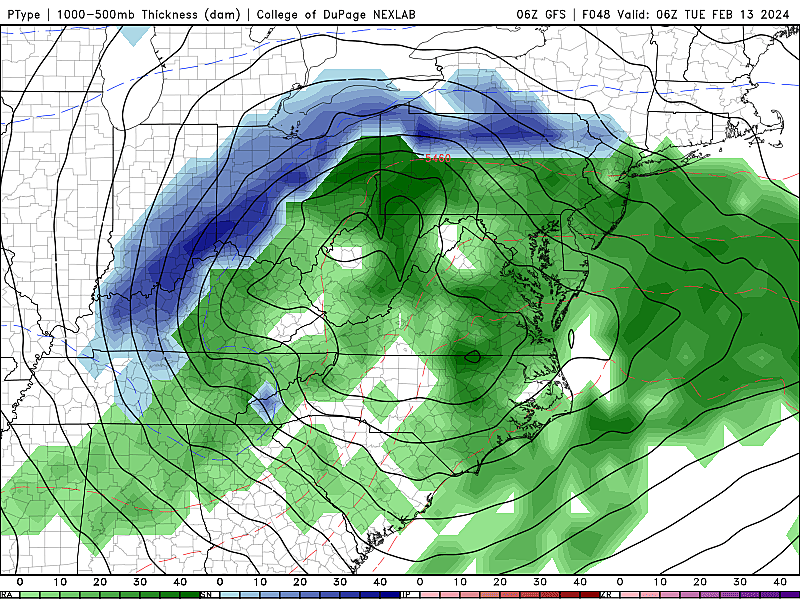
Early Tuesday morning, starting around 2 a.m., temperatures will start to drop throughout northern New Jersey, allowing a transition from rain to snow. Periods of heavy precipitation are possible during this time, making for sloppy driving conditions.
The most concerning period — call it the "brunt" of the storm, if you want — will be Tuesday morning between about 5 a.m. and 9 a.m. That's when we will see a further transition from rain to snow, perhaps as far south as Trenton and New Brunswick. The morning rush hour is terrible timing for such a "snowy" surprise.
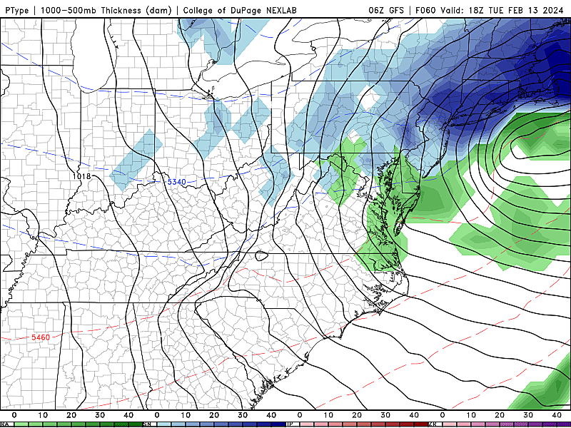
From Tuesday late morning through the midday hours, rain may change to snow in the southern half of the state. However, little to no accumulation is expected, as the ground will be wet and precipitation much lighter during this time.
By about 2 p.m. Tuesday afternoon, the storm moves away, snow/rain turns off, and skies will start to clear.
During the Tuesday evening commute, the weather will be clear, but there could be residual snowy, icy, and/or wet road issues.
Same deal for Wednesday morning. If the heavier snow predictions come true, some North Jersey towns may need another day of school delays/closings to fully clean up.
Accumulations (or Lack Thereof)
I still believe the "snow zone" of northwestern New Jersey — north of I-80 and west of I-287 — will reach "major winter storm" status with 6 to 10 inches of accumulation from Monday night to Tuesday.
The rest of North Jersey, approximately north of Interstate 78, could see 3 to 6 inches of snow during the early morning hours of Tuesday. Moderate accumulations are certainly enough to cause travel headaches.
From I-78 to that line between Trenton and New Brunswick, the latest forecast calls for 1 to 3 inches of snowfall. This is a notable downgrade from "moderate" to "minor" snowfall.
For the entire southern half of the state, this will be predominantly a rainmaker storm system. A quick hit of snow on the backside could be a healthy coating on colder surfaces. Call it 0 to 1 inch.
Southern and coastal New Jersey will see very little snow. Maybe an hour or two as things wrap up midday Tuesday. No accumulation is expected. Up to an inch of rainfall is possible.
Other Impacts
In addition to the snow and rain, it is going to turn blustery and colder during and after the storm. Wind gusts of 30 mph are possible. As temperatures plunge below freezing Tuesday night, wind chills may dip into the teens. Back to bundling up, folks.
There is also a pretty significant coastal flooding threat developing here. As the storm system intensifies off the Jersey Shore, the ocean will get all churned up. This comes after an entire week of spotty minor flooding, due to a high astronomical tide and swollen back bays. Do not be surprised when tidal waterways crest in the "moderate" flooding category Tuesday morning. Followed by one more round of widespread "minor" flooding Tuesday evening.
Advisories
The National Weather Service has issued a Winter Storm Watch for all or part of 6 counties in northern New Jersey: Hunterdon, Warren, Morris, Sussex, western Passaic, and western Bergen counties. That watch will likely become a warning, as long as the 6+ inch snow forecast holds. (Which I would say is likely for all but Hunterdon counties.)
We will probably see a slate of winter weather advisories farther south and east. Maybe down to Mercer/Middlesex.
A Coastal Flood Watch is also posted for the Shore, in anticipation of tidal flooding.
Final Thoughts
We are now 36 hours from the storm's onset. While forecast confidence and certainty continues to improve, there is still opportunity for this storm track to evolve further. Even a shift of 50 miles in either direction could result in significant differences in the snow total forecast. (As we've seen in the past day.)
So it is still important to keep a close eye on the forecast. We will continue to update as new info comes in during the day Sunday. I'll push out one more grand, comprehensive forecast package Monday morning. And then we will nowcast our way through the storm, with the latest news, weather, and traffic updates during and after the wintry, wet weather.
I will mention that as colder temperatures tak hold through the next week or two, there is another storm system looming at the end of the week. At the moment, it looks like just a quick hit of snow/rain late Thursday night. Just something else to watch.
Let it snow: 12 things to know about winter forecasting in NJ
Gallery Credit: Dan Zarrow
Dan Zarrow is Chief Meteorologist for Townsquare Media New Jersey. Follow him on Facebook for the latest forecast and realtime weather updates.
Glossary of NJ winter weather words and phrases
Gallery Credit: Dan Zarrow
More From New Jersey 101.5 FM


