
NJ’s arctic chill and next 1-3″ snow day: What you need to know
UPDATE... This article is outdated...
For the latest storm forecast information, please refer to my newest weather blog post.
The Bottom Line
There are two big headlines through the rest of this wintry week of weather:
1.) It is cold. You knew that.
2.) More snow, as our next storm system rolls in Friday.
In case you're keeping score, this will be the 5th (and final) rapid-fire storm this month. Magnitude and impacts look similar to Tuesday, minus the freezing rain threat. (Thankfully.)
Will there be travel impacts? Yes.
Any big warmup in sight? Not really.

Wednesday
Penguins and polar bears of New Jersey, this forecast is for you!
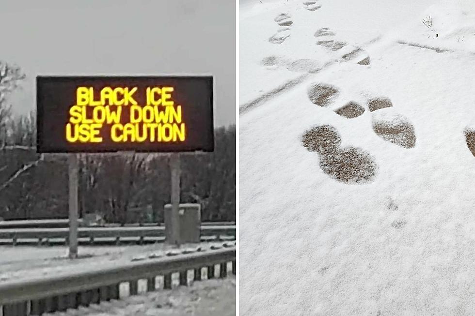
By the numbers, Wednesday looks like New Jersey's coldest day in over a year — since Christmas Eve 2022. We will be stuck below freezing all day long. Needless to say, you'll need to bundle up warmly. And watch your step, with lots of icy spots around after Tuesday's wintry/wet weather.
We've got widespread teens on the temperature map Wednesday morning, with many wind chills ("feels like" or "apparent" temperatures) in the single digits.
Highs Wednesday afternoon will only reach the lower to mid 20s.
It will be a sunny and dry day. Even though temperatures will be frigid, that sunshine will help melt some snow and ice. Especially on blacktop surfaces.
No surprise, Wednesday night will be cold too. Lows will dip back into the teens.
One piece of good news to share: The Passaic River in North Jersey is forecast to drop below flood stage Wednesday, after raging since last week's rain storm. I am very glad to see our latest chapter of river flooding come to an end.
Thursday
Temperatures will be slightly better. Especially the southern half of the state (approximately) which will reach above freezing for a few hours.
Highs on Thursday should reach the lower-mid 30s. Skies will become mostly cloudy or even overcast. And there could be a few flurries and snow showers around, especially late-day. But no substantial accumulation or travel impacts are expected.
Friday
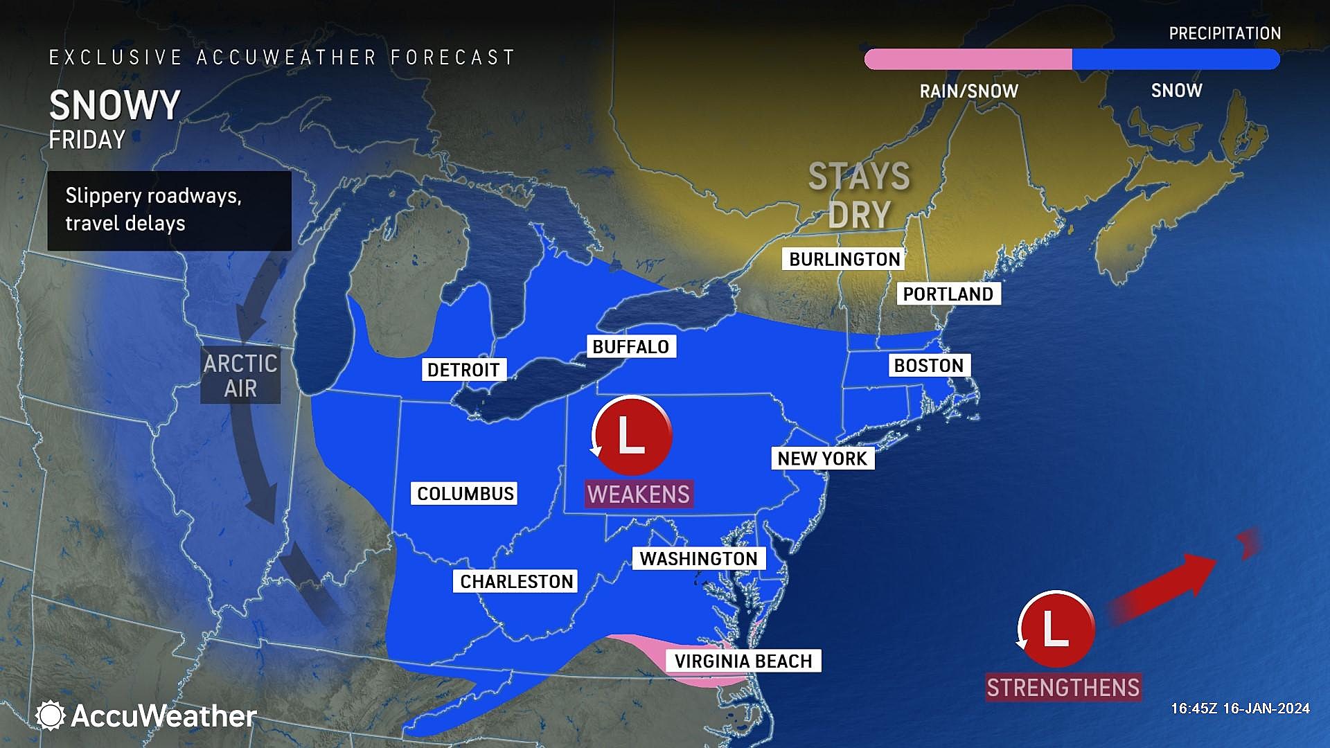
Here comes our next storm system, and another chance for nuisance snow accumulations.
When I am analyzing a winter storm — especially in the early stages — I usually play a game I call "interrogating the forecast". I ask critical questions of myself and research the answers, to discover insight into how a storm may play out. (Kind of following the scientific method here — hypothesis, test, etc.)
Not to get too technical, but let me share two such questions regarding Friday's storm specifically. This not only demonstrates the internal battle I am having in determining snow totals and impacts, but also lists some important "what we know so far" details.
1.) What are the reasons this storm could produce impactful snow on Friday?
—Temperatures will be cold enough for an (almost) all snow event. Maybe some mixing along the immediate coast, east of the Parkway.
—We will still have a healthy coating of snow and ice on the ground. That will allow for immediate stickage.
—Cold, dry air means a higher snow ratio. Fluffy, powdery snow accumulates faster than heavy, dense stuff.
2.) What are the limiting factors that could restrict the snowfall potential of Friday's storm?
—The primary storm system is really not that strong or dynamic. Snowfall intensity will be light to moderate, similar to Tuesday.
—The period of "steady" snowfall is limited to about 6 hours. A half-inch an hour for six hours yields three inches of snow.
—The "brunt" of the storm is during the daytime hours, from about mid-morning through late afternoon. Not during the colder overnight this time around.
—I believe models are overdoing the moisture potential. Especially the mesoscale models, which are accordingly suggesting the highest snow totals.
—Tuesday's storm generally underperformed expectations.
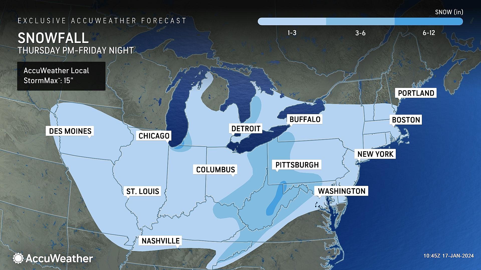
Therefore, I believe the evidence is pointing more toward minor-to-moderate impacts once again, with widespread snow totals around 1 to 3 inches. Some forecasters are going as high as 6 inches, but I just don't buy it. (Yet.)
I have also decided not to draw an "official" definitive NJ snow map just yet. Especially since it would be rather boring, with a 1-3" contour covering the entire state. For the record, I am leaning more toward the 1" end of that range for North Jersey and the immediate coast, and the 3" end for inland South Jersey.
My biggest concern? Friday evening's rush hour. Snow will be done falling by then. But even a couple fresh inches of snow on the ground could make things slippery and treacherous. Especially if you're unprepared and unaware.
In between periods of light to moderate snow on Friday, it will be cloudy and cold. High temperatures will settle around the freezing mark, in the lower 30s. Wind is not expected to be a factor, with a breeze maxing out around 15 mph.
Saturday
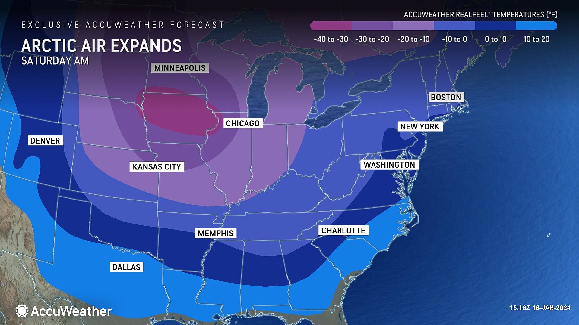
In the wake of Friday's storm, Saturday gets even colder. It could be the coldest day of the week. (And a candidate for coldest of the year, depending how the rest of winter goes.)
Morning lows near 10 degrees. Afternoon highs only in the lower 20s. A brisk wind will keep the wind chill close to 10 throughout the day.
It's not quite "dangerous" cold, since wind chills stay above zero. And it's not "record" cold, since record lows are also below zero. But you can't deny this is some unseasonably chilly weather.
Sunday & Beyond
Temperatures will moderate on Sunday, into the 30s. Sunshine wins, but the warming effect will be canceled out by the chilly breeze.
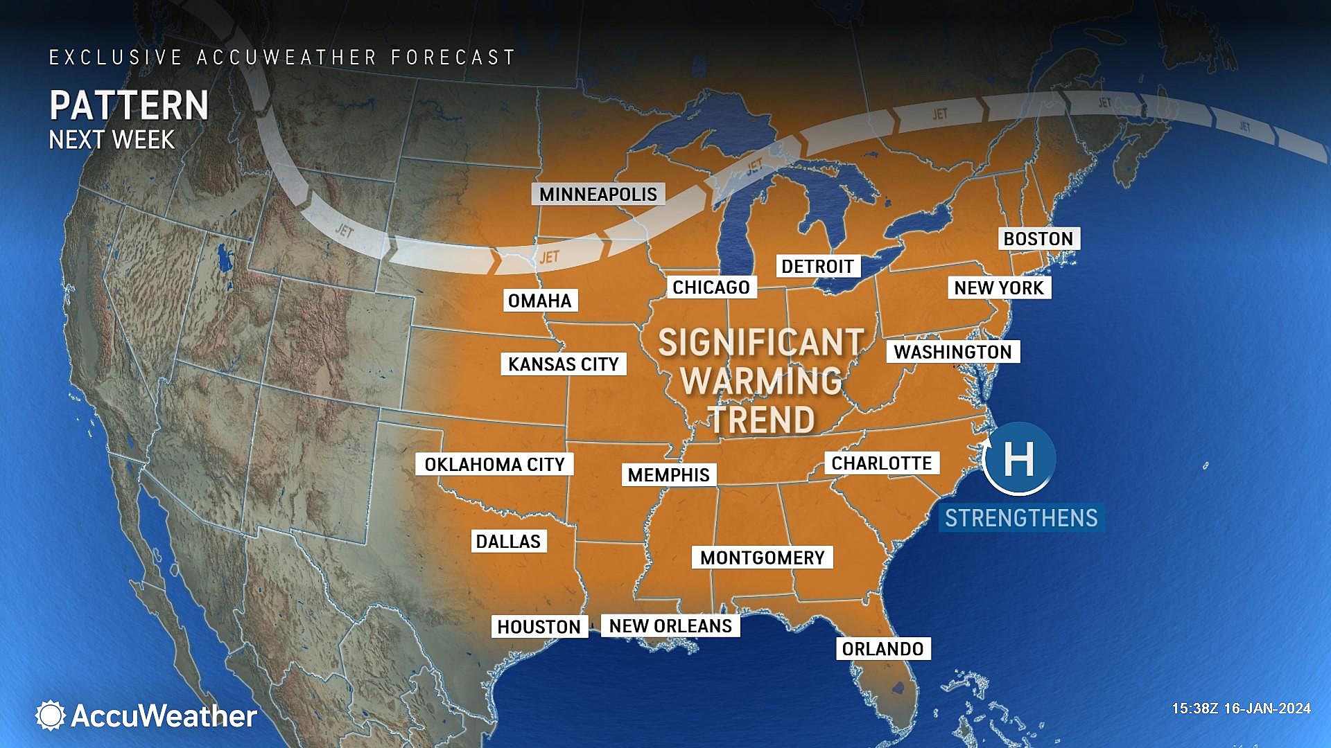
We will probably see some 40s by the middle of next week, which will feel downright tropical after this week's cold snap.
Our weather also turns unsettled again with a series of storm systems in the forecast between Tuesday night and Friday. Right now, they look like primarily rainmakers, but I can't rule out a quick thumping of snow at any point in time. This is 7+ days away, so I'm not going to focus on those impacts just yet — let's see how everything else plays out first.
New Jersey Snow Photos: January 16, 2024
Gallery Credit: Shawn Michaels
Dan Zarrow is Chief Meteorologist for Townsquare Media New Jersey. Follow him on Facebook for the latest forecast and realtime weather updates.
16 Amazing Winter Day Trips That Aren't Too Far From New Jersey
Gallery Credit: Chris Coleman
More From New Jersey 101.5 FM


