NJ winter weather alert: Heavy snow to impact Tuesday AM commute
UPDATE... This article is outdated...
For the latest storm forecast information, please refer to my newest weather blog post.
Grab the shovel and salt. And be sure to pack your patience. New Jersey descends into winter weather again, with a potent storm peaking Tuesday morning. The forecast has once again trended colder and snowier, necessitating this eleventh-hour update.
There are still some big questions baked into this dynamic wintry/wet forecast. How much snow will fall? How much of it will be able to stick? (Especially with above-freezing temperatures in central and southern New Jersey?) Just how heavy and wet will the snow be? (Spoiler alert: Very.) Will the transition from rain to snow happen cleanly and on-time? Where will mesoscale snow bands set up, potentially spitting out 1+ inch/hour snowfall? (Or will it be wintry mix? Or plain rain?)

Changes
Most of what I posted Monday morning still applies, especially in terms of storm timing and impacts. (Those elements are what I always stress as being more important anyway.)
Still, I think the latest data warrants some tweaks to our snow forecast map. I am basically changing four things with this update:
1.) Bumped up snowfall expectations in central and southern New Jersey by an inch or two. (6-12" becomes 8-12", 3-6" becomes 4-8", 1-3" becomes 2-4", 0-1" becomes 0-2".)
2.) Eliminated the straight 0" snow contour along the southern coast. I think minor accumulations could now in play.
3.) Extended light blue 2-4" snow contour slightly down the I-295 corridor.
4.) Stronger wording on the sloppiness of Tuesday morning's commute.
Transition Timing
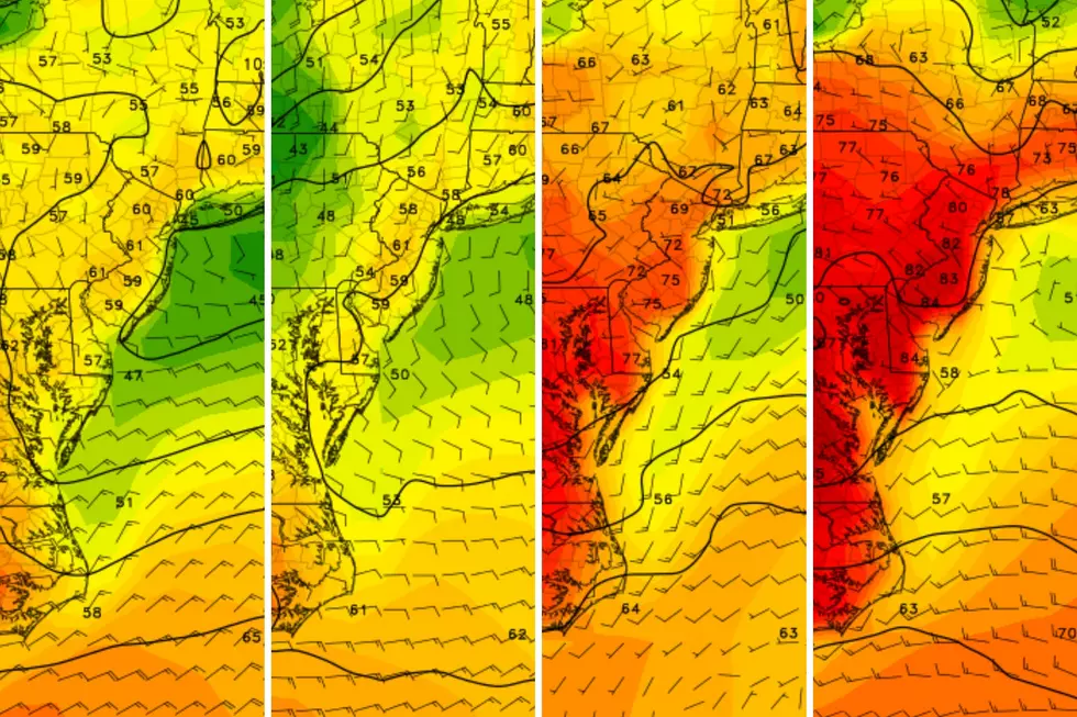
Almost everyone in New Jersey (south of I-80) will see plain rain to start Monday evening. And then Tuesday morning — just in time for the AM rush hour — rain will change to wintry mix and snow, from north to south. This flip will coincide with the "brunt" of the storm, the time of the heaviest precipitation bands developing. Terrible timing for awful travel conditions, including low visibility and poor traction.
The map I posted above attempts to estimate the timing of the transition from snow to rain on Tuesday. Crossing the I-78 corridor right around daybreak. Reaching the I-195 corridor around mid-morning. And progressing deep into South Jersey by late morning.
Advisories
The National Weather Service has issued their final forecast and suite of advisory products in advance of the storm. This should give you further county-by-county confirmation of when travel conditions will become treacherous.
Winter Storm Warning: (over 6 inches of snow could cause dangerous travel)
—11 p.m. Monday to 3 p.m. Tuesday... Sussex
—Midnight to 3 p.m. Tuesday... Hunterdon, Mercer, Middlesex, western Monmouth, Morris, Somerset, Warren
—1 a.m. to 6 p.m. Tuesday... Bergen, western Essex, Passaic
—4 a.m. to 6 p.m. Tuesday... eastern Essex, Hudson, Union
Winter Weather Advisory: (over 3 inches of snow could cause slick travel)
—3 a.m. to 3 p.m. Tuesday... northwestern Burlington, Camden, Gloucester, coastal Monmouth, Ocean, Salem
Wind Advisory: (wind gusts could top 40 mph)
—5 a.m. to 5 p.m. Tuesday... coastal Atlantic, coastal Cape May, coastal Monmouth, coastal Ocean
Coastal Flood Warning: (moderate category tidal flooding at high tide)
—Until 3 a.m. Wednesday... Atlantic, southeastern Burlington, Cape May, Middlesex, Monmouth, Ocean
Coastal Flood Advisory: (minor category tidal flooding at high tide)
—Until 3 a.m. Wednesday... Cumberland
—Until 10 a.m. Wednesday... northwestern Burlington, Camden, Gloucester
—Until 4 p.m. Wednesday... Salem
A Special Word of Caution
I consider a snow forecast to be "good" when there are equal chances of it being too high and too low. I think that is where I stand right now. Although please understand this remains an uncomfortably low confidence situation.
To be completely straightforward, I am concerned about some recent forecast model solutions that paint 6+ inches of snow dipping south of the I-195 corridor. That is a huge departure from what we were seeing even 12 to 24 hours ago. And significantly more than the "0 to 2 inches" in my latest forecast.
Trenton in Mercer County is a perfect example of how tricky this forecast is. It's possible that only a half-inch of snow sticks there. On the other hand, some models "puke out" upwards of 8 inches of accumulation there. I have gone with a middle-of-the-road final answer (2 to 4 inches). But we have to keep overperformance in mind from this thing, statewide.
The Bottom Line
It's going to rain. Then it's going to snow. A lot in some places. And treacherous travel conditions throughout the Tuesday morning rush hour remains our biggest concern.
Hopefully you have a sense for what a dynamic storm this will be. It is going to be especially important to stay vigilant to changing weather conditions on Tuesday, and stay close to the play-by-play forecast. (We call that "nowcasting," by the way.)
Our team will be up dark n' early Tuesday morning to bring you the latest, both on-air and online. Thanks as always for putting your trust in us, and thanks for following along. Stay smart and be safe out there.
Let it snow: 12 things to know about winter forecasting in NJ
Gallery Credit: Dan Zarrow
Dan Zarrow is Chief Meteorologist for Townsquare Media New Jersey. Follow him on Facebook for the latest forecast and realtime weather updates.
Glossary of NJ winter weather words and phrases
Gallery Credit: Dan Zarrow
More From New Jersey 101.5 FM


