

NJ weather: How will rain, clouds, and fog affect your weekend?
The Bottom Line
Welcome to December! Friday is the start of climatological winter, the coldest three calendar months of the year. (We like to use full calendar months for record-keeping purposes.) On average, December is New Jersey's 3rd coldest, 4th wettest, and 3rd snowiest month of the year.
There is still no significant snow threat on the horizon for New Jersey. But we do have to talk about some inclement weather to start the new month.
Clouds march in early Friday, before rain showers fill in during the afternoon and evening. There are no alarm bells to ring for downpours, severe weather, or winter weather. It is just going to turn a little bit wet.
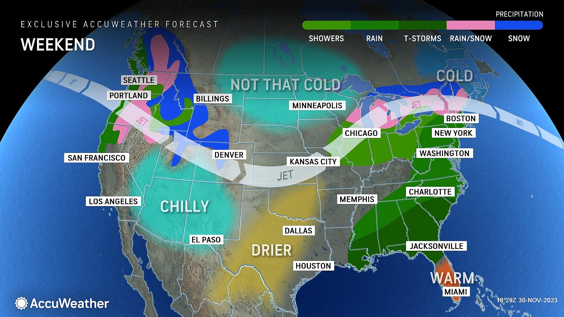
Saturday will be cloudy and blah, but probably dry. Pockets of rain return on Sunday. And then temperatures tumble again early next week.

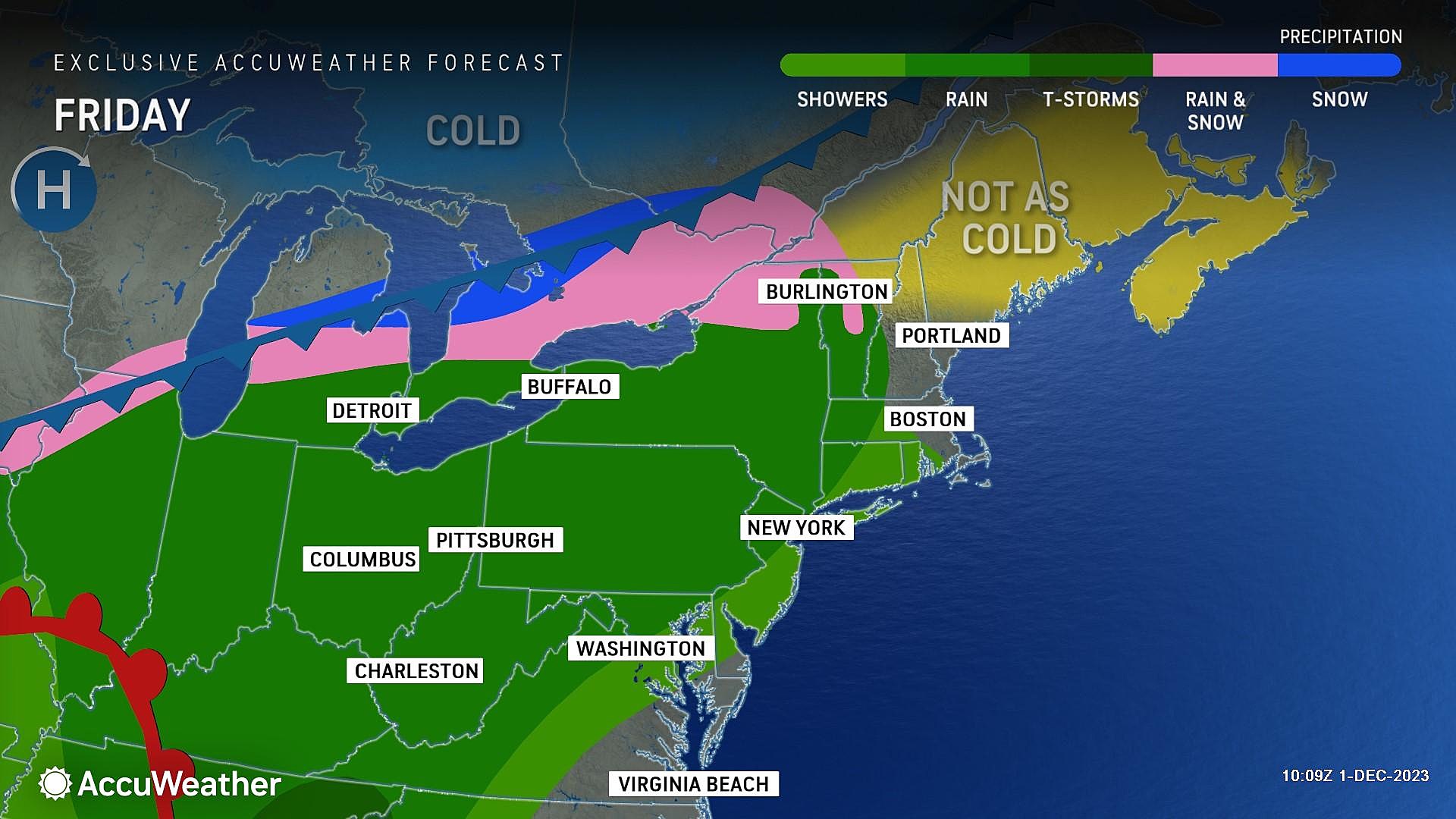
Friday
You may catch a glimmer of sunshine early Friday morning. But that's pretty much the last hint of bright sky New Jersey will see until Monday.
Temperatures Friday morning are below freezing across the interior of NJ, but just above freezing along the edges (urban and coastal areas). A chilly start to the day and the month.
But we will warm up nicely, to the lower 50s on average Friday. That is a couple degrees cooler than Thursday (due to clouds and eventual rain), but close to normal for this time of year.
Rain showers may arrive in New Jersey as early as midday Friday — 11 a.m. or Noon. Rainfall will pick up through the afternoon. The steadiest rain of the day looks to come around dinnertime — around 5 or 6 p.m. And then rain will dial back and exit the Garden State by late Friday night — by Midnight at the latest.
Rainfall totals will end up around a quarter-inch. Everyone in the state likely gets wet at some point.
After the rain Friday night, I am concerned about dense fog forming by Saturday morning. Low temperatures will meet the dew point in the mid 40s or so.
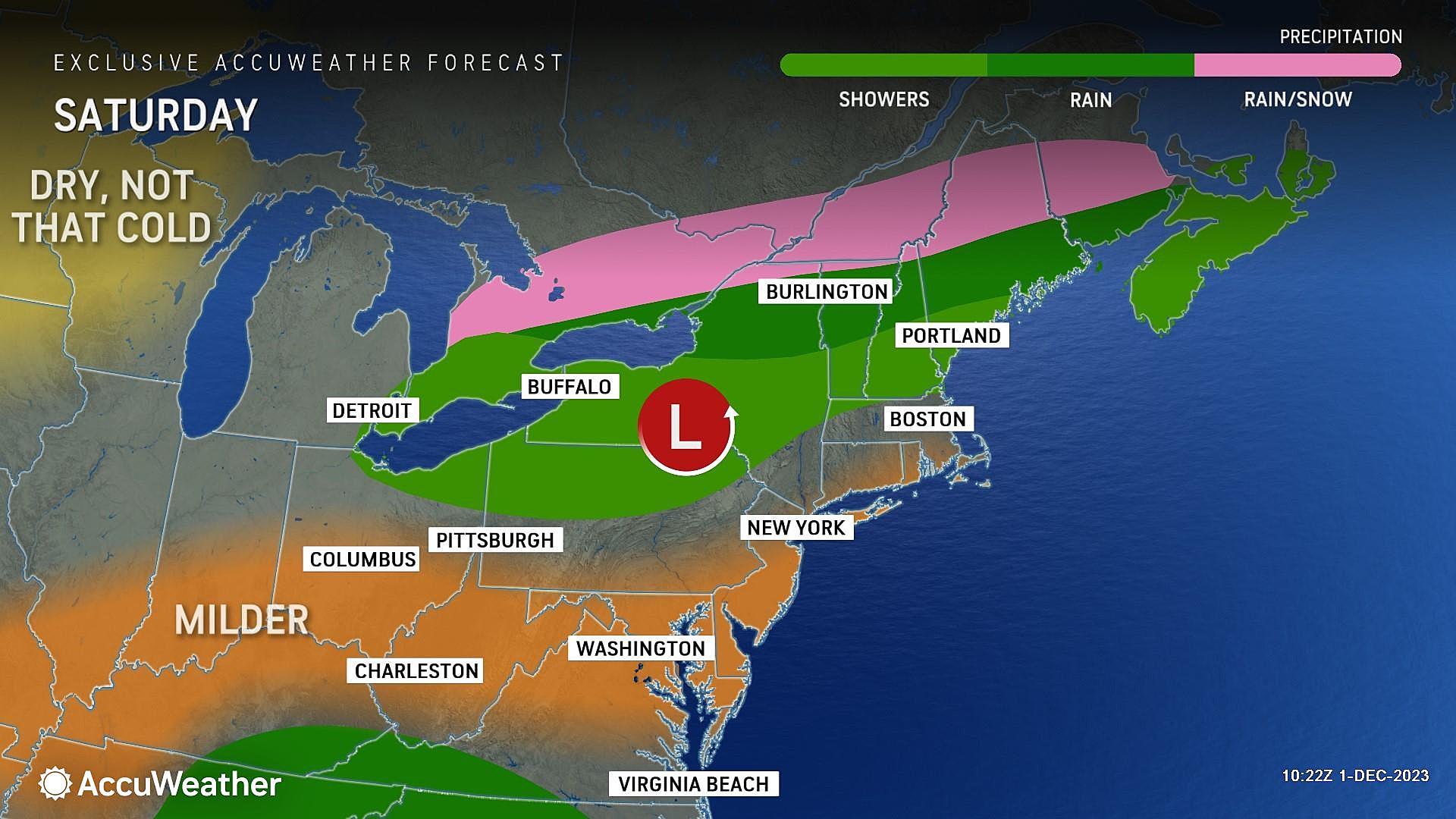
Saturday
Blah. Gray skies. It will look unsettled. Like the sky will open up at any moment. But I really do not think it will.
Saturday will be cloudy, but probably dry during the daytime hours. Temperatures will stay on the mild side, reaching about 55 to 60 degrees in the afternoon.
Showers may creep in to South Jersey again just after sunset Saturday evening. However, most of the impacts of our next storm system will hold off until Sunday.
Sunday
Wet again.
This time around, pockets of rain will stream into New Jersey throughout the day. Starting in South Jersey early Sunday morning, possibly before daybreak. And then potentially becoming steadier and more widespread as the day goes on.
Some models are painting some pretty soggy conditions by Sunday afternoon, putting the kibosh on any outdoor plans. I can not guarantee a return of dry weather until late Sunday evening.
Rainfall totals could approach an inch, if a tap into rich moisture allows for downpours and embedded thunderstorms to develop.
So Sunday does not look like a pretty day, although parts may be salvageable. Especially the farther north in New Jersey you are. And once again, it's only wet — not wintry — with high temperatures holding steady in the 50s.
Monday & Beyond
The big headline for next week will be another cooldown. The timing of which is uncertain, but Monday seems like the best bet for now.
While thermometers may hit 50 degrees on Monday, a stiff westerly breeze will start to blow. That chilly wind will eventually push temps downward.
Our latest forecast puts highs in the 40s for Tuesday and Wednesday, and then only around 40 degrees on Thursday. Widespread freezes return to the early mornings by midweek too.
As for precipitation chances next week, they will be limited. But that brisk west-northwest wind could spark some flurries and snow showers, especially in the Tuesday and Wednesday time frame. Nothing big though.
A list of NJ malls where you can get photos with Santa for the 2023 holiday season
Gallery Credit: Mike Brant
Dan Zarrow is Chief Meteorologist for Townsquare Media New Jersey. Follow him on Facebook for the latest forecast and realtime weather updates.
LOOK: Biggest snowfalls recorded in New Jersey history
Gallery Credit: Stacker
More From New Jersey 101.5 FM


