

NJ weather forecast for the next four days: Cold, nice, nice, wet
The Bottom Line
Thursday's forecast is quiet but cold. Not bitter, brutal, or frigid. Just cold. You'll be reaching for warmer clothes and/or a heavier coat for one more day.
A welcome warmup kicks in for Friday and Saturday, leading to some very nice mid-December days.
But once again, the second half of the weekend turns wet and stormy. There have been three shifts in this potential coastal storm forecast: 1.) Rainfall totals have come down a bit, 2.) Brunt timing is a bit earlier, and 3.) Backside snow shower chance has shot up through the middle of next week.

Thursday
Just plain cold.
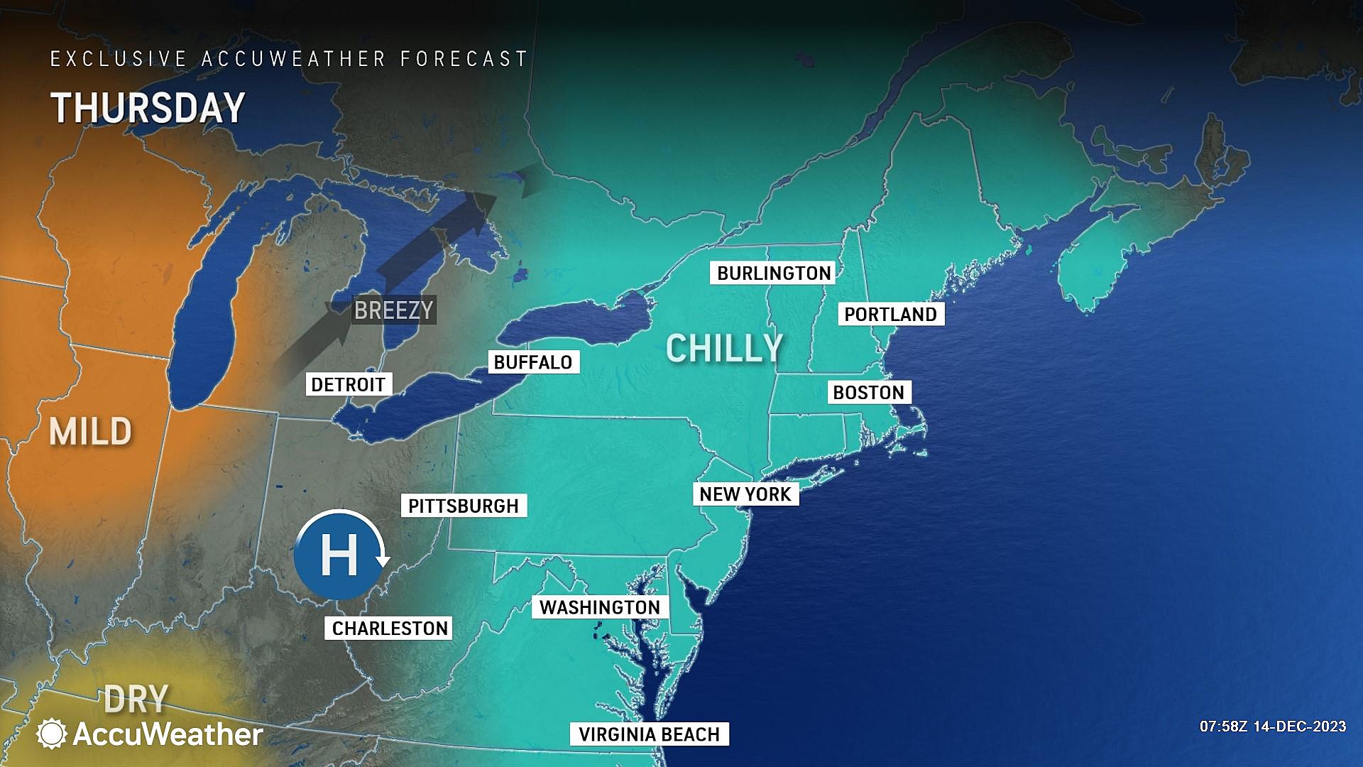
Temperatures are starting the day primarily in the 20s. Only a few spots along the Shore and in city centers are at or above the freezing mark.
Highs on Thursday will only reach about 40 degrees. I'll call that January-ish. At least skies will be bright and sunny, and our weather will stay completely dry. Winds will remain light too — but you know any little breeze will add a little bite to the cold air.
Thursday night will be clear and chilly, with lows around 30.
Friday
Warmer. Better. Overall, a very nice mid-December high.
Highs will push into the lower 50s on Friday, a full 10+ degrees warmer than Thursday. And we will even keep the gorgeous sunshine. No weather concerns, nothing to complain about, all around good news.
Saturday
Saturday will be pleasant too, although the day will feature significantly more cloud cover.
As skies become mostly cloudy (or even overcast), high temperatures should still reach the lower 50s.
A touch of humidity in the air will prevent low temperatures Saturday night from falling much below 40 degrees.
Sunday
Here comes our next big weathermaker, a coastal storm system. Just like last weekend, Sunday will turn inclement and stormy and wet. Just like last weekend, you may salvage the first part of the day. But just like last weekend, there will be some downpours and flooding concerns.
Temperatures will climb through the 50s Sunday night, so this is another rain machine. Not a winter storm. (At least not yet.)
Chronologically, there will be a few hours of dry weather Sunday morning. But it is becoming more and more likely that by midday, rain showers will take over southern and central New Jersey (at least).
Model guidance suggests the timeline of this storm has shifted a bit earlier. It looks like the biggest risk for heavy rain will be Sunday evening. (Again, just like last weekend.)
The forecast also now calls for total rainfall in the 1 to 2 inch range. (Rather than up to 4 inches, as we previously hypothesized.) Still very wet, of course. And enough to warrant some flooding alarm bells.
The wind will kick up too, especially toward daybreak Monday. I'm seeing gusts in the 30-40 mph range for now — not particularly destructive, but definitely noticeable. Biggest potential impact would be power outages.
Because this is a coastal storm, those strong winds will blow from the east. That will present a coastal flooding risk as well.
Monday & Beyond
Steady rain should wrap up around daybreak Monday, with lingering showers possible through the rest of the day. It will stay mostly cloudy and breezy.
While temperatures early Monday will be close to 60 degrees, colder air will push thermometers downward through the rest of the day. It's not an "arctic blast" — just a correction back to more seasonable conditions.
Even though the rain eventually ends on Monday, that coastal storm is not necessarily done with New Jersey yet. Both the GFS and Euro models show an off-shore stall. So the spinning area of low pressure could spit some rain/snow showers back our way through Tuesday and Wednesday. If it's close enough and if it's cold enough, there could be some quick snow accumulation to watch for.
So even though I am confident the late-weekend coastal storm will be mainly a rainmaker, the "end" evolution of the storm is still in question. We will keep you posted.
30 unique 'experience' gifts New Jerseyans actually want to get
Gallery Credit: Dan Zarrow
Dan Zarrow is Chief Meteorologist for Townsquare Media New Jersey. Follow him on Facebook for the latest forecast and realtime weather updates.
11 last minute gift ideas for those 'C-List' people in your life
Gallery Credit: Joe Votruba
More From New Jersey 101.5 FM


