

NJ turns warmer and wetter: Any new icing or flooding concerns?
The Bottom Line
This weekend was cold. Ridiculously cold. Almost all of New Jersey was stuck below freezing for the duration, thanks to a cold air mass and fresh snow cover. In fact, much of North Jersey has been stuck below freezing for over a week now.
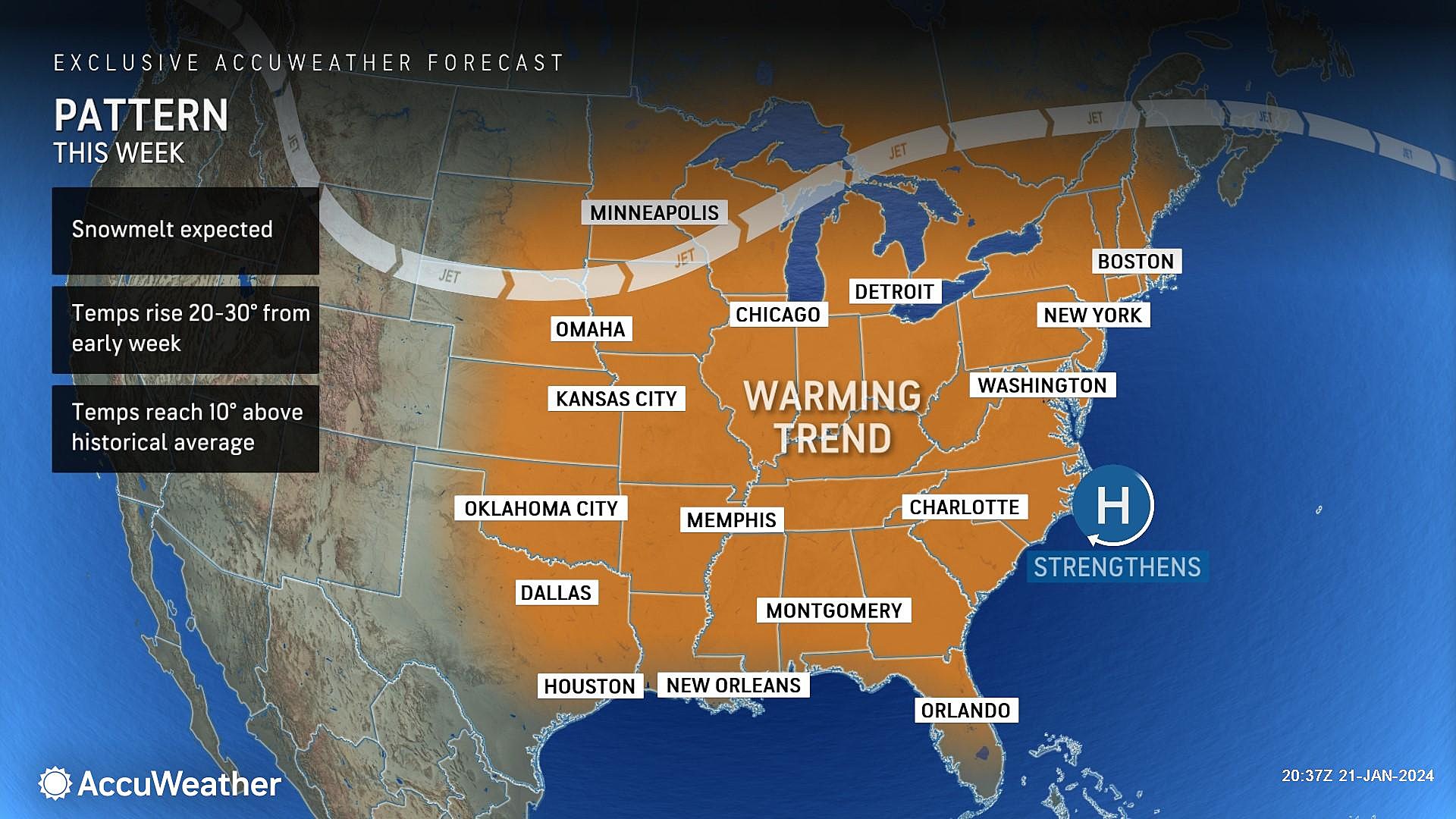
Now let's look ahead to this week. The temperature range is also ridiculous, but in a different way. We have a welcome warmup on the way. While Monday morning is starting out with single digit temperatures in North Jersey, we could see 60s in South Jersey by Thursday and Friday. Swinging from 20 degrees below normal to 20 degrees above. Again, ridiculous.
Unfortunately, the burst of springlike temperatures comes with wet weather. A series of disturbances will drive in several periods of rain this week.
I do have some minor icing concerns, due to wintry mix and/or rain falling on frozen ground. And there could be some localized flooding issues, as ice dams block storm drains. But overall, there are no major alarm bells to ring —this is the first time in 2024 I've been able to say that!
The rain and relative warmth should lead to substantial snow/ice melt. Our next threat of widespread snow would come until the end of next weekend, at the earliest.

Monday
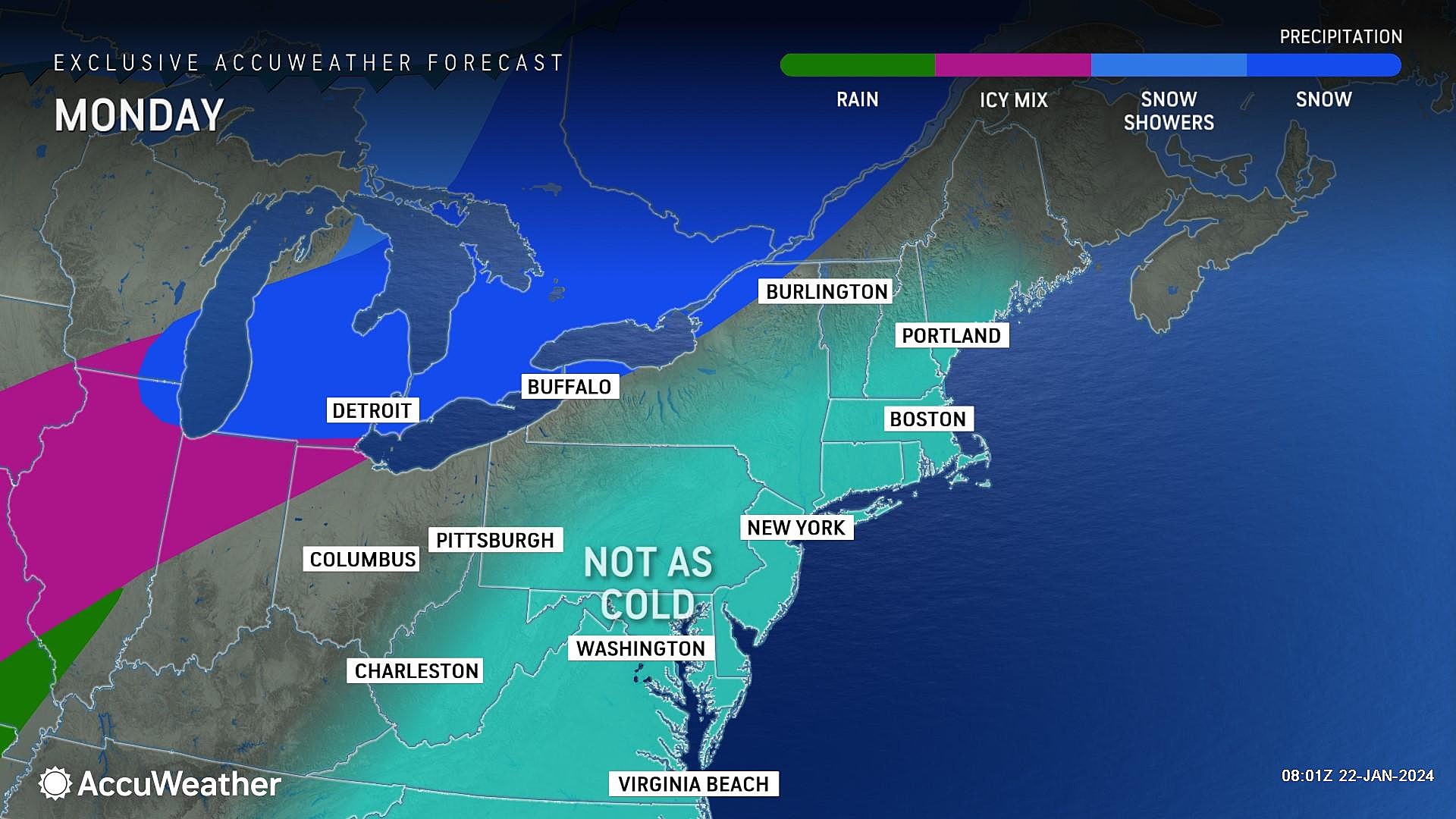
Let the big thaw begin!
Temperatures Monday morning are among the coldest of the entire season so far. The wicked wintry wind has lightened up, so there's less of a wind chill. But still, temperatures range from the single digits in spots, to the teens for most, to the 20s along the immediate coast. Yet again, we are bundling up nice and snugly to start the day.
Monday afternoon's temperatures will be better though. Highs are forecast to reach the mid 30s — above freezing for most. We will start with sunshine, before some high clouds increase through the afternoon. There will be a breeze, up to 15 mph — but that is much lighter and less biting than over the last few days.
I can not rule out a sprinkle or flurry at some point. But in general, Monday will be a tranquil weather day. (Enjoy, because it might be the last quiet day of the week.)
Monday night will not be nearly as frigid as the last six consecutive nights. Low will dip to around 30 degrees by Tuesday morning, under partly cloudy skies.
Tuesday
Tuesday turns even warmer, with highs pushing into the lower 40s. However, we do have to start talking about daily rain chances too.
Tuesday's showers should be limited to northern New Jersey, approximately north of Interstate 78. Best chance will be from late morning through early evening. All light stuff.
The problem is temperatures of both the air and the ground in North Jersey raise borderline concerns about icing potential. There is a chance for some wintry mix precipitation, rather than straight rain, at onset. In addition, the cold, icy ground raises the risk of "freezing" rain. I'm not that concerned, especially since the geography is limited. Just watch for new icy spots.
Wednesday
Even warmer, even wetter.
High temperatures on Wednesday will push into the mid-upper 40s. That is a full 20 degrees higher than Saturday's deep freeze day.
Skies will be cloudy. And I could see a few hit-or-miss, spotty showers around early in the day.
The best chance of rain Wednesday will come after sunset. That next disturbance will lead to an extended period of wet weather lasting into Thursday and Friday too.
Thursday
Thursday looks like the wettest day of the week. At least this storm system will come with a surge of warmth for the southern half of the state.
Expect periods of rain throughout the day Thursday. The threat of downpours and/or thunderstorms is low — it's just going to be a wet and inclement day. Umbrellas up, windshield wipers on.
High temperatures on Thursday will be stuck in the 40s in North Jersey. Meanwhile, to the south, thermometers may very well spike to 60 degrees. The exact dividing line between "cool" and "mild" is fuzzy — but my latest forecast has most of the state in the 50s. So if you catch a break in the raindrops, you will also catch a taste of springtime temperatures.
And at least your furnace will get a much-deserved break too, as that warmup kicks in.
Friday & Beyond
Latest model guidance shows Thursday's rain lingering into the first of Friday. Then we get a break.
The temperature forecast on Friday is highly uncertain. One scenario has reasonably mild temperatures around 50 degrees. Another — the Euro model — pushes temps to widespread 60s.
A cold front kicks off the weekend, knocking daytime temperatures back into the 40s. It looks like there will be one more storm system in this sequence, arriving on Sunday. And with colder air in the neighborhood, snow will be a possibility. The wintry potential is not great — maybe a few limited inches of accumulation. But it is something we will have to watch as the week rolls on.
I favor a return to arctic cold as January turns to February. And, of course, that will ramp up our snow chances once again too. Still lots of winter left to come.
Cough, cough: NJ's favorite lost voice and sore throat remedies
Gallery Credit: Dan Zarrow
Dan Zarrow is Chief Meteorologist for Townsquare Media New Jersey. Follow him on Facebook for the latest forecast and realtime weather updates.
Dan Zarrow's Top 10 Weather and Climate Stories of 2023
Gallery Credit: Dan Zarrow
More From New Jersey 101.5 FM


